San José Tetel elevation
San José Tetel (Tlaxcala, Yauhquemehcan), Mexico elevation is 2487 meters and San José Tetel elevation in feet is 8159 ft above sea level [src 1]. San José Tetel is a populated place (feature code) with elevation that is 1173 meters (3848 ft) bigger than average city elevation in Mexico.
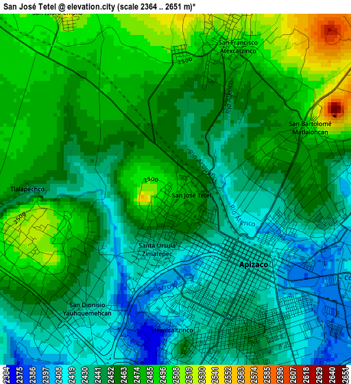
Below is the Elevation map of San José Tetel, which displays elevation range with different colors. Scale of the first map is from 2364 to 2651 m (7756 to 8698 ft) with average elevation of 2458.1 meters (=8065 ft) [note 1]
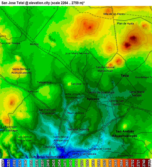
These maps also provides idea of topography and contour of this city, they are displayed at different zoom levels. More info about maps, scale and edge coordinates you can find below images.
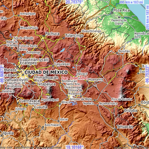
| \ | Map #1 | Map #2 | Topo.Map |
| Scale [m] | 2364..2651 m | 2264..2759 m | × |
| Scale [ft] | 7756..8698 ft | 7428..9052 ft | × |
| Average | 2458.1 m = 8065 ft | 2476.4 m = 8125 ft | × |
| Width | 9.22 km = 5.7 mi | 18.43 km = 11.5 mi | 294.9 km = 183.2 mi |
| Height | 9.22 km = 5.7 mi | 18.43 km = 11.5 mi | 294.9 km = 183.2 mi |
| ↑Max Latitude | 19.474566° | 19.515992° | 20.75375° |
| Latitude at center | 19.43313° | 19.43313° | 19.43313° |
| ↓Min Latitude | 19.391683° | 19.350225° | 18.10168° |
| ← Min Longitude | -98.203425° | -98.247371° | -99.56573° |
| Longitude center | -98.15948° | -98.15948° | -98.15948° |
| →Max Longitude | -98.115535° | -98.071589° | -96.75323° |
Nearby cities:
Cities around San José Tetel sort by population:
• Apizaco elevation 2424 m
2.8 km,  142°
142°
• Zimatepec 2448 m
1.4 km,  202°
202°
• Santa Anita Huiloac 2429 m
5.2 km,  161°
161°
• San Luis Apizaquito 2413 m
4.5 km,  101°
101°
• San Benito Xaltocan 2401 m
3.1 km,  194°
194°
• Atexcatzingo 2509 m
4.2 km,  18°
18°
• Yauhquemehcan 2434 m
3.8 km,  219°
219°
• Hualcaltzinco 2403 m
3.6 km,  180°
180°
• Colonia San Isidro 2420 m
5.4 km,  115°
115°
• Topilco de Juárez 2449 m
4.4 km,  252°
252°
• San Francisco Tlacuilohcan 2436 m
4.9 km, 224°
• José María Morelos 2511 m
3.6 km,  1°
1°
Multilingual:
 En español:
San José Tetel elevación 2487 m.
 En France:
San José Tetel élévation 2487 m.
 Auf Deutsch:
San José Tetel höhe über dem Meeresspiegel ist 2487 m.

Sources and notes:
- [note 1] Map square and city borders are not equal. Map elevation data is calculated only from area inside that square.
- [src 1] Elevation data from geonames database provided with same terms of usage.
- [src 2] The elevation map of San José Tetel is generated using elevation data from NASA's 3 arcsec (90m) resolution SRTM data.
- [src 3] Base (background) map © OpenStreetMap contributors tiles are generated by Geofabrik and OpenTopoMap.
Copyright & License:
This San José Tetel Elevation Map is licensed under CC BY-SA. You may reuse any part from this page, if you give a proper credit by linking to this URL:
 More info on terms of use page.