Tinajas elevation
Tinajas (Hidalgo, Tepeji del Río de Ocampo), Mexico elevation is 2266 meters and Tinajas elevation in feet is 7434 ft above sea level [src 1]. Tinajas is a populated place (feature code) with elevation that is 952 meters (3123 ft) bigger than average city elevation in Mexico.
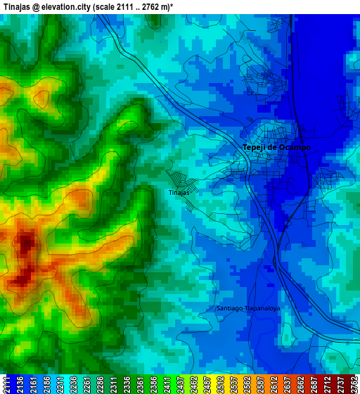
Below is the Elevation map of Tinajas, which displays elevation range with different colors. Scale of the first map is from 2111 to 2762 m (6926 to 9062 ft) with average elevation of 2269.2 meters (=7445 ft) [note 1]
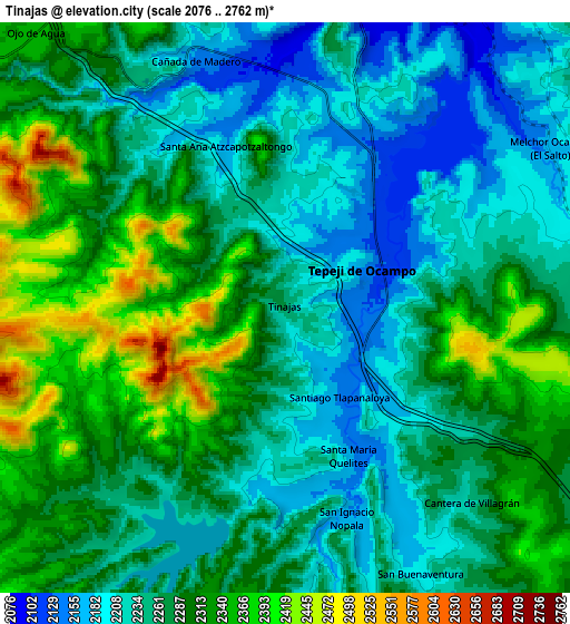
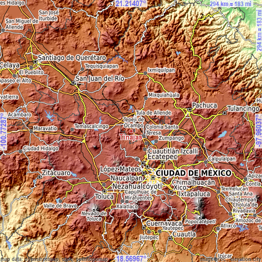
These maps also provides idea of topography and contour of this city, they are displayed at different zoom levels. More info about maps, scale and edge coordinates you can find below images.
| \ | Map #1 | Map #2 | Topo.Map |
| Scale [m] | 2111..2762 m | 2076..2762 m | × |
| Scale [ft] | 6926..9062 ft | 6811..9062 ft | × |
| Average | 2269.2 m = 7445 ft | 2273.4 m = 7459 ft | × |
| Width | 9.19 km = 5.7 mi | 18.38 km = 11.4 mi | 294 km = 182.7 mi |
| Height | 9.19 km = 5.7 mi | 18.38 km = 11.4 mi | 294 km = 182.7 mi |
| ↑Max Latitude | 19.938707° | 19.980012° | 21.21407° |
| Latitude at center | 19.89739° | 19.89739° | 19.89739° |
| ↓Min Latitude | 19.856063° | 19.814725° | 18.56967° |
| ← Min Longitude | -99.410565° | -99.454511° | -100.77287° |
| Longitude center | -99.36662° | -99.36662° | -99.36662° |
| →Max Longitude | -99.322675° | -99.278729° | -97.96037° |
Nearby cities:
Cities around Tinajas sort by population:
• Tepeji del Río de Ocampo elevation 2161 m
2.5 km,  70°
70°
• Tianguistengo (La Romera) 2139 m
4.7 km, 66°
• Santiago Tlautla 2110 m
7.2 km,  357°
357°
• San Luis Taxhimay 2248 m
7.2 km,  207°
207°
• Santa María Quelites 2170 m
5.2 km,  157°
157°
• Santa María Magdalena 2126 m
8.5 km,  354°
354°
• Cañada de Madero 2128 m
8.1 km,  339°
339°
• Santiago Tlapanaloya 2160 m
3.4 km,  151°
151°
• Loma Alta Taxhimay 2279 m
7.5 km,  215°
215°
• Cantera de Villagrán 2231 m
8.7 km,  136°
136°
• San Ignacio Nopala 2168 m
7.2 km, 162°
• Santa Ana Azcapotzaltongo 2194 m
5.6 km, 336°
Multilingual:
 En español:
Tinajas elevación 2266 m.
 En France:
Tinajas élévation 2266 m.
 Auf Deutsch:
Tinajas höhe über dem Meeresspiegel ist 2266 m.

Sources and notes:
- [note 1] Map square and city borders are not equal. Map elevation data is calculated only from area inside that square.
- [src 1] Elevation data from geonames database provided with same terms of usage.
- [src 2] The elevation map of Tinajas is generated using elevation data from NASA's 3 arcsec (90m) resolution SRTM data.
- [src 3] Base (background) map © OpenStreetMap contributors tiles are generated by Geofabrik and OpenTopoMap.
Copyright & License:
This Tinajas Elevation Map is licensed under CC BY-SA. You may reuse any part from this page, if you give a proper credit by linking to this URL:
 More info on terms of use page.