La Pe elevation
La Pe (Oaxaca), Mexico elevation is 1475 meters and La Pe elevation in feet is 4839 ft above sea level [src 1]. La Pe is a seat of a second-order administrative division (feature code) with elevation that is 161 meters (528 ft) bigger than average city elevation in Mexico.
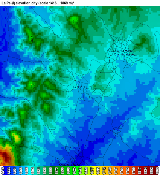
Below is the Elevation map of La Pe, which displays elevation range with different colors. Scale of the first map is from 1416 to 1869 m (4646 to 6132 ft) with average elevation of 1498.4 meters (=4916 ft) [note 1]
These maps also provides idea of topography and contour of this city, they are displayed at different zoom levels. More info about maps, scale and edge coordinates you can find below images.
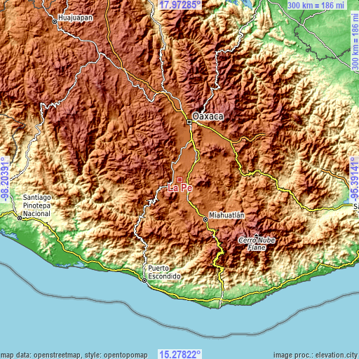
| \ | Map #1 | Topo.Map |
| Scale [m] | 1416..1869 m | × |
| Scale [ft] | 4646..6132 ft | × |
| Average | 1498.4 m = 4916 ft | × |
| Width | 9.36 km = 5.8 mi | 299.6 km = 186.2 mi |
| Height | 9.36 km = 5.8 mi | 299.6 km = 186.2 mi |
| ↑Max Latitude | 16.672373° | 17.97285° |
| Latitude at center | 16.63027° | 16.63027° |
| ↓Min Latitude | 16.588158° | 15.27822° |
| ← Min Longitude | -96.841605° | -98.20391° |
| Longitude center | -96.79766° | -96.79766° |
| →Max Longitude | -96.753715° | -95.39141° |
Nearby cities:
Cities around La Pe sort by population:
• Ejutla de Crespo elevation 1448 m
10 km,  135°
135°
• Ayoquezco de Aldama 1451 m
7.6 km,  320°
320°
• San José del Progreso 1591 m
13.6 km,  62°
62°
• Santa Martha Chichihualtepec 1492 m
3.3 km,  49°
49°
• San Agustín Amatengo 1366 m
13.3 km,  176°
176°
• Agua del Espino 1434 m
4.4 km,  186°
186°
• Magdalena Ocotlán 1530 m
12.8 km, 46°
• San Martín Lachila 1431 m
5.8 km,  249°
249°
• Santa Ana Tlapacoyan 1484 m
13.3 km,  341°
341°
• San Martín de los Canseco 1530 m
8 km,  68°
68°
• San Miguel Ejutla 1454 m
8.3 km,  131°
131°
• Taniche 1412 m
8.2 km,  146°
146°
Multilingual:
 En español:
La Pe elevación 1475 m.
 En France:
La Pe élévation 1475 m.


Sources and notes:
- [note 1] Map square and city borders are not equal. Map elevation data is calculated only from area inside that square.
- [src 1] Elevation data from geonames database provided with same terms of usage.
- [src 2] The elevation map of La Pe is generated using elevation data from NASA's 3 arcsec (90m) resolution SRTM data.
- [src 3] Base (background) map © OpenStreetMap contributors tiles are generated by Geofabrik and OpenTopoMap.
Copyright & License:
This La Pe Elevation Map is licensed under CC BY-SA. You may reuse any part from this page, if you give a proper credit by linking to this URL:
 More info on terms of use page.