Acamixtla elevation
Acamixtla (Guerrero, Taxco de Alarcón), Mexico elevation is 1594 meters and Acamixtla elevation in feet is 5230 ft above sea level [src 1]. Acamixtla is a populated place (feature code) with elevation that is 280 meters (919 ft) bigger than average city elevation in Mexico.
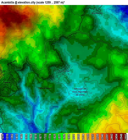
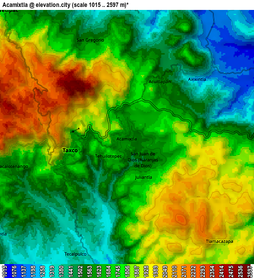
Below is the Elevation map of Acamixtla, which displays elevation range with different colors. Scale of the first map is from 1259 to 2597 m (4131 to 8520 ft) with average elevation of 1754.9 meters (=5758 ft) [note 1]
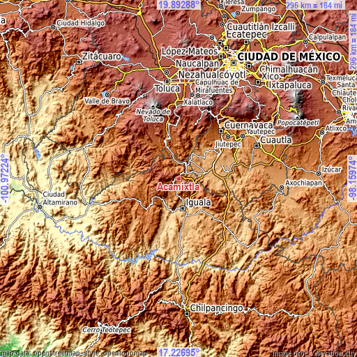
These maps also provides idea of topography and contour of this city, they are displayed at different zoom levels. More info about maps, scale and edge coordinates you can find below images.
| \ | Map #1 | Map #2 | Topo.Map |
| Scale [m] | 1259..2597 m | 1015..2597 m | × |
| Scale [ft] | 4131..8520 ft | 3330..8520 ft | × |
| Average | 1754.9 m = 5758 ft | 1709 m = 5607 ft | × |
| Width | 9.26 km = 5.8 mi | 18.53 km = 11.5 mi | 296.4 km = 184.2 mi |
| Height | 9.26 km = 5.8 mi | 18.53 km = 11.5 mi | 296.4 km = 184.2 mi |
| ↑Max Latitude | 18.606773° | 18.648417° | 19.89288° |
| Latitude at center | 18.56512° | 18.56512° | 18.56512° |
| ↓Min Latitude | 18.523456° | 18.481783° | 17.22695° |
| ← Min Longitude | -99.609935° | -99.653881° | -100.97224° |
| Longitude center | -99.56599° | -99.56599° | -99.56599° |
| →Max Longitude | -99.522045° | -99.478099° | -98.15974° |
Nearby cities:
Cities around Acamixtla sort by population:
• Taxco de Alarcón elevation 1770 m
4.4 km,  254°
254°
• Tlamacazapa 1952 m
10.3 km,  137°
137°
• Acuitlapan 1579 m
4.7 km,  31°
31°
• Taxco el Viejo 1276 m
9.3 km,  191°
191°
• Tehuilotepec 1694 m
2.2 km,  226°
226°
• Cacalotenango 1606 m
8.4 km,  255°
255°
• Paintla 1339 m
11.7 km, 233°
• Axixintla 1222 m
6.5 km,  50°
50°
• San Juan de Dios (Naranjas de Dios) 1499 m
2 km,  147°
147°
• Tecalpulco 1415 m
9.4 km,  204°
204°
• Chontalcoatlán 1259 m
9.9 km,  355°
355°
• San Gregorio 1550 m
7.8 km,  337°
337°
Multilingual:
 En español:
Acamixtla elevación 1594 m.
 En France:
Acamixtla élévation 1594 m.
 Auf Deutsch:
Acamixtla höhe über dem Meeresspiegel ist 1594 m.

Sources and notes:
- [note 1] Map square and city borders are not equal. Map elevation data is calculated only from area inside that square.
- [src 1] Elevation data from geonames database provided with same terms of usage.
- [src 2] The elevation map of Acamixtla is generated using elevation data from NASA's 3 arcsec (90m) resolution SRTM data.
- [src 3] Base (background) map © OpenStreetMap contributors tiles are generated by Geofabrik and OpenTopoMap.
Copyright & License:
This Acamixtla Elevation Map is licensed under CC BY-SA. You may reuse any part from this page, if you give a proper credit by linking to this URL:
 More info on terms of use page.