Amatán elevation
Amatán (Chiapas), Mexico elevation is 807 meters and Amatán elevation in feet is 2648 ft above sea level [src 1]. Amatán is a seat of a second-order administrative division (feature code) with elevation that is 507 meters (1663 ft) smaller than average city elevation in Mexico.
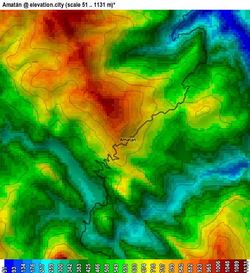
Below is the Elevation map of Amatán, which displays elevation range with different colors. Scale of the first map is from 51 to 1131 m (167 to 3711 ft) with average elevation of 550.6 meters (=1806 ft) [note 1]
These maps also provides idea of topography and contour of this city, they are displayed at different zoom levels. More info about maps, scale and edge coordinates you can find below images.
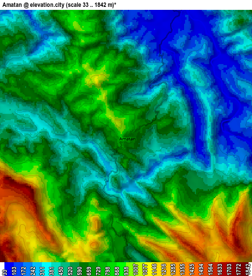
| \ | Map #1 | Map #2 | Topo.Map |
| Scale [m] | 51..1131 m | 33..1842 m | × |
| Scale [ft] | 167..3711 ft | 108..6043 ft | × |
| Average | 550.6 m = 1806 ft | 627.8 m = 2060 ft | × |
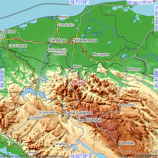
| Width | 9.33 km = 5.8 mi | 18.65 km = 11.6 mi | 298.4 km = 185.4 mi |
| Height | 9.33 km = 5.8 mi | 18.65 km = 11.6 mi | 298.4 km = 185.4 mi |
| ↑Max Latitude | 17.416225° | 17.458151° | 18.71135° |
| Latitude at center | 17.37429° | 17.37429° | 17.37429° |
| ↓Min Latitude | 17.332345° | 17.29039° | 16.02739° |
| ← Min Longitude | -92.862875° | -92.906821° | -94.22518° |
| Longitude center | -92.81893° | -92.81893° | -92.81893° |
| →Max Longitude | -92.774985° | -92.731039° | -91.41268° |
Nearby cities:
Cities around Amatán sort by population:
• Tapijulapa elevation 54 m
10.6 km,  23°
23°
• San José Chapayal 1199 m
11.2 km,  222°
222°
• Oxolotán 62 m
7.4 km,  85°
85°
• La Gloria 659 m
16.2 km,  297°
297°
• Raya Zaragoza 80 m
14.6 km,  76°
76°
• Zacatonal de Juárez 586 m
11.7 km,  169°
169°
• Puxcatán 58 m
16.4 km,  58°
58°
• Ignacio Zaragoza 889 m
15.7 km,  233°
233°
• Reforma y Planada 431 m
5.2 km,  285°
285°
• Aurora Ermita 1508 m
16.5 km,  200°
200°
• Chapallal Grande 781 m
16 km,  237°
237°
• Libertad 239 m
11.7 km,  70°
70°
Multilingual:
 En español:
Amatán elevación 807 m.
 En France:
Amatán élévation 807 m.


Sources and notes:
- [note 1] Map square and city borders are not equal. Map elevation data is calculated only from area inside that square.
- [src 1] Elevation data from geonames database provided with same terms of usage.
- [src 2] The elevation map of Amatán is generated using elevation data from NASA's 3 arcsec (90m) resolution SRTM data.
- [src 3] Base (background) map © OpenStreetMap contributors tiles are generated by Geofabrik and OpenTopoMap.
Copyright & License:
This Amatán Elevation Map is licensed under CC BY-SA. You may reuse any part from this page, if you give a proper credit by linking to this URL:
 More info on terms of use page.