San Pedro Amuzgos elevation
San Pedro Amuzgos (Oaxaca), Mexico elevation is 509 meters and San Pedro Amuzgos elevation in feet is 1670 ft above sea level [src 1]. San Pedro Amuzgos is a populated place (feature code) with elevation that is 805 meters (2641 ft) smaller than average city elevation in Mexico.
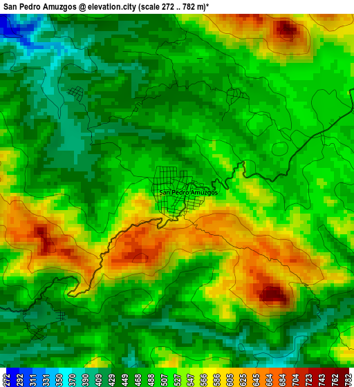
Below is the Elevation map of San Pedro Amuzgos, which displays elevation range with different colors. Scale of the first map is from 272 to 782 m (892 to 2566 ft) with average elevation of 502.8 meters (=1650 ft) [note 1]
These maps also provides idea of topography and contour of this city, they are displayed at different zoom levels. More info about maps, scale and edge coordinates you can find below images.
| \ | Map #1 | Map #2 | Topo.Map |
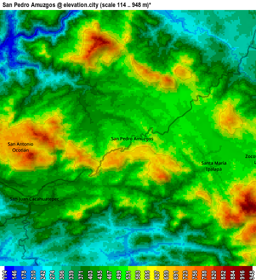
| Scale [m] | 272..782 m | 114..948 m | × |
| Scale [ft] | 892..2566 ft | 374..3110 ft | × |
| Average | 502.8 m = 1650 ft | 452 m = 1483 ft | × |
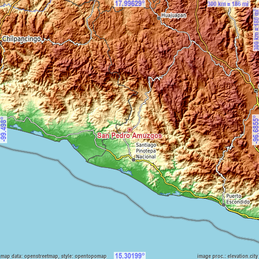
| Width | 9.36 km = 5.8 mi | 18.73 km = 11.6 mi | 299.6 km = 186.2 mi |
| Height | 9.36 km = 5.8 mi | 18.73 km = 11.6 mi | 299.6 km = 186.2 mi |
| ↑Max Latitude | 16.695977° | 16.738065° | 17.99629° |
| Latitude at center | 16.65388° | 16.65388° | 16.65388° |
| ↓Min Latitude | 16.611773° | 16.569658° | 15.30199° |
| ← Min Longitude | -98.135695° | -98.179641° | -99.498° |
| Longitude center | -98.09175° | -98.09175° | -98.09175° |
| →Max Longitude | -98.047805° | -98.003859° | -96.6855° |
Nearby cities:
Cities around San Pedro Amuzgos sort by population:
• San Juan Cacahuatepec elevation 424 m
8 km,  237°
237°
• San Antonio Tepetlapa 414 m
12.5 km,  167°
167°
• Huajintepec 333 m
15.5 km,  251°
251°
• Guadalupe Victoria 456 m
14.9 km,  319°
319°
• Santa María Ipalapa 486 m
6.6 km,  104°
104°
• San Pedro Tulixtlahuaca 410 m
14.1 km,  154°
154°
• San Sebastián Ixcapa 244 m
13.3 km,  205°
205°
• Colonia Renacimiento 478 m
15.5 km, 321°
• Zocoteaca de León 493 m
9.6 km, 100°
• San Antonio Ocotlán 719 m
7.9 km,  266°
266°
• Camotinchan 200 m
11.1 km,  198°
198°
• San Vicente Piñas 600 m
15 km,  12°
12°
Multilingual:
 En español:
San Pedro Amuzgos elevación 509 m.
 En France:
San Pedro Amuzgos élévation 509 m.
 Auf Deutsch:
San Pedro Amuzgos höhe über dem Meeresspiegel ist 509 m.

Sources and notes:
- [note 1] Map square and city borders are not equal. Map elevation data is calculated only from area inside that square.
- [src 1] Elevation data from geonames database provided with same terms of usage.
- [src 2] The elevation map of San Pedro Amuzgos is generated using elevation data from NASA's 3 arcsec (90m) resolution SRTM data.
- [src 3] Base (background) map © OpenStreetMap contributors tiles are generated by Geofabrik and OpenTopoMap.
Copyright & License:
This San Pedro Amuzgos Elevation Map is licensed under CC BY-SA. You may reuse any part from this page, if you give a proper credit by linking to this URL:
 More info on terms of use page.