Calimaya elevation
Calimaya (State of Mexico), Mexico elevation is 2698 meters and Calimaya elevation in feet is 8852 ft above sea level [src 1]. Calimaya is a seat of a second-order administrative division (feature code) with elevation that is 1384 meters (4541 ft) bigger than average city elevation in Mexico.
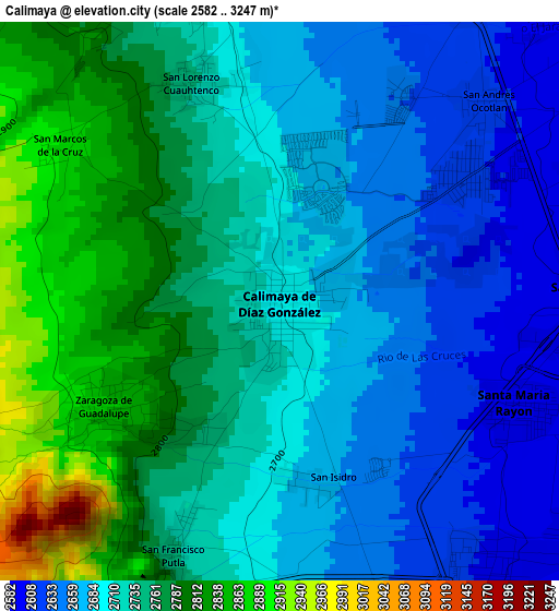
Below is the Elevation map of Calimaya, which displays elevation range with different colors. Scale of the first map is from 2582 to 3247 m (8471 to 10653 ft) with average elevation of 2727.4 meters (=8948 ft) [note 1]
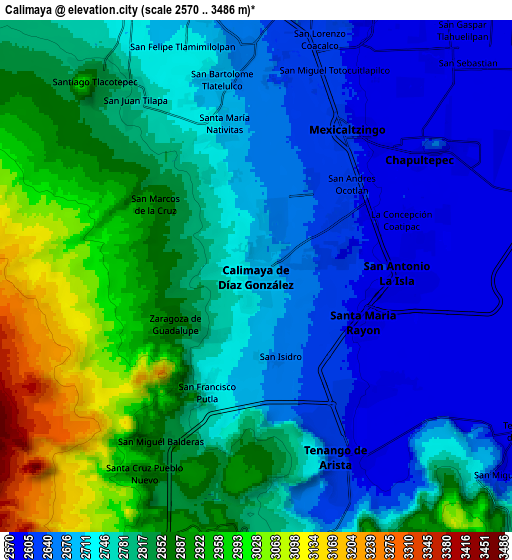
These maps also provides idea of topography and contour of this city, they are displayed at different zoom levels. More info about maps, scale and edge coordinates you can find below images.
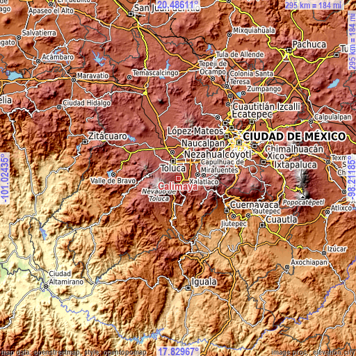
| \ | Map #1 | Map #2 | Topo.Map |
| Scale [m] | 2582..3247 m | 2570..3486 m | × |
| Scale [ft] | 8471..10653 ft | 8432..11437 ft | × |
| Average | 2727.4 m = 8948 ft | 2780 m = 9121 ft | × |
| Width | 9.23 km = 5.7 mi | 18.46 km = 11.5 mi | 295.4 km = 183.6 mi |
| Height | 9.23 km = 5.7 mi | 18.46 km = 11.5 mi | 295.4 km = 183.6 mi |
| ↑Max Latitude | 19.204745° | 19.246239° | 20.48611° |
| Latitude at center | 19.16324° | 19.16324° | 19.16324° |
| ↓Min Latitude | 19.121725° | 19.080199° | 17.82967° |
| ← Min Longitude | -99.662045° | -99.705991° | -101.02435° |
| Longitude center | -99.6181° | -99.6181° | -99.6181° |
| →Max Longitude | -99.574155° | -99.530209° | -98.21185° |
Nearby cities:
Cities around Calimaya sort by population:
• San Antonio la Isla elevation 2589 m
5.4 km,  88°
88°
• Santa María Rayón 2595 m
4.4 km,  112°
112°
• Santa María Nativitas 2703 m
5.5 km,  347°
347°
• Zaragoza de Guadalupe 2861 m
3.2 km,  238°
238°
• San Andrés Ocotlán 2612 m
4.7 km,  45°
45°
• San Francisco Putla 2749 m
4.3 km,  204°
204°
• San Lorenzo Cuauhtenco 2743 m
3.9 km,  338°
338°
• San Diego la Huerta 2778 m
2.6 km,  217°
217°
• San Francisco Tetetla 2635 m
5.5 km,  161°
161°
• La Concepción Coatipac (La Conchita) 2595 m
5.6 km,  68°
68°
• Villas del Campo 2670 m
2 km,  18°
18°
• San Marcos de la Cruz 2893 m
4.6 km,  304°
304°
Multilingual:
 En español:
Calimaya elevación 2698 m.
 En France:
Calimaya élévation 2698 m.
 Auf Deutsch:
Calimaya höhe über dem Meeresspiegel ist 2698 m.

Sources and notes:
- [note 1] Map square and city borders are not equal. Map elevation data is calculated only from area inside that square.
- [src 1] Elevation data from geonames database provided with same terms of usage.
- [src 2] The elevation map of Calimaya is generated using elevation data from NASA's 3 arcsec (90m) resolution SRTM data.
- [src 3] Base (background) map © OpenStreetMap contributors tiles are generated by Geofabrik and OpenTopoMap.
Copyright & License:
This Calimaya Elevation Map is licensed under CC BY-SA. You may reuse any part from this page, if you give a proper credit by linking to this URL:
 More info on terms of use page.