Chiapilla elevation
Chiapilla (Chiapas), Mexico elevation is 543 meters and Chiapilla elevation in feet is 1781 ft above sea level [src 1]. Chiapilla is a seat of a second-order administrative division (feature code) with elevation that is 771 meters (2530 ft) smaller than average city elevation in Mexico.
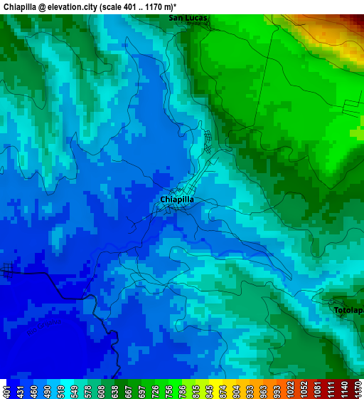
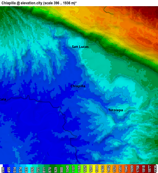
Below is the Elevation map of Chiapilla, which displays elevation range with different colors. Scale of the first map is from 401 to 1170 m (1316 to 3839 ft) with average elevation of 561.8 meters (=1843 ft) [note 1]
These maps also provides idea of topography and contour of this city, they are displayed at different zoom levels. More info about maps, scale and edge coordinates you can find below images.
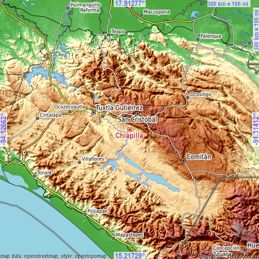
| \ | Map #1 | Map #2 | Topo.Map |
| Scale [m] | 401..1170 m | 396..1936 m | × |
| Scale [ft] | 1316..3839 ft | 1299..6352 ft | × |
| Average | 561.8 m = 1843 ft | 731.5 m = 2400 ft | × |
| Width | 9.37 km = 5.8 mi | 18.73 km = 11.6 mi | 299.7 km = 186.2 mi |
| Height | 9.37 km = 5.8 mi | 18.73 km = 11.6 mi | 299.7 km = 186.2 mi |
| ↑Max Latitude | 16.611866° | 16.653972° | 17.91277° |
| Latitude at center | 16.56975° | 16.56975° | 16.56975° |
| ↓Min Latitude | 16.527625° | 16.485491° | 15.21729° |
| ← Min Longitude | -92.764315° | -92.808261° | -94.12662° |
| Longitude center | -92.72037° | -92.72037° | -92.72037° |
| →Max Longitude | -92.676425° | -92.632479° | -91.31412° |
Nearby cities:
Cities around Chiapilla sort by population:
• Acala elevation 420 m
9.1 km,  260°
260°
• San Lucas 665 m
4.7 km,  3°
3°
• Totolapa 655 m
5.2 km,  124°
124°
• Pasté 2314 m
15.1 km,  351°
351°
• Nachig 2270 m
17.9 km,  358°
358°
• Nuevo León 1130 m
18.4 km, 120°
• Nuevo Vicente Guerrero (El Chichonal) 503 m
18.6 km,  239°
239°
• Vicente Guerrero 491 m
14.6 km,  176°
176°
• Unión Buena Vista 533 m
14 km,  228°
228°
• Mariano Matamoros 1051 m
17.5 km, 124°
• Apas 2124 m
17.5 km,  333°
333°
• Bochojbo Alto 2442 m
18.5 km, 1°
Multilingual:
 En español:
Chiapilla elevación 543 m.
 En France:
Chiapilla élévation 543 m.
 Auf Deutsch:
Chiapilla höhe über dem Meeresspiegel ist 543 m.

Sources and notes:
- [note 1] Map square and city borders are not equal. Map elevation data is calculated only from area inside that square.
- [src 1] Elevation data from geonames database provided with same terms of usage.
- [src 2] The elevation map of Chiapilla is generated using elevation data from NASA's 3 arcsec (90m) resolution SRTM data.
- [src 3] Base (background) map © OpenStreetMap contributors tiles are generated by Geofabrik and OpenTopoMap.
Copyright & License:
This Chiapilla Elevation Map is licensed under CC BY-SA. You may reuse any part from this page, if you give a proper credit by linking to this URL:
 More info on terms of use page.