Totolapa elevation
Totolapa (Chiapas), Mexico elevation is 655 meters and Totolapa elevation in feet is 2149 ft above sea level [src 1]. Totolapa is a seat of a second-order administrative division (feature code) with elevation that is 659 meters (2162 ft) smaller than average city elevation in Mexico.
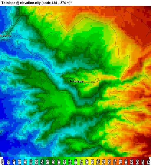
Below is the Elevation map of Totolapa, which displays elevation range with different colors. Scale of the first map is from 434 to 874 m (1424 to 2867 ft) with average elevation of 621.2 meters (=2038 ft) [note 1]
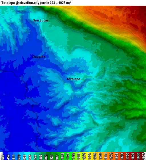
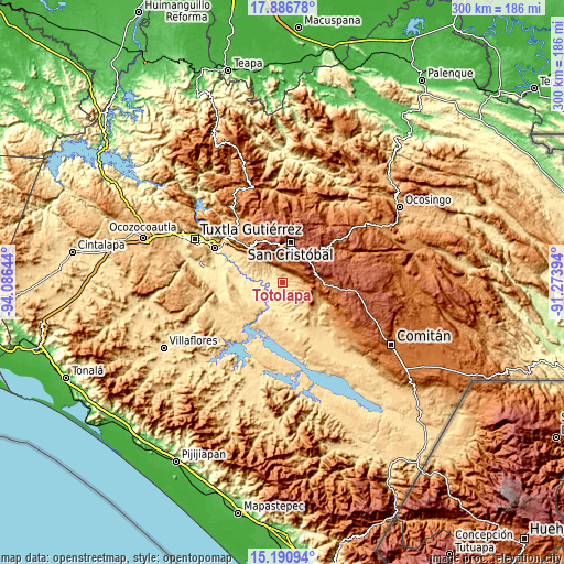
These maps also provides idea of topography and contour of this city, they are displayed at different zoom levels. More info about maps, scale and edge coordinates you can find below images.
| \ | Map #1 | Map #2 | Topo.Map |
| Scale [m] | 434..874 m | 393..1927 m | × |
| Scale [ft] | 1424..2867 ft | 1289..6322 ft | × |
| Average | 621.2 m = 2038 ft | 742.9 m = 2437 ft | × |
| Width | 9.37 km = 5.8 mi | 18.74 km = 11.6 mi | 299.7 km = 186.2 mi |
| Height | 9.37 km = 5.8 mi | 18.74 km = 11.6 mi | 299.8 km = 186.3 mi |
| ↑Max Latitude | 16.585692° | 16.627804° | 17.88678° |
| Latitude at center | 16.54357° | 16.54357° | 16.54357° |
| ↓Min Latitude | 16.501439° | 16.459299° | 15.19094° |
| ← Min Longitude | -92.724135° | -92.768081° | -94.08644° |
| Longitude center | -92.68019° | -92.68019° | -92.68019° |
| →Max Longitude | -92.636245° | -92.592299° | -91.27394° |
Nearby cities:
Cities around Totolapa sort by population:
• Acala elevation 420 m
13.3 km,  276°
276°
• San Lucas 665 m
8.6 km,  331°
331°
• Nicolás Ruiz 751 m
15.6 km,  139°
139°
• Chiapilla 543 m
5.2 km,  304°
304°
• Pasté 2314 m
19 km,  340°
340°
• Ricardo Flores Magón 480 m
16.7 km,  185°
185°
• Nuevo León 1130 m
13.2 km,  118°
118°
• Betania 2211 m
18.3 km,  67°
67°
• Vicente Guerrero 491 m
12.1 km,  196°
196°
• Unión Buena Vista 533 m
16.1 km,  246°
246°
• Mariano Matamoros 1051 m
12.3 km, 124°
• Mitzitón 2381 m
18.5 km,  51°
51°
Multilingual:
 En español:
Totolapa elevación 655 m.
 En France:
Totolapa élévation 655 m.
 Auf Deutsch:
Totolapa höhe über dem Meeresspiegel ist 655 m.

Sources and notes:
- [note 1] Map square and city borders are not equal. Map elevation data is calculated only from area inside that square.
- [src 1] Elevation data from geonames database provided with same terms of usage.
- [src 2] The elevation map of Totolapa is generated using elevation data from NASA's 3 arcsec (90m) resolution SRTM data.
- [src 3] Base (background) map © OpenStreetMap contributors tiles are generated by Geofabrik and OpenTopoMap.
Copyright & License:
This Totolapa Elevation Map is licensed under CC BY-SA. You may reuse any part from this page, if you give a proper credit by linking to this URL:
 More info on terms of use page.