China elevation
China (Nuevo León), Mexico elevation is 140 meters and China elevation in feet is 459 ft above sea level [src 1]. China is a seat of a second-order administrative division (feature code) with elevation that is 1174 meters (3852 ft) smaller than average city elevation in Mexico.
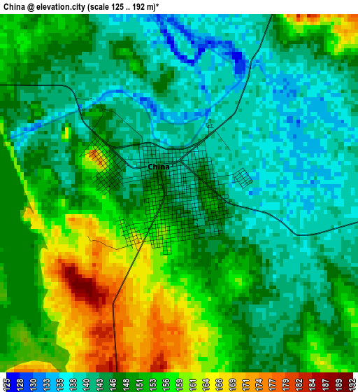
Below is the Elevation map of China, which displays elevation range with different colors. Scale of the first map is from 125 to 192 m (410 to 630 ft) with average elevation of 148.9 meters (=489 ft) [note 1]
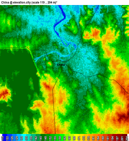
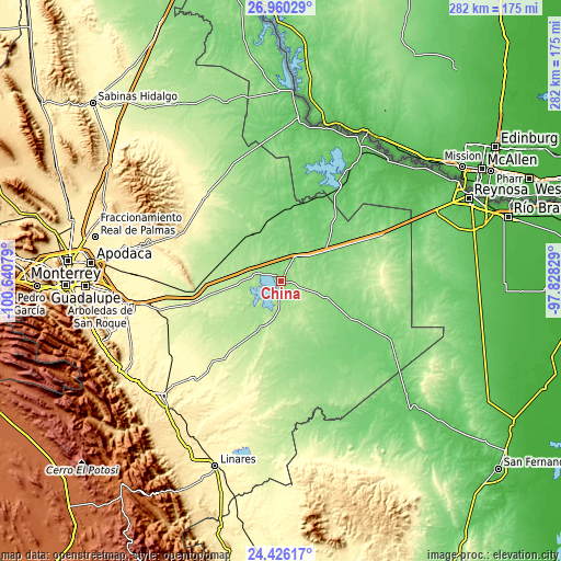
These maps also provides idea of topography and contour of this city, they are displayed at different zoom levels. More info about maps, scale and edge coordinates you can find below images.
| \ | Map #1 | Map #2 | Topo.Map |
| Scale [m] | 125..192 m | 119..204 m | × |
| Scale [ft] | 410..630 ft | 390..669 ft | × |
| Average | 148.9 m = 489 ft | 154.1 m = 506 ft | × |
| Width | 8.81 km = 5.5 mi | 17.61 km = 10.9 mi | 281.8 km = 175.1 mi |
| Height | 8.81 km = 5.5 mi | 17.61 km = 10.9 mi | 281.8 km = 175.1 mi |
| ↑Max Latitude | 25.739562° | 25.77914° | 26.96029° |
| Latitude at center | 25.69997° | 25.69997° | 25.69997° |
| ↓Min Latitude | 25.660365° | 25.620747° | 24.42617° |
| ← Min Longitude | -99.278485° | -99.322431° | -100.64079° |
| Longitude center | -99.23454° | -99.23454° | -99.23454° |
| →Max Longitude | -99.190595° | -99.146649° | -97.82829° |
Nearby cities:
Cities around China sort by population:
• Ciudad Cerralvo elevation 289 m
57.3 km,  318°
318°
• Ciudad General Terán 316 m
66.6 km,  222°
222°
• General Bravo 130 m
11.6 km,  27°
27°
• Comales 86 m
62.1 km, 30°
• Los Herreras 156 m
28.7 km, 323°
• San Juan 273 m
63.3 km,  253°
253°
• Pueblo Nuevo 250 m
57.9 km, 245°
• Los Ramones 214 m
39.2 km,  269°
269°
• General Treviño 158 m
63.3 km,  336°
336°
• Doctor Coss 115 m
25.5 km,  11°
11°
• Melchor Ocampo 255 m
50.2 km, 321°
• Los Aldamas 104 m
40.5 km, 5°
Multilingual:
 En español:
China elevación 140 m.
 En France:
China élévation 140 m.


Sources and notes:
- [note 1] Map square and city borders are not equal. Map elevation data is calculated only from area inside that square.
- [src 1] Elevation data from geonames database provided with same terms of usage.
- [src 2] The elevation map of China is generated using elevation data from NASA's 3 arcsec (90m) resolution SRTM data.
- [src 3] Base (background) map © OpenStreetMap contributors tiles are generated by Geofabrik and OpenTopoMap.
Copyright & License:
This China Elevation Map is licensed under CC BY-SA. You may reuse any part from this page, if you give a proper credit by linking to this URL:
 More info on terms of use page.