Colotlipa elevation
Colotlipa (Guerrero, Quechultenango), Mexico elevation is 750 meters and Colotlipa elevation in feet is 2461 ft above sea level [src 1]. Colotlipa is a populated place (feature code) with elevation that is 564 meters (1850 ft) smaller than average city elevation in Mexico.
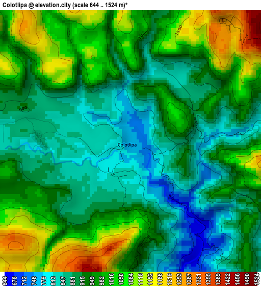
Below is the Elevation map of Colotlipa, which displays elevation range with different colors. Scale of the first map is from 644 to 1524 m (2113 to 5000 ft) with average elevation of 950.7 meters (=3119 ft) [note 1]
These maps also provides idea of topography and contour of this city, they are displayed at different zoom levels. More info about maps, scale and edge coordinates you can find below images.
| \ | Map #1 | Map #2 | Topo.Map |
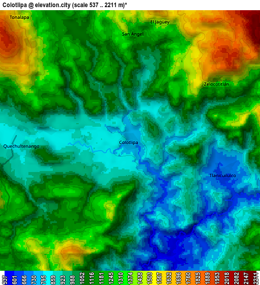
| Scale [m] | 644..1524 m | 537..2211 m | × |
| Scale [ft] | 2113..5000 ft | 1762..7254 ft | × |
| Average | 950.7 m = 3119 ft | 1102.3 m = 3616 ft | × |
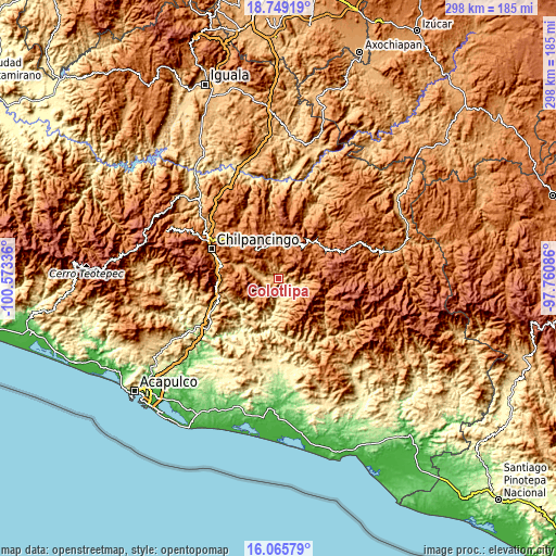
| Width | 9.32 km = 5.8 mi | 18.65 km = 11.6 mi | 298.4 km = 185.4 mi |
| Height | 9.32 km = 5.8 mi | 18.65 km = 11.6 mi | 298.4 km = 185.4 mi |
| ↑Max Latitude | 17.454347° | 17.496264° | 18.74919° |
| Latitude at center | 17.41242° | 17.41242° | 17.41242° |
| ↓Min Latitude | 17.370484° | 17.328538° | 16.06579° |
| ← Min Longitude | -99.211055° | -99.255001° | -100.57336° |
| Longitude center | -99.16711° | -99.16711° | -99.16711° |
| →Max Longitude | -99.123165° | -99.079219° | -97.76086° |
Nearby cities:
Cities around Colotlipa sort by population:
• Quechultenango elevation 841 m
8 km,  271°
271°
• Ayahualulco 1425 m
9.9 km,  350°
350°
• Tlamixtlahuacan 1218 m
11.8 km,  328°
328°
• Tlaxinga (Clatzinga) 1466 m
12.4 km, 347°
• Atenxoxola 1424 m
8.8 km,  16°
16°
• Alcozacán 1878 m
12.8 km,  36°
36°
• Zizicazapa 1582 m
11.6 km,  7°
7°
• San Ángel 1245 m
7.7 km,  1°
1°
• San Martín 1017 m
14.6 km,  292°
292°
• Zelocotitlán 1298 m
7.5 km,  59°
59°
• Acalco 1609 m
10.4 km, 0°
• Tonalapa 1525 m
11.8 km,  317°
317°
Multilingual:
 En español:
Colotlipa elevación 750 m.
 En France:
Colotlipa élévation 750 m.
 Auf Deutsch:
Colotlipa höhe über dem Meeresspiegel ist 750 m.

Sources and notes:
- [note 1] Map square and city borders are not equal. Map elevation data is calculated only from area inside that square.
- [src 1] Elevation data from geonames database provided with same terms of usage.
- [src 2] The elevation map of Colotlipa is generated using elevation data from NASA's 3 arcsec (90m) resolution SRTM data.
- [src 3] Base (background) map © OpenStreetMap contributors tiles are generated by Geofabrik and OpenTopoMap.
Copyright & License:
This Colotlipa Elevation Map is licensed under CC BY-SA. You may reuse any part from this page, if you give a proper credit by linking to this URL:
 More info on terms of use page.