Melchor Ocampo elevation
Melchor Ocampo (Hidalgo, Tepeji del Río de Ocampo), Mexico elevation is 2185 meters and Melchor Ocampo elevation in feet is 7169 ft above sea level [src 1]. Melchor Ocampo is a populated place (feature code) with elevation that is 871 meters (2858 ft) bigger than average city elevation in Mexico.
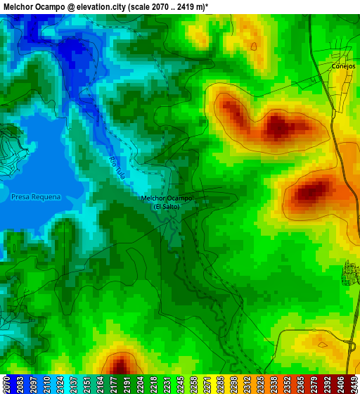
Below is the Elevation map of Melchor Ocampo, which displays elevation range with different colors. Scale of the first map is from 2070 to 2419 m (6791 to 7936 ft) with average elevation of 2209 meters (=7247 ft) [note 1]
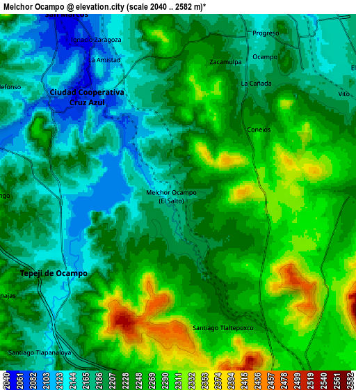
These maps also provides idea of topography and contour of this city, they are displayed at different zoom levels. More info about maps, scale and edge coordinates you can find below images.
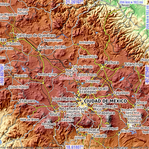
| \ | Map #1 | Map #2 | Topo.Map |
| Scale [m] | 2070..2419 m | 2040..2582 m | × |
| Scale [ft] | 6791..7936 ft | 6693..8471 ft | × |
| Average | 2209 m = 7247 ft | 2222.1 m = 7290 ft | × |
| Width | 9.19 km = 5.7 mi | 18.37 km = 11.4 mi | 293.9 km = 182.6 mi |
| Height | 9.19 km = 5.7 mi | 18.37 km = 11.4 mi | 294 km = 182.7 mi |
| ↑Max Latitude | 19.986704° | 20.027997° | 21.26167° |
| Latitude at center | 19.9454° | 19.9454° | 19.9454° |
| ↓Min Latitude | 19.904085° | 19.86276° | 18.61807° |
| ← Min Longitude | -99.325655° | -99.369601° | -100.68796° |
| Longitude center | -99.28171° | -99.28171° | -99.28171° |
| →Max Longitude | -99.237765° | -99.193819° | -97.87546° |
Nearby cities:
Cities around Melchor Ocampo sort by population:
• Tepeji del Río de Ocampo elevation 2161 m
7.9 km,  235°
235°
• San Miguel Vindho 2134 m
6.6 km,  325°
325°
• Tianguistengo (La Romera) 2139 m
5.8 km,  233°
233°
• Conejos 2259 m
5.2 km,  49°
49°
• Bomintzha 2233 m
7.7 km,  6°
6°
• Santa María Ilucan 2105 m
8 km,  310°
310°
• Santiago Tlaltepoxco 2261 m
7.2 km,  162°
162°
• Monte Alegre 2077 m
7.5 km,  303°
303°
• La Amistad 2101 m
8.1 km, 330°
• Cañada 2183 m
7.3 km,  37°
37°
• Paseos de la Pradera 2264 m
7.6 km,  142°
142°
• Zacamulpa 2198 m
7.2 km,  21°
21°
Multilingual:
 En español:
Melchor Ocampo elevación 2185 m.
 En France:
Melchor Ocampo élévation 2185 m.
 Auf Deutsch:
Melchor Ocampo höhe über dem Meeresspiegel ist 2185 m.

Sources and notes:
- [note 1] Map square and city borders are not equal. Map elevation data is calculated only from area inside that square.
- [src 1] Elevation data from geonames database provided with same terms of usage.
- [src 2] The elevation map of Melchor Ocampo is generated using elevation data from NASA's 3 arcsec (90m) resolution SRTM data.
- [src 3] Base (background) map © OpenStreetMap contributors tiles are generated by Geofabrik and OpenTopoMap.
Copyright & License:
This Melchor Ocampo Elevation Map is licensed under CC BY-SA. You may reuse any part from this page, if you give a proper credit by linking to this URL:
 More info on terms of use page.