Hidalgo elevation
Hidalgo (Tamaulipas, Reynosa), Mexico elevation is 33 meters and Hidalgo elevation in feet is 108 ft above sea level [src 1]. Hidalgo is a populated place (feature code) with elevation that is 1281 meters (4203 ft) smaller than average city elevation in Mexico.
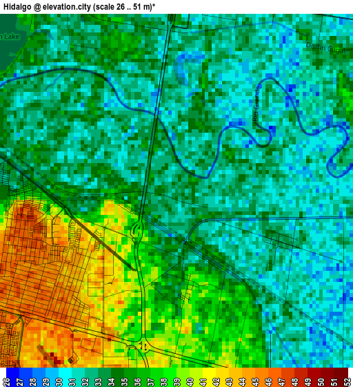
Below is the Elevation map of Hidalgo, which displays elevation range with different colors. Scale of the first map is from 26 to 51 m (85 to 167 ft) with average elevation of 34.4 meters (=113 ft) [note 1]
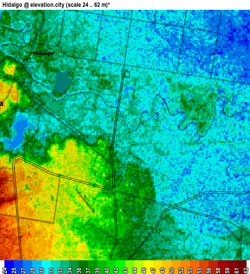
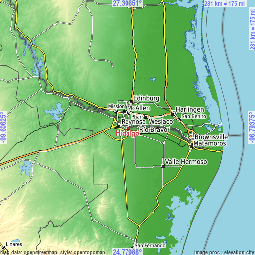
These maps also provides idea of topography and contour of this city, they are displayed at different zoom levels. More info about maps, scale and edge coordinates you can find below images.
| \ | Map #1 | Map #2 | Topo.Map |
| Scale [m] | 26..51 m | 24..62 m | × |
| Scale [ft] | 85..167 ft | 79..203 ft | × |
| Average | 34.4 m = 113 ft | 34.9 m = 115 ft | × |
| Width | 8.78 km = 5.5 mi | 17.56 km = 10.9 mi | 280.9 km = 174.5 mi |
| Height | 8.78 km = 5.5 mi | 17.56 km = 10.9 mi | 280.9 km = 174.5 mi |
| ↑Max Latitude | 26.089474° | 26.128935° | 27.30651° |
| Latitude at center | 26.05° | 26.05° | 26.05° |
| ↓Min Latitude | 26.010512° | 25.971012° | 24.77988° |
| ← Min Longitude | -98.243945° | -98.287891° | -99.60625° |
| Longitude center | -98.2° | -98.2° | -98.2° |
| →Max Longitude | -98.156055° | -98.112109° | -96.79375° |
Nearby cities:
Cities around Hidalgo sort by population:
• Reynosa elevation 49 m
9.5 km,  291°
291°
• Ciudad Río Bravo 36 m
12.7 km,  123°
123°
• Ciudad Gustavo Díaz Ordaz 45 m
44.4 km,  297°
297°
• Nuevo Progreso 28 m
24.8 km,  88°
88°
• Ramírez 20 m
42.8 km,  104°
104°
• Anáhuac 18 m
52.3 km,  125°
125°
• El Realito 20 m
53.7 km,  142°
142°
• El Control 24 m
40 km, 104°
• Los Cavazos 44 m
18.1 km,  306°
306°
• Valadeces 48 m
51.7 km, 292°
• Vamos Tamaulipas 41 m
7.4 km,  197°
197°
• Santa Apolonia 20 m
50.1 km,  154°
154°
Multilingual:
 En español:
Hidalgo elevación 33 m.
 En France:
Hidalgo élévation 33 m.


Sources and notes:
- [note 1] Map square and city borders are not equal. Map elevation data is calculated only from area inside that square.
- [src 1] Elevation data from geonames database provided with same terms of usage.
- [src 2] The elevation map of Hidalgo is generated using elevation data from NASA's 3 arcsec (90m) resolution SRTM data.
- [src 3] Base (background) map © OpenStreetMap contributors tiles are generated by Geofabrik and OpenTopoMap.
Copyright & License:
This Hidalgo Elevation Map is licensed under CC BY-SA. You may reuse any part from this page, if you give a proper credit by linking to this URL:
 More info on terms of use page.