Huehuetán elevation
Huehuetán (Chiapas), Mexico elevation is 64 meters and Huehuetán elevation in feet is 210 ft above sea level [src 1]. Huehuetán is a seat of a second-order administrative division (feature code) with elevation that is 1250 meters (4101 ft) smaller than average city elevation in Mexico.
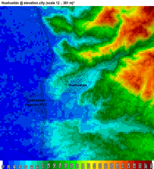
Below is the Elevation map of Huehuetán, which displays elevation range with different colors. Scale of the first map is from 12 to 381 m (39 to 1250 ft) with average elevation of 108.6 meters (=356 ft) [note 1]
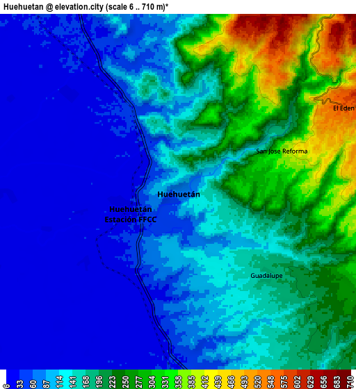
These maps also provides idea of topography and contour of this city, they are displayed at different zoom levels. More info about maps, scale and edge coordinates you can find below images.
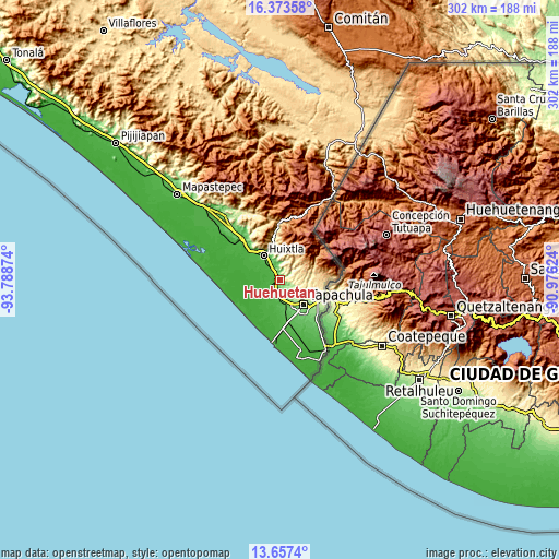
| \ | Map #1 | Map #2 | Topo.Map |
| Scale [m] | 12..381 m | 6..710 m | × |
| Scale [ft] | 39..1250 ft | 20..2329 ft | × |
| Average | 108.6 m = 356 ft | 148.7 m = 488 ft | × |
| Width | 9.44 km = 5.9 mi | 18.88 km = 11.7 mi | 302 km = 187.7 mi |
| Height | 9.44 km = 5.9 mi | 18.88 km = 11.7 mi | 302 km = 187.7 mi |
| ↑Max Latitude | 15.06225° | 15.104681° | 16.37358° |
| Latitude at center | 15.01981° | 15.01981° | 15.01981° |
| ↓Min Latitude | 14.977362° | 14.934905° | 13.6574° |
| ← Min Longitude | -92.426435° | -92.470381° | -93.78874° |
| Longitude center | -92.38249° | -92.38249° | -92.38249° |
| →Max Longitude | -92.338545° | -92.294599° | -90.97624° |
Nearby cities:
Cities around Huehuetán sort by population:
• Estación Huehuetán elevation 30 m
2.8 km,  249°
249°
• Álvaro Obregón 47 m
10.9 km,  177°
177°
• Xochiltepec 47 m
13.2 km,  335°
335°
• Guadalupe 172 m
6.4 km,  133°
133°
• Primer Cantón 41 m
12.8 km,  331°
331°
• Plan de Ayala 14 m
10.9 km, 248°
• Nuevo Pumpuapa (Cereso) 45 m
10.6 km,  170°
170°
• Chamulapita 111 m
5.6 km,  14°
14°
• Marte R. Gómez 20 m
12.3 km,  212°
212°
• Estación Tuzantán 34 m
12.1 km,  322°
322°
• Villa Hidalgo 116 m
9.7 km, 5°
• Cantón Villaflor 244 m
11 km,  16°
16°
Multilingual:
 En español:
Huehuetán elevación 64 m.
 En France:
Huehuetán élévation 64 m.
 Auf Deutsch:
Huehuetán höhe über dem Meeresspiegel ist 64 m.

Sources and notes:
- [note 1] Map square and city borders are not equal. Map elevation data is calculated only from area inside that square.
- [src 1] Elevation data from geonames database provided with same terms of usage.
- [src 2] The elevation map of Huehuetán is generated using elevation data from NASA's 3 arcsec (90m) resolution SRTM data.
- [src 3] Base (background) map © OpenStreetMap contributors tiles are generated by Geofabrik and OpenTopoMap.
Copyright & License:
This Huehuetán Elevation Map is licensed under CC BY-SA. You may reuse any part from this page, if you give a proper credit by linking to this URL:
 More info on terms of use page.