Ixcatepec elevation
Ixcatepec (Veracruz), Mexico elevation is 208 meters and Ixcatepec elevation in feet is 682 ft above sea level [src 1]. Ixcatepec is a populated place (feature code) with elevation that is 1106 meters (3629 ft) smaller than average city elevation in Mexico.
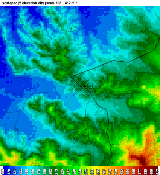
Below is the Elevation map of Ixcatepec, which displays elevation range with different colors. Scale of the first map is from 108 to 412 m (354 to 1352 ft) with average elevation of 186.5 meters (=612 ft) [note 1]
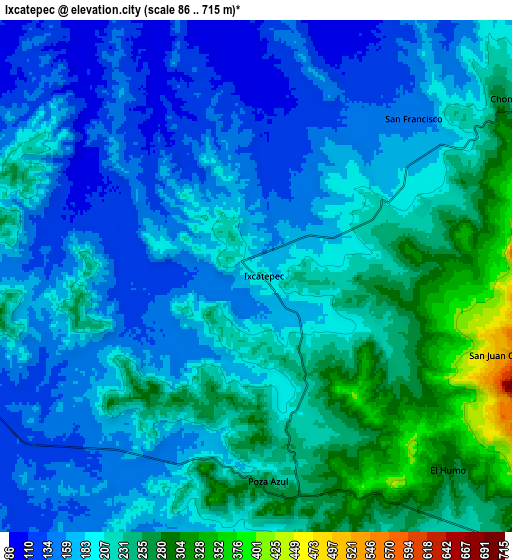
These maps also provides idea of topography and contour of this city, they are displayed at different zoom levels. More info about maps, scale and edge coordinates you can find below images.
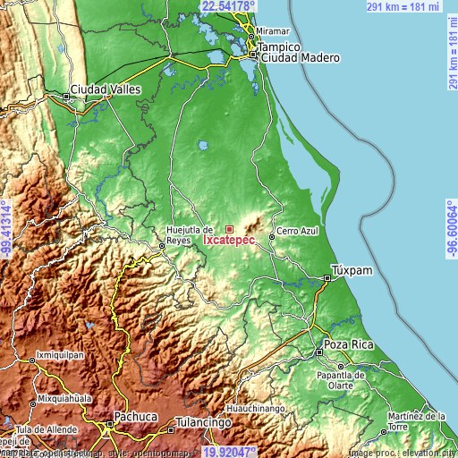
| \ | Map #1 | Map #2 | Topo.Map |
| Scale [m] | 108..412 m | 86..715 m | × |
| Scale [ft] | 354..1352 ft | 282..2346 ft | × |
| Average | 186.5 m = 612 ft | 198.4 m = 651 ft | × |
| Width | 9.11 km = 5.7 mi | 18.22 km = 11.3 mi | 291.5 km = 181.1 mi |
| Height | 9.11 km = 5.7 mi | 18.22 km = 11.3 mi | 291.5 km = 181.1 mi |
| ↑Max Latitude | 21.277905° | 21.318849° | 22.54178° |
| Latitude at center | 21.23695° | 21.23695° | 21.23695° |
| ↓Min Latitude | 21.195983° | 21.155005° | 19.92047° |
| ← Min Longitude | -98.050835° | -98.094781° | -99.41314° |
| Longitude center | -98.00689° | -98.00689° | -98.00689° |
| →Max Longitude | -97.962945° | -97.918999° | -96.60064° |
Nearby cities:
Cities around Ixcatepec sort by population:
• Tepetzintla elevation 279 m
18 km,  116°
116°
• Tamalín 147 m
23.2 km,  60°
60°
• Citlaltépec 231 m
16.8 km,  52°
52°
• Tlacolula 153 m
16.9 km,  163°
163°
• Chontla 262 m
10.8 km, 52°
• El Humo 297 m
9.6 km,  135°
135°
• San Francisco 147 m
8 km,  44°
44°
• Tierra Blanca 301 m
12.5 km,  133°
133°
• Tancoco 251 m
23 km,  76°
76°
• San Sebastián 112 m
13.2 km,  260°
260°
• Tantima 199 m
20.9 km, 59°
• Las Sabinas 227 m
15.9 km, 55°
Multilingual:
 En español:
Ixcatepec elevación 208 m.
 En France:
Ixcatepec élévation 208 m.
 Auf Deutsch:
Ixcatepec höhe über dem Meeresspiegel ist 208 m.

Sources and notes:
- [note 1] Map square and city borders are not equal. Map elevation data is calculated only from area inside that square.
- [src 1] Elevation data from geonames database provided with same terms of usage.
- [src 2] The elevation map of Ixcatepec is generated using elevation data from NASA's 3 arcsec (90m) resolution SRTM data.
- [src 3] Base (background) map © OpenStreetMap contributors tiles are generated by Geofabrik and OpenTopoMap.
Copyright & License:
This Ixcatepec Elevation Map is licensed under CC BY-SA. You may reuse any part from this page, if you give a proper credit by linking to this URL:
 More info on terms of use page.