San Francisco Ixhuatan elevation
San Francisco Ixhuatan (Oaxaca, San Francisco Ixhuatán), Mexico elevation is 19 meters and San Francisco Ixhuatan elevation in feet is 62 ft above sea level [src 1]. San Francisco Ixhuatan is a populated place (feature code) with elevation that is 1295 meters (4249 ft) smaller than average city elevation in Mexico.
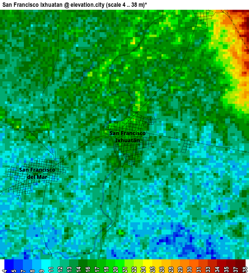
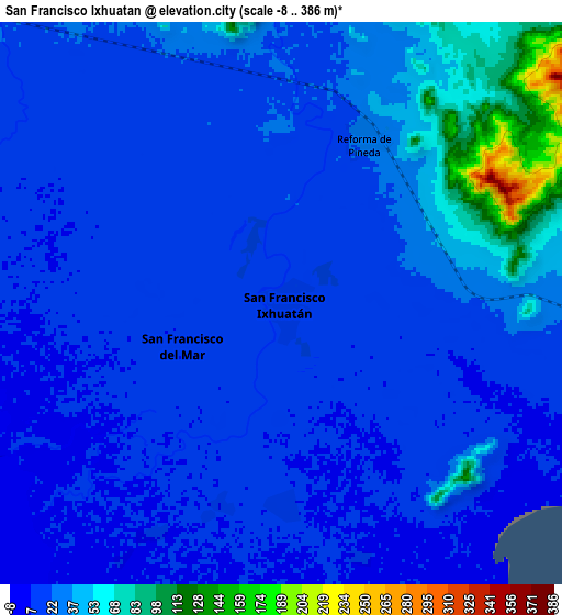
Below is the Elevation map of San Francisco Ixhuatan, which displays elevation range with different colors. Scale of the first map is from 4 to 38 m (13 to 125 ft) with average elevation of 13.8 meters (=45 ft) [note 1]
These maps also provides idea of topography and contour of this city, they are displayed at different zoom levels. More info about maps, scale and edge coordinates you can find below images.
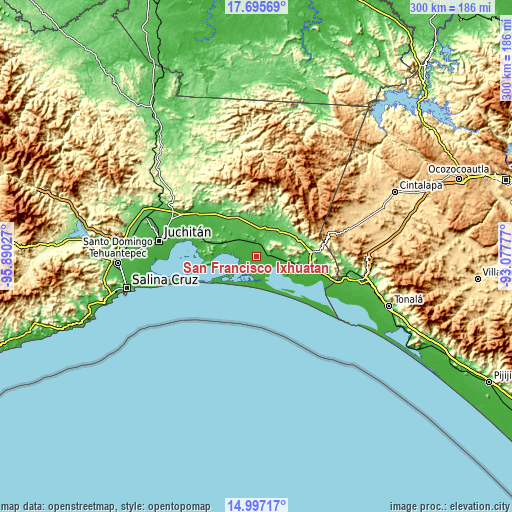
| \ | Map #1 | Map #2 | Topo.Map |
| Scale [m] | 4..38 m | -8..386 m | × |
| Scale [ft] | 13..125 ft | -26..1266 ft | × |
| Average | 13.8 m = 45 ft | 25.9 m = 85 ft | × |
| Width | 9.38 km = 5.8 mi | 18.75 km = 11.7 mi | 300 km = 186.4 mi |
| Height | 9.38 km = 5.8 mi | 18.75 km = 11.7 mi | 300.1 km = 186.5 mi |
| ↑Max Latitude | 16.393253° | 16.435408° | 17.69569° |
| Latitude at center | 16.35109° | 16.35109° | 16.35109° |
| ↓Min Latitude | 16.308918° | 16.266736° | 14.99717° |
| ← Min Longitude | -94.527965° | -94.571911° | -95.89027° |
| Longitude center | -94.48402° | -94.48402° | -94.48402° |
| →Max Longitude | -94.440075° | -94.396129° | -93.07777° |
Nearby cities:
Cities around San Francisco Ixhuatan sort by population:
• Chahuites elevation 25 m
31.6 km,  102°
102°
• Chahuite 25 m
32.6 km, 100°
• Las Amilpas 2 m
14.3 km,  276°
276°
• San Pedro Tapanatepec 57 m
31.1 km,  85°
85°
• Santo Domingo Zanatepec 70 m
20.7 km,  44°
44°
• San Francisco del Mar 13 m
3.6 km,  249°
249°
• San Francisco del Mar Viejo 8 m
20.7 km,  230°
230°
• Niltepec 69 m
27.4 km,  329°
329°
• San Dionisio del Mar 19 m
29.4 km,  264°
264°
• Reforma de Pineda 29 m
6.2 km,  26°
26°
• Guamúchil 9 m
19.8 km, 275°
• General Pascual Fentes 108 m
25.4 km,  68°
68°
Multilingual:
 En español:
Ixhuatán, San Francisco Ixhuatan elevación 19 m.
 En France:
San Francisco Ixhuatan élévation 19 m.
 Auf Deutsch:
San Francisco Ixhuatan höhe über dem Meeresspiegel ist 19 m.
 На русском:
San Francisco Ixhuatan высота над уровнем моря 19 м
Sources and notes:
- [note 1] Map square and city borders are not equal. Map elevation data is calculated only from area inside that square.
- [src 1] Elevation data from geonames database provided with same terms of usage.
- [src 2] The elevation map of San Francisco Ixhuatan is generated using elevation data from NASA's 3 arcsec (90m) resolution SRTM data.
- [src 3] Base (background) map © OpenStreetMap contributors tiles are generated by Geofabrik and OpenTopoMap.
Copyright & License:
This San Francisco Ixhuatan Elevation Map is licensed under CC BY-SA. You may reuse any part from this page, if you give a proper credit by linking to this URL:
 More info on terms of use page.