Jalapa elevation
Jalapa (Oaxaca, Santa María Jalapa del Marqués), Mexico elevation is 126 meters and Jalapa elevation in feet is 413 ft above sea level [src 1]. Jalapa is a populated place (feature code) with elevation that is 1188 meters (3898 ft) smaller than average city elevation in Mexico.
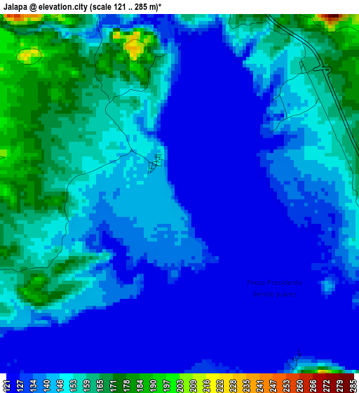
Below is the Elevation map of Jalapa, which displays elevation range with different colors. Scale of the first map is from 121 to 285 m (397 to 935 ft) with average elevation of 144.4 meters (=474 ft) [note 1]
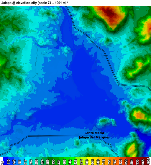
These maps also provides idea of topography and contour of this city, they are displayed at different zoom levels. More info about maps, scale and edge coordinates you can find below images.
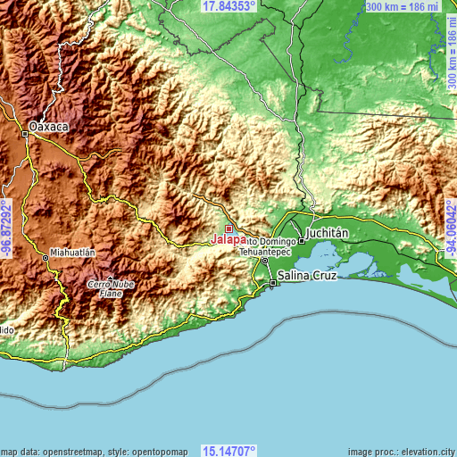
| \ | Map #1 | Map #2 | Topo.Map |
| Scale [m] | 121..285 m | 74..1001 m | × |
| Scale [ft] | 397..935 ft | 243..3284 ft | × |
| Average | 144.4 m = 474 ft | 232.8 m = 764 ft | × |
| Width | 9.37 km = 5.8 mi | 18.74 km = 11.6 mi | 299.8 km = 186.3 mi |
| Height | 9.37 km = 5.8 mi | 18.74 km = 11.6 mi | 299.8 km = 186.3 mi |
| ↑Max Latitude | 16.542131° | 16.584253° | 17.84353° |
| Latitude at center | 16.5° | 16.5° | 16.5° |
| ↓Min Latitude | 16.45786° | 16.41571° | 15.14707° |
| ← Min Longitude | -95.510615° | -95.554561° | -96.87292° |
| Longitude center | -95.46667° | -95.46667° | -95.46667° |
| →Max Longitude | -95.422725° | -95.378779° | -94.06042° |
Nearby cities:
Cities around Jalapa sort by population:
• Santo Domingo Tehuantepec elevation 44 m
31 km,  129°
129°
• San Blas Atempa 54 m
31.8 km, 126°
• Santa María Jalapa del Marqués 161 m
7 km,  160°
160°
• Magdalena Tequisistlán 204 m
18.3 km,  232°
232°
• Santa María Mixtequilla 54 m
26 km,  122°
122°
• Santiago Laollaga 128 m
29.2 km,  71°
71°
• Santiago Lachiguiri 803 m
21.9 km,  341°
341°
• Santa María Guenagati 330 m
29.1 km,  24°
24°
• Colonia Jordán 34 m
30.8 km,  113°
113°
• Magdalena Tlacotepec 114 m
28.2 km,  89°
89°
• Colonia San Luis 50 m
27.5 km, 119°
• San Miguel Tenango 1613 m
29.4 km,  207°
207°
Multilingual:
 En español:
Jalapa elevación 126 m.
 En France:
Jalapa élévation 126 m.


Sources and notes:
- [note 1] Map square and city borders are not equal. Map elevation data is calculated only from area inside that square.
- [src 1] Elevation data from geonames database provided with same terms of usage.
- [src 2] The elevation map of Jalapa is generated using elevation data from NASA's 3 arcsec (90m) resolution SRTM data.
- [src 3] Base (background) map © OpenStreetMap contributors tiles are generated by Geofabrik and OpenTopoMap.
Copyright & License:
This Jalapa Elevation Map is licensed under CC BY-SA. You may reuse any part from this page, if you give a proper credit by linking to this URL:
 More info on terms of use page.