La Libertad elevation
La Libertad (Chiapas, Suchiate), Mexico elevation is 16 meters and La Libertad elevation in feet is 52 ft above sea level [src 1]. La Libertad is a populated place (feature code) with elevation that is 1298 meters (4259 ft) smaller than average city elevation in Mexico.
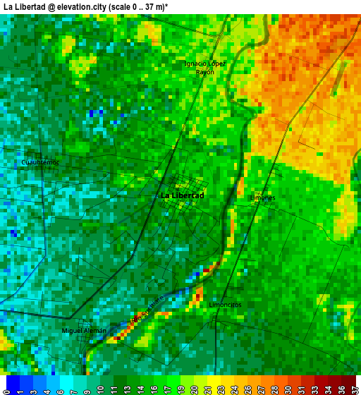
Below is the Elevation map of La Libertad, which displays elevation range with different colors. Scale of the first map is from 0 to 37 m (0 to 121 ft) with average elevation of 14.7 meters (=48 ft) [note 1]
These maps also provides idea of topography and contour of this city, they are displayed at different zoom levels. More info about maps, scale and edge coordinates you can find below images.
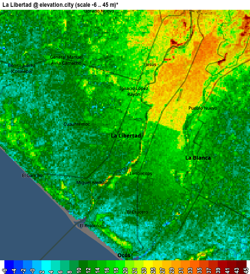
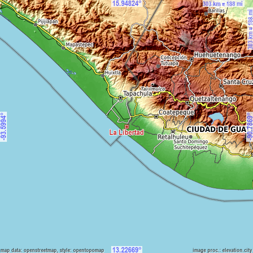
| \ | Map #1 | Map #2 | Topo.Map |
| Scale [m] | 0..37 m | -6..45 m | × |
| Scale [ft] | 0..121 ft | -20..148 ft | × |
| Average | 14.7 m = 48 ft | 14.3 m = 47 ft | × |
| Width | 9.46 km = 5.9 mi | 18.91 km = 11.8 mi | 302.6 km = 188 mi |
| Height | 9.46 km = 5.9 mi | 18.91 km = 11.8 mi | 302.6 km = 188 mi |
| ↑Max Latitude | 14.634194° | 14.676709° | 15.94824° |
| Latitude at center | 14.59167° | 14.59167° | 14.59167° |
| ↓Min Latitude | 14.549138° | 14.506598° | 13.22669° |
| ← Min Longitude | -92.237095° | -92.281041° | -93.5994° |
| Longitude center | -92.19315° | -92.19315° | -92.19315° |
| →Max Longitude | -92.149205° | -92.105259° | -90.7869° |
Nearby cities:
Cities around La Libertad sort by population:
• Ciudad Hidalgo elevation 29 m
10.9 km,  23°
23°
• Brisas Barra de Suchiate 4 m
7 km,  208°
208°
• Frontera Hidalgo 72 m
20.7 km,  4°
4°
• Metapa 112 m
27.2 km, 0°
• Ignacio Zaragoza 48 m
16.7 km,  8°
8°
• Texcaltic 86 m
22.7 km, 1°
• El Encanto 8 m
28 km,  303°
303°
• Ignacio López Rayón 18 m
3.4 km, 11°
• Guadalupe Victoria 68 m
24.4 km,  345°
345°
• Congregación Reforma 44 m
24.9 km,  328°
328°
• Omoa 86 m
27.2 km, 350°
• Tinajas 1ra. Sección 17 m
20.2 km,  313°
313°
Multilingual:
 En español:
La Libertad elevación 16 m.
 En France:
La Libertad élévation 16 m.
 Auf Deutsch:
La Libertad höhe über dem Meeresspiegel ist 16 m.

Sources and notes:
- [note 1] Map square and city borders are not equal. Map elevation data is calculated only from area inside that square.
- [src 1] Elevation data from geonames database provided with same terms of usage.
- [src 2] The elevation map of La Libertad is generated using elevation data from NASA's 3 arcsec (90m) resolution SRTM data.
- [src 3] Base (background) map © OpenStreetMap contributors tiles are generated by Geofabrik and OpenTopoMap.
Copyright & License:
This La Libertad Elevation Map is licensed under CC BY-SA. You may reuse any part from this page, if you give a proper credit by linking to this URL:
 More info on terms of use page.