Mecayapan elevation
Mecayapan (Veracruz), Mexico elevation is 347 meters and Mecayapan elevation in feet is 1138 ft above sea level [src 1]. Mecayapan is a seat of a second-order administrative division (feature code) with elevation that is 967 meters (3173 ft) smaller than average city elevation in Mexico.
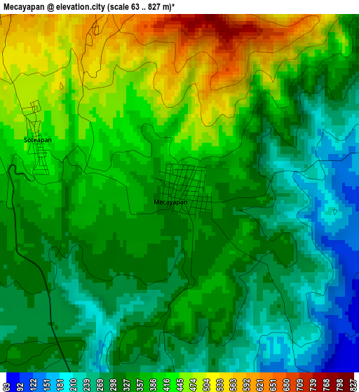
Below is the Elevation map of Mecayapan, which displays elevation range with different colors. Scale of the first map is from 63 to 827 m (207 to 2713 ft) with average elevation of 358.1 meters (=1175 ft) [note 1]
These maps also provides idea of topography and contour of this city, they are displayed at different zoom levels. More info about maps, scale and edge coordinates you can find below images.
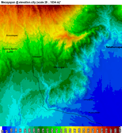
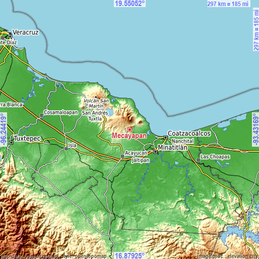
| \ | Map #1 | Map #2 | Topo.Map |
| Scale [m] | 63..827 m | 28..1034 m | × |
| Scale [ft] | 207..2713 ft | 92..3392 ft | × |
| Average | 358.1 m = 1175 ft | 339.9 m = 1115 ft | × |
| Width | 9.28 km = 5.8 mi | 18.57 km = 11.5 mi | 297 km = 184.5 mi |
| Height | 9.28 km = 5.8 mi | 18.57 km = 11.5 mi | 297 km = 184.5 mi |
| ↑Max Latitude | 18.261747° | 18.303474° | 19.55052° |
| Latitude at center | 18.22001° | 18.22001° | 18.22001° |
| ↓Min Latitude | 18.178263° | 18.136506° | 16.87925° |
| ← Min Longitude | -94.881885° | -94.925831° | -96.24419° |
| Longitude center | -94.83794° | -94.83794° | -94.83794° |
| →Max Longitude | -94.793995° | -94.750049° | -93.43169° |
Nearby cities:
Cities around Mecayapan sort by population:
• Tatahuicapan elevation 120 m
8.6 km,  70°
70°
• Soteapan 450 m
4 km,  292°
292°
• Buenavista 514 m
10.1 km,  275°
275°
• Ocozotepec 670 m
8.8 km,  299°
299°
• Morelos 408 m
12.6 km,  249°
249°
• Huazuntlán 73 m
8.5 km,  146°
146°
• Ixhuapán 84 m
6.4 km,  139°
139°
• El Aguacate 450 m
14.2 km,  260°
260°
• San Fernando 675 m
7.4 km,  317°
317°
• El Tulín 601 m
12.6 km, 284°
• Saltillo 200 m
7 km,  193°
193°
• Ocotal Chico 608 m
4.8 km,  330°
330°
Multilingual:
 En español:
Mecayapan elevación 347 m.
 En France:
Mecayapan élévation 347 m.
 Auf Deutsch:
Mecayapan höhe über dem Meeresspiegel ist 347 m.

Sources and notes:
- [note 1] Map square and city borders are not equal. Map elevation data is calculated only from area inside that square.
- [src 1] Elevation data from geonames database provided with same terms of usage.
- [src 2] The elevation map of Mecayapan is generated using elevation data from NASA's 3 arcsec (90m) resolution SRTM data.
- [src 3] Base (background) map © OpenStreetMap contributors tiles are generated by Geofabrik and OpenTopoMap.
Copyright & License:
This Mecayapan Elevation Map is licensed under CC BY-SA. You may reuse any part from this page, if you give a proper credit by linking to this URL:
 More info on terms of use page.