Metlatónoc elevation
Metlatónoc (Guerrero), Mexico elevation is 2022 meters and Metlatónoc elevation in feet is 6634 ft above sea level [src 1]. Metlatónoc is a seat of a second-order administrative division (feature code) with elevation that is 708 meters (2323 ft) bigger than average city elevation in Mexico.
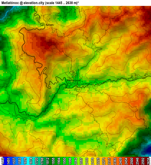
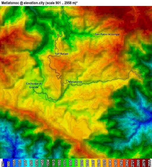
Below is the Elevation map of Metlatónoc, which displays elevation range with different colors. Scale of the first map is from 1445 to 2638 m (4741 to 8655 ft) with average elevation of 2160.9 meters (=7090 ft) [note 1]
These maps also provides idea of topography and contour of this city, they are displayed at different zoom levels. More info about maps, scale and edge coordinates you can find below images.
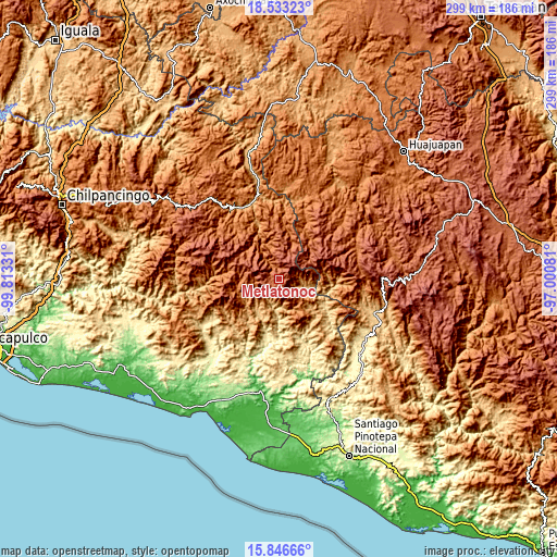
| \ | Map #1 | Map #2 | Topo.Map |
| Scale [m] | 1445..2638 m | 901..2958 m | × |
| Scale [ft] | 4741..8655 ft | 2956..9705 ft | × |
| Average | 2160.9 m = 7090 ft | 2025.9 m = 6647 ft | × |
| Width | 9.34 km = 5.8 mi | 18.67 km = 11.6 mi | 298.7 km = 185.6 mi |
| Height | 9.34 km = 5.8 mi | 18.67 km = 11.6 mi | 298.7 km = 185.6 mi |
| ↑Max Latitude | 17.236796° | 17.278763° | 18.53323° |
| Latitude at center | 17.19482° | 17.19482° | 17.19482° |
| ↓Min Latitude | 17.152834° | 17.110839° | 15.84666° |
| ← Min Longitude | -98.451005° | -98.494951° | -99.81331° |
| Longitude center | -98.40706° | -98.40706° | -98.40706° |
| →Max Longitude | -98.363115° | -98.319169° | -97.00081° |
Nearby cities:
Cities around Metlatónoc sort by population:
• Cochoapa el Grande elevation 2017 m
5.2 km,  267°
267°
• San Vicente Zoyatlán 2059 m
14.9 km,  17°
17°
• Xochapa 1440 m
21.5 km,  347°
347°
• Jicayán de Tovar 711 m
19.6 km,  112°
112°
• Tlahuapa 1614 m
21.4 km, 20°
• San Rafael 2182 m
4 km,  332°
332°
• San Pablo Atzompa 2181 m
7 km,  34°
34°
• San Miguel el Grande 1737 m
19.1 km,  72°
72°
• El Jicaral 829 m
23.6 km, 108°
• Zilacayotitlán 2255 m
18.8 km,  306°
306°
• Santiago Tilapa 1918 m
17.1 km, 65°
• Melchor Ocampo 1535 m
18.7 km, 346°
Multilingual:
 En español:
Metlatónoc elevación 2022 m.
 En France:
Metlatónoc élévation 2022 m.
 Auf Deutsch:
Metlatónoc höhe über dem Meeresspiegel ist 2022 m.

Sources and notes:
- [note 1] Map square and city borders are not equal. Map elevation data is calculated only from area inside that square.
- [src 1] Elevation data from geonames database provided with same terms of usage.
- [src 2] The elevation map of Metlatónoc is generated using elevation data from NASA's 3 arcsec (90m) resolution SRTM data.
- [src 3] Base (background) map © OpenStreetMap contributors tiles are generated by Geofabrik and OpenTopoMap.
Copyright & License:
This Metlatónoc Elevation Map is licensed under CC BY-SA. You may reuse any part from this page, if you give a proper credit by linking to this URL:
 More info on terms of use page.