San Baltazar Atlimeyaya elevation
San Baltazar Atlimeyaya (Puebla, Tianguismanalco), Mexico elevation is 2196 meters and San Baltazar Atlimeyaya elevation in feet is 7205 ft above sea level [src 1]. San Baltazar Atlimeyaya is a populated place (feature code) with elevation that is 882 meters (2894 ft) bigger than average city elevation in Mexico.
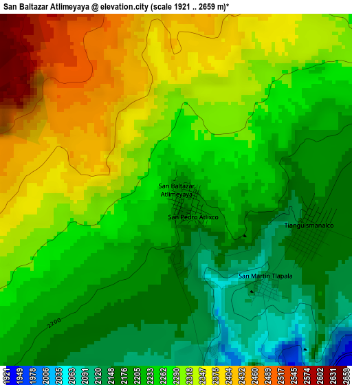
Below is the Elevation map of San Baltazar Atlimeyaya, which displays elevation range with different colors. Scale of the first map is from 1921 to 2659 m (6302 to 8724 ft) with average elevation of 2267.8 meters (=7440 ft) [note 1]
These maps also provides idea of topography and contour of this city, they are displayed at different zoom levels. More info about maps, scale and edge coordinates you can find below images.
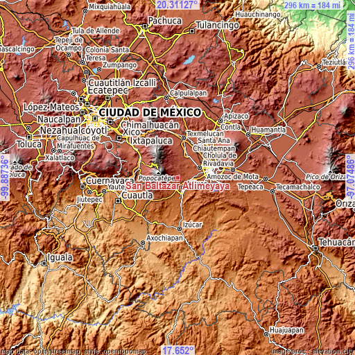
| \ | Map #1 | Topo.Map |
| Scale [m] | 1921..2659 m | × |
| Scale [ft] | 6302..8724 ft | × |
| Average | 2267.8 m = 7440 ft | × |
| Width | 9.24 km = 5.7 mi | 295.7 km = 183.7 mi |
| Height | 9.24 km = 5.7 mi | 295.7 km = 183.7 mi |
| ↑Max Latitude | 19.028489° | 20.31127° |
| Latitude at center | 18.98694° | 18.98694° |
| ↓Min Latitude | 18.94538° | 17.652° |
| ← Min Longitude | -98.525055° | -99.88736° |
| Longitude center | -98.48111° | -98.48111° |
| →Max Longitude | -98.437165° | -97.07486° |
Nearby cities:
Cities around San Baltazar Atlimeyaya sort by population:
• Atlixco elevation 1846 m
10 km,  151°
151°
• Nealtican 2236 m
9 km,  38°
38°
• San Nicolás de los Ranchos 2448 m
9.4 km,  356°
356°
• Tianguismanalco 2168 m
3.6 km,  109°
109°
• San Pedro Benito Juárez 2337 m
8.6 km,  239°
239°
• San Pedro Yancuitlalpan 2437 m
10.1 km, 358°
• El Encanto del Cerril 1898 m
8.5 km,  136°
136°
• Tecuanipan 2159 m
9.2 km,  71°
71°
• Colonia Agrícola de Ocotepec (Colonia San José) 2154 m
9.2 km,  226°
226°
• San Martín Tlamapa 2127 m
8.9 km,  96°
96°
• San Martín Tlapala 2122 m
3.2 km,  133°
133°
• Ciudad de Atlixco 1843 m
10.2 km, 154°
Multilingual:
 En español:
San Baltazar Atlimeyaya elevación 2196 m.
 En France:
San Baltazar Atlimeyaya élévation 2196 m.
 Auf Deutsch:
San Baltazar Atlimeyaya höhe über dem Meeresspiegel ist 2196 m.
 На русском:
San Baltazar Atlimeyaya высота над уровнем моря 2196 м
Sources and notes:
- [note 1] Map square and city borders are not equal. Map elevation data is calculated only from area inside that square.
- [src 1] Elevation data from geonames database provided with same terms of usage.
- [src 2] The elevation map of San Baltazar Atlimeyaya is generated using elevation data from NASA's 3 arcsec (90m) resolution SRTM data.
- [src 3] Base (background) map © OpenStreetMap contributors tiles are generated by Geofabrik and OpenTopoMap.
Copyright & License:
This San Baltazar Atlimeyaya Elevation Map is licensed under CC BY-SA. You may reuse any part from this page, if you give a proper credit by linking to this URL:
 More info on terms of use page.