San José de Gracia elevation
San José de Gracia (Puebla, Molcaxac), Mexico elevation is 1902 meters and San José de Gracia elevation in feet is 6240 ft above sea level [src 1]. San José de Gracia is a populated place (feature code) with elevation that is 588 meters (1929 ft) bigger than average city elevation in Mexico.
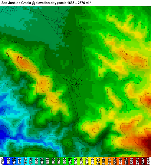
Below is the Elevation map of San José de Gracia, which displays elevation range with different colors. Scale of the first map is from 1638 to 2376 m (5374 to 7795 ft) with average elevation of 1940 meters (=6365 ft) [note 1]
These maps also provides idea of topography and contour of this city, they are displayed at different zoom levels. More info about maps, scale and edge coordinates you can find below images.
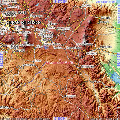
| \ | Map #1 | Topo.Map |
| Scale [m] | 1638..2376 m | × |
| Scale [ft] | 5374..7795 ft | × |
| Average | 1940 m = 6365 ft | × |
| Width | 9.26 km = 5.8 mi | 296.3 km = 184.1 mi |
| Height | 9.26 km = 5.8 mi | 296.3 km = 184.1 mi |
| ↑Max Latitude | 18.685054° | 19.97055° |
| Latitude at center | 18.64342° | 18.64342° |
| ↓Min Latitude | 18.601776° | 17.30584° |
| ← Min Longitude | -97.891235° | -99.25354° |
| Longitude center | -97.84729° | -97.84729° |
| →Max Longitude | -97.803345° | -96.44104° |
Nearby cities:
Cities around San José de Gracia sort by population:
• Xochitlan Todos Santos elevation 1908 m
10.1 km,  48°
48°
• Tepexi de Rodríguez 1726 m
10.8 km,  230°
230°
• Santa Clara Huitziltepec 1919 m
14.4 km,  345°
345°
• Huajoyuca 1834 m
17.4 km,  213°
213°
• Juan N. Méndez 1935 m
13.7 km,  144°
144°
• Santa Cruz Huitziltepec 1857 m
10.4 km,  343°
343°
• Tepazolco 1971 m
17.1 km,  68°
68°
• San Lucas el Viejo 1922 m
14.1 km, 74°
• Tepetlacolco 1911 m
16.3 km,  90°
90°
• Dolores Hidalgo 1930 m
12.7 km, 353°
• Tula 1839 m
13.4 km, 209°
• El Progreso 1891 m
9.3 km,  186°
186°
Multilingual:
 En español:
San José de Gracia elevación 1902 m.
 En France:
San José de Gracia élévation 1902 m.
 Auf Deutsch:
San José de Gracia höhe über dem Meeresspiegel ist 1902 m.
 На русском:
San José de Gracia высота над уровнем моря 1902 м
Sources and notes:
- [note 1] Map square and city borders are not equal. Map elevation data is calculated only from area inside that square.
- [src 1] Elevation data from geonames database provided with same terms of usage.
- [src 2] The elevation map of San José de Gracia is generated using elevation data from NASA's 3 arcsec (90m) resolution SRTM data.
- [src 3] Base (background) map © OpenStreetMap contributors tiles are generated by Geofabrik and OpenTopoMap.
Copyright & License:
This San José de Gracia Elevation Map is licensed under CC BY-SA. You may reuse any part from this page, if you give a proper credit by linking to this URL:
 More info on terms of use page.