San Pablo Huixtepec elevation
San Pablo Huixtepec (Oaxaca), Mexico elevation is 1485 meters and San Pablo Huixtepec elevation in feet is 4872 ft above sea level [src 1]. San Pablo Huixtepec is a seat of a second-order administrative division (feature code) with elevation that is 171 meters (561 ft) bigger than average city elevation in Mexico.
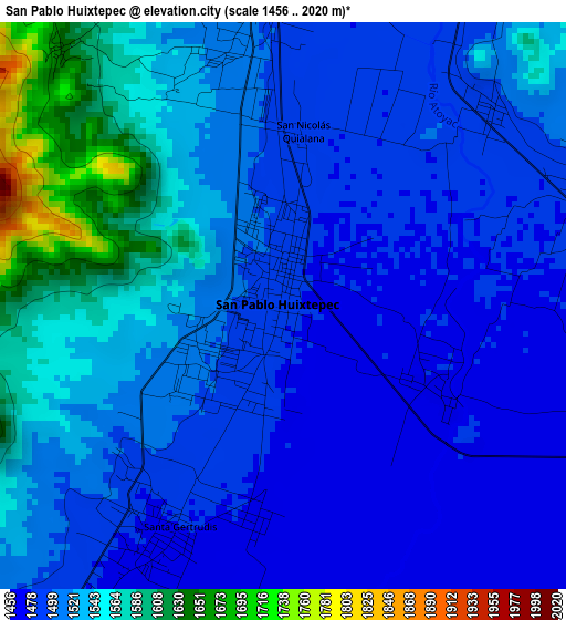
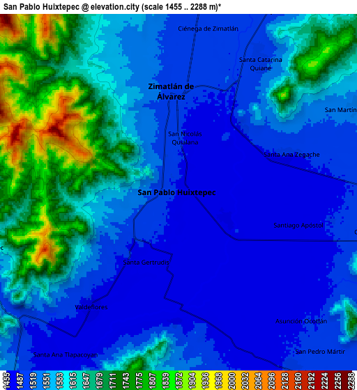
Below is the Elevation map of San Pablo Huixtepec, which displays elevation range with different colors. Scale of the first map is from 1456 to 2020 m (4777 to 6627 ft) with average elevation of 1517.3 meters (=4978 ft) [note 1]
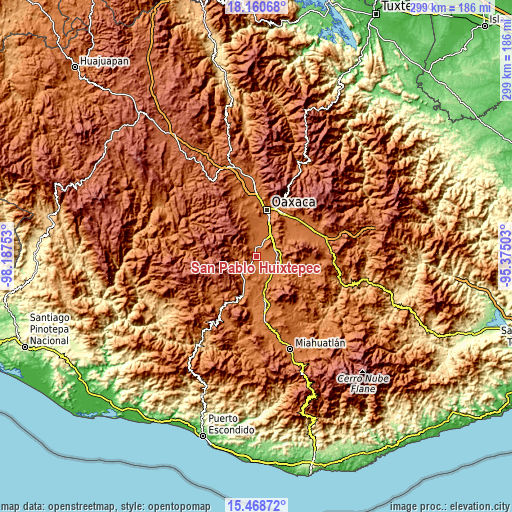
These maps also provides idea of topography and contour of this city, they are displayed at different zoom levels. More info about maps, scale and edge coordinates you can find below images.
| \ | Map #1 | Map #2 | Topo.Map |
| Scale [m] | 1456..2020 m | 1455..2288 m | × |
| Scale [ft] | 4777..6627 ft | 4774..7507 ft | × |
| Average | 1517.3 m = 4978 ft | 1578.9 m = 5180 ft | × |
| Width | 9.35 km = 5.8 mi | 18.71 km = 11.6 mi | 299.3 km = 186 mi |
| Height | 9.35 km = 5.8 mi | 18.71 km = 11.6 mi | 299.3 km = 186 mi |
| ↑Max Latitude | 16.861541° | 16.903592° | 18.16068° |
| Latitude at center | 16.81948° | 16.81948° | 16.81948° |
| ↓Min Latitude | 16.77741° | 16.735331° | 15.46872° |
| ← Min Longitude | -96.825225° | -96.869171° | -98.18753° |
| Longitude center | -96.78128° | -96.78128° | -96.78128° |
| →Max Longitude | -96.737335° | -96.693389° | -95.37503° |
Nearby cities:
Cities around San Pablo Huixtepec sort by population:
• Zimatlán de Álvarez elevation 1505 m
5.6 km,  356°
356°
• Santiago Apostol 1478 m
6.7 km,  105°
105°
• Ciénega de Zimatlán 1501 m
8.4 km,  10°
10°
• Santa Ana Zegache 1490 m
5.8 km,  70°
70°
• Asunción Ocotlán 1485 m
9 km,  135°
135°
• Santa Gertrudis 1475 m
4.3 km,  208°
208°
• Santa Catarina Quiané 1502 m
8.2 km,  31°
31°
• San Martín Tilcajete 1539 m
10.2 km,  63°
63°
• Valdeflores 1478 m
7.5 km,  217°
217°
• Santa Ana Tlapacoyan 1484 m
10.3 km, 214°
• San Nicolás Quialana 1488 m
2.7 km, 5°
• Santa Inés Yatzeche 1475 m
2.9 km,  119°
119°
Multilingual:
 En español:
San Pablo Huixtepec elevación 1485 m.
 En France:
San Pablo Huixtepec élévation 1485 m.
 Auf Deutsch:
San Pablo Huixtepec höhe über dem Meeresspiegel ist 1485 m.
 На русском:
San Pablo Huixtepec высота над уровнем моря 1485 м
Sources and notes:
- [note 1] Map square and city borders are not equal. Map elevation data is calculated only from area inside that square.
- [src 1] Elevation data from geonames database provided with same terms of usage.
- [src 2] The elevation map of San Pablo Huixtepec is generated using elevation data from NASA's 3 arcsec (90m) resolution SRTM data.
- [src 3] Base (background) map © OpenStreetMap contributors tiles are generated by Geofabrik and OpenTopoMap.
Copyright & License:
This San Pablo Huixtepec Elevation Map is licensed under CC BY-SA. You may reuse any part from this page, if you give a proper credit by linking to this URL:
 More info on terms of use page.