Santa Cruz Ayotuxco elevation
Santa Cruz Ayotuxco (Morelos), Mexico elevation is 2839 meters and Santa Cruz Ayotuxco elevation in feet is 9314 ft above sea level [src 1]. Santa Cruz Ayotuxco is a populated place (feature code) with elevation that is 1525 meters (5003 ft) bigger than average city elevation in Mexico.
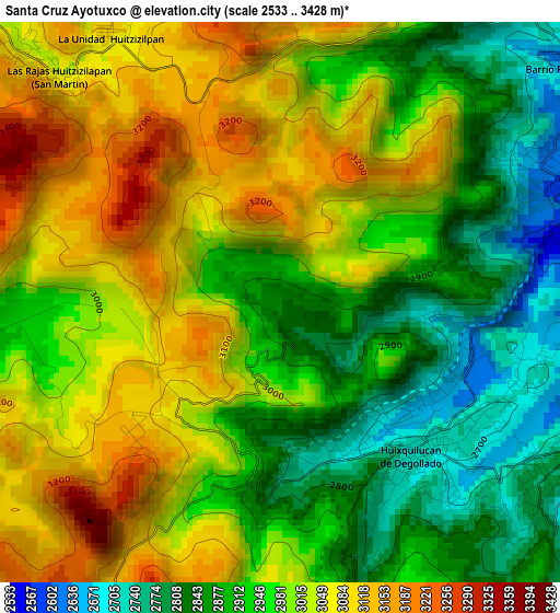
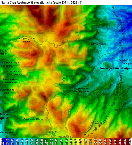
Below is the Elevation map of Santa Cruz Ayotuxco, which displays elevation range with different colors. Scale of the first map is from 2533 to 3428 m (8310 to 11247 ft) with average elevation of 2977.5 meters (=9769 ft) [note 1]
These maps also provides idea of topography and contour of this city, they are displayed at different zoom levels. More info about maps, scale and edge coordinates you can find below images.
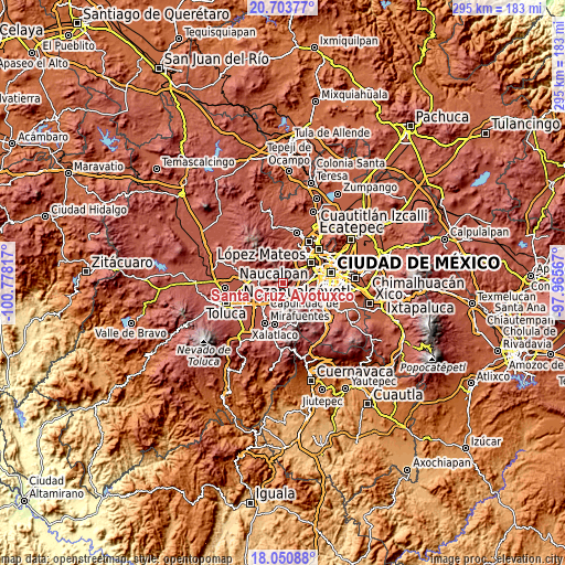
| \ | Map #1 | Map #2 | Topo.Map |
| Scale [m] | 2533..3428 m | 2371..3526 m | × |
| Scale [ft] | 8310..11247 ft | 7779..11568 ft | × |
| Average | 2977.5 m = 9769 ft | 2937.5 m = 9637 ft | × |
| Width | 9.22 km = 5.7 mi | 18.44 km = 11.5 mi | 295 km = 183.3 mi |
| Height | 9.22 km = 5.7 mi | 18.44 km = 11.5 mi | 295 km = 183.3 mi |
| ↑Max Latitude | 19.424179° | 19.465618° | 20.70377° |
| Latitude at center | 19.38273° | 19.38273° | 19.38273° |
| ↓Min Latitude | 19.34127° | 19.2998° | 18.05088° |
| ← Min Longitude | -99.415865° | -99.459811° | -100.77817° |
| Longitude center | -99.37192° | -99.37192° | -99.37192° |
| →Max Longitude | -99.327975° | -99.284029° | -97.96567° |
Nearby cities:
Cities around Santa Cruz Ayotuxco sort by population:
• Huixquilucan elevation 2712 m
3.4 km,  138°
138°
• Huixquilucan de Degollado 2712 m
3.4 km, 137°
• Dos Ríos 2644 m
3.1 km,  106°
106°
• San Francisco Ayotuzco 2687 m
2.4 km, 140°
• Ignacio Allende 2828 m
4.4 km,  165°
165°
• El Cerrito 2734 m
3.9 km, 140°
• Cerro de San Francisco 2707 m
2.5 km,  122°
122°
• Barrio de Canales 2948 m
1.1 km,  200°
200°
• Paraje la Pera 2700 m
2.8 km,  94°
94°
• La Glorieta 3153 m
3.5 km,  335°
335°
• El Palacio 2728 m
3.8 km,  155°
155°
• Barrio de San Ramón 2711 m
4.4 km,  103°
103°
Multilingual:
 En español:
Santa Cruz Ayotuxco elevación 2839 m.
 En France:
Santa Cruz Ayotuxco élévation 2839 m.
 Auf Deutsch:
Santa Cruz Ayotuxco höhe über dem Meeresspiegel ist 2839 m.
 На русском:
Santa Cruz Ayotuxco высота над уровнем моря 2839 м
Sources and notes:
- [note 1] Map square and city borders are not equal. Map elevation data is calculated only from area inside that square.
- [src 1] Elevation data from geonames database provided with same terms of usage.
- [src 2] The elevation map of Santa Cruz Ayotuxco is generated using elevation data from NASA's 3 arcsec (90m) resolution SRTM data.
- [src 3] Base (background) map © OpenStreetMap contributors tiles are generated by Geofabrik and OpenTopoMap.
Copyright & License:
This Santa Cruz Ayotuxco Elevation Map is licensed under CC BY-SA. You may reuse any part from this page, if you give a proper credit by linking to this URL:
 More info on terms of use page.