Santa Rosa Xajay elevation
Santa Rosa Xajay (Querétaro, San Juan del Río), Mexico elevation is 2007 meters and Santa Rosa Xajay elevation in feet is 6585 ft above sea level [src 1]. Santa Rosa Xajay is a populated place (feature code) with elevation that is 693 meters (2274 ft) bigger than average city elevation in Mexico.
Below is the Elevation map of Santa Rosa Xajay, which displays elevation range with different colors. Scale of the first map is from 1889 to 2698 m (6198 to 8852 ft) with average elevation of 2085.7 meters (=6843 ft) [note 1]
These maps also provides idea of topography and contour of this city, they are displayed at different zoom levels. More info about maps, scale and edge coordinates you can find below images.
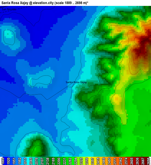
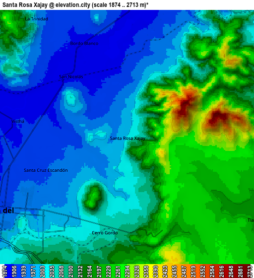
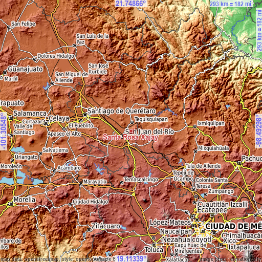
| \ | Map #1 | Map #2 | Topo.Map |
| Scale [m] | 1889..2698 m | 1874..2713 m | × |
| Scale [ft] | 6198..8852 ft | 6148..8901 ft | × |
| Average | 2085.7 m = 6843 ft | 2081.4 m = 6829 ft | × |
| Width | 9.16 km = 5.7 mi | 18.31 km = 11.4 mi | 293 km = 182.1 mi |
| Height | 9.16 km = 5.7 mi | 18.31 km = 11.4 mi | 293 km = 182.1 mi |
| ↑Max Latitude | 20.477844° | 20.519007° | 21.74866° |
| Latitude at center | 20.43667° | 20.43667° | 20.43667° |
| ↓Min Latitude | 20.395485° | 20.354289° | 19.11339° |
| ← Min Longitude | -99.943175° | -99.987121° | -101.30548° |
| Longitude center | -99.89923° | -99.89923° | -99.89923° |
| →Max Longitude | -99.855285° | -99.811339° | -98.49298° |
Nearby cities:
Cities around Santa Rosa Xajay sort by population:
• San Juan del Río elevation 1923 m
11.4 km,  242°
242°
• Tequisquiapan 1881 m
9.6 km,  4°
4°
• San Nicolás 1899 m
6 km,  318°
318°
• La Llave 1903 m
10.4 km,  288°
288°
• Paso de Mata 2126 m
10.9 km,  195°
195°
• Visthá 1908 m
8.2 km,  277°
277°
• Tlaxcalilla 2213 m
10.9 km,  127°
127°
• Bordo Blanco 1898 m
7.3 km,  335°
335°
• Cerro Gordo 2046 m
7.2 km,  192°
192°
• Villas Fundadores [Fraccionamiento] 2054 m
6.6 km, 189°
• La Trinidad 1965 m
11 km, 322°
• Santa Cruz Escandón 1936 m
6.3 km,  248°
248°
Multilingual:
 En español:
Santa Rosa Xajay elevación 2007 m.
 En France:
Santa Rosa Xajay élévation 2007 m.
 Auf Deutsch:
Santa Rosa Xajay höhe über dem Meeresspiegel ist 2007 m.

Sources and notes:
- [note 1] Map square and city borders are not equal. Map elevation data is calculated only from area inside that square.
- [src 1] Elevation data from geonames database provided with same terms of usage.
- [src 2] The elevation map of Santa Rosa Xajay is generated using elevation data from NASA's 3 arcsec (90m) resolution SRTM data.
- [src 3] Base (background) map © OpenStreetMap contributors tiles are generated by Geofabrik and OpenTopoMap.
Copyright & License:
This Santa Rosa Xajay Elevation Map is licensed under CC BY-SA. You may reuse any part from this page, if you give a proper credit by linking to this URL:
 More info on terms of use page.