Singuilucan elevation
Singuilucan (Hidalgo), Mexico elevation is 2635 meters and Singuilucan elevation in feet is 8645 ft above sea level [src 1]. Singuilucan is a seat of a second-order administrative division (feature code) with elevation that is 1321 meters (4334 ft) bigger than average city elevation in Mexico.
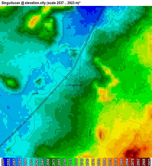
Below is the Elevation map of Singuilucan, which displays elevation range with different colors. Scale of the first map is from 2537 to 2923 m (8323 to 9590 ft) with average elevation of 2664.3 meters (=8741 ft) [note 1]
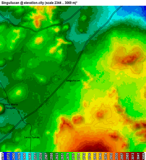
These maps also provides idea of topography and contour of this city, they are displayed at different zoom levels. More info about maps, scale and edge coordinates you can find below images.
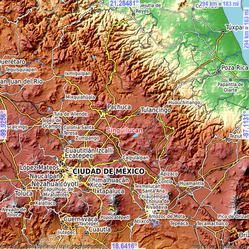
| \ | Map #1 | Map #2 | Topo.Map |
| Scale [m] | 2537..2923 m | 2344..3069 m | × |
| Scale [ft] | 8323..9590 ft | 7690..10069 ft | × |
| Average | 2664.3 m = 8741 ft | 2677.1 m = 8783 ft | × |
| Width | 9.18 km = 5.7 mi | 18.37 km = 11.4 mi | 293.9 km = 182.6 mi |
| Height | 9.19 km = 5.7 mi | 18.37 km = 11.4 mi | 293.9 km = 182.6 mi |
| ↑Max Latitude | 20.010038° | 20.051325° | 21.28481° |
| Latitude at center | 19.96874° | 19.96874° | 19.96874° |
| ↓Min Latitude | 19.927431° | 19.886112° | 18.6416° |
| ← Min Longitude | -98.563295° | -98.607241° | -99.9256° |
| Longitude center | -98.51935° | -98.51935° | -98.51935° |
| →Max Longitude | -98.475405° | -98.431459° | -97.1131° |
Nearby cities:
Cities around Singuilucan sort by population:
• Javier Rojo Gómez elevation 2208 m
15.4 km,  43°
43°
• Unidades Habitacionales 2228 m
14.8 km, 44°
• Epazoyucan 2465 m
13.4 km,  294°
294°
• Pedregal de San José 2179 m
16 km,  47°
47°
• Santo Tomas 2655 m
8.9 km,  215°
215°
• Colonia Felipe Ángeles 2258 m
14.2 km, 47°
• Los Romeros 2318 m
12.8 km,  58°
58°
• La Lagunilla 2473 m
11.8 km,  21°
21°
• Santa Mónica 2571 m
10.8 km,  278°
278°
• Paxtepec 2320 m
13.1 km, 44°
• El Susto 2509 m
10.4 km, 15°
• San Gabriel Azteca 2562 m
14.1 km,  225°
225°
Multilingual:
 En español:
Singuilucan elevación 2635 m.
 En France:
Singuilucan élévation 2635 m.
 Auf Deutsch:
Singuilucan höhe über dem Meeresspiegel ist 2635 m.

Sources and notes:
- [note 1] Map square and city borders are not equal. Map elevation data is calculated only from area inside that square.
- [src 1] Elevation data from geonames database provided with same terms of usage.
- [src 2] The elevation map of Singuilucan is generated using elevation data from NASA's 3 arcsec (90m) resolution SRTM data.
- [src 3] Base (background) map © OpenStreetMap contributors tiles are generated by Geofabrik and OpenTopoMap.
Copyright & License:
This Singuilucan Elevation Map is licensed under CC BY-SA. You may reuse any part from this page, if you give a proper credit by linking to this URL:
 More info on terms of use page.