Soconusco elevation
Soconusco (Veracruz), Mexico elevation is 78 meters and Soconusco elevation in feet is 256 ft above sea level [src 1]. Soconusco is a seat of a second-order administrative division (feature code) with elevation that is 1236 meters (4055 ft) smaller than average city elevation in Mexico.
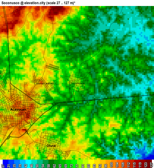
Below is the Elevation map of Soconusco, which displays elevation range with different colors. Scale of the first map is from 27 to 127 m (89 to 417 ft) with average elevation of 72.3 meters (=237 ft) [note 1]
These maps also provides idea of topography and contour of this city, they are displayed at different zoom levels. More info about maps, scale and edge coordinates you can find below images.
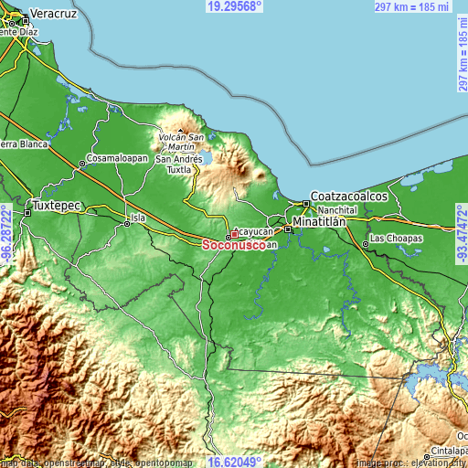
| \ | Map #1 | Map #2 | Topo.Map |
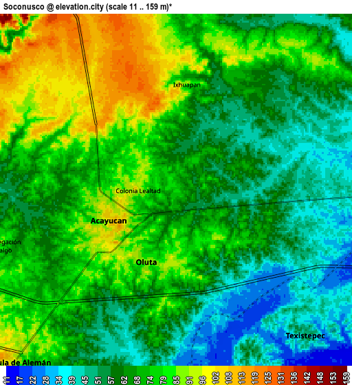
| Scale [m] | 27..127 m | 11..159 m | × |
| Scale [ft] | 89..417 ft | 36..522 ft | × |
| Average | 72.3 m = 237 ft | 67.9 m = 223 ft | × |
| Width | 9.3 km = 5.8 mi | 18.59 km = 11.6 mi | 297.5 km = 184.9 mi |
| Height | 9.3 km = 5.8 mi | 18.59 km = 11.6 mi | 297.5 km = 184.9 mi |
| ↑Max Latitude | 18.004948° | 18.046737° | 19.29568° |
| Latitude at center | 17.96315° | 17.96315° | 17.96315° |
| ↓Min Latitude | 17.921342° | 17.879524° | 16.62049° |
| ← Min Longitude | -94.924915° | -94.968861° | -96.28722° |
| Longitude center | -94.88097° | -94.88097° | -94.88097° |
| →Max Longitude | -94.837025° | -94.793079° | -93.47472° |
Nearby cities:
Cities around Soconusco sort by population:
• Acayucan elevation 102 m
3.8 km,  246°
246°
• Sayula de Alemán 93 m
12.3 km,  222°
222°
• Oluta 81 m
4.1 km,  204°
204°
• Texistepec 49 m
10.2 km,  138°
138°
• Dehesa 79 m
12.6 km,  259°
259°
• Colonia Lealtad 104 m
2.3 km,  269°
269°
• Cruz del Milagro 131 m
15 km, 246°
• Fraccionamiento Santa Cruz 84 m
1.8 km,  303°
303°
• Comején 85 m
10.9 km,  357°
357°
• Congregación Hidalgo 82 m
9.9 km, 253°
• Ixhuapan 88 m
5.6 km,  4°
4°
• Campo de Águila 185 m
16.1 km,  316°
316°
Multilingual:
 En español:
Soconusco elevación 78 m.
 En France:
Soconusco élévation 78 m.
 Auf Deutsch:
Soconusco höhe über dem Meeresspiegel ist 78 m.

Sources and notes:
- [note 1] Map square and city borders are not equal. Map elevation data is calculated only from area inside that square.
- [src 1] Elevation data from geonames database provided with same terms of usage.
- [src 2] The elevation map of Soconusco is generated using elevation data from NASA's 3 arcsec (90m) resolution SRTM data.
- [src 3] Base (background) map © OpenStreetMap contributors tiles are generated by Geofabrik and OpenTopoMap.
Copyright & License:
This Soconusco Elevation Map is licensed under CC BY-SA. You may reuse any part from this page, if you give a proper credit by linking to this URL:
 More info on terms of use page.