Soyaniquilpan elevation
Soyaniquilpan (State of Mexico, Soyaniquilpan de Juárez), Mexico elevation is 2406 meters and Soyaniquilpan elevation in feet is 7894 ft above sea level [src 1]. Soyaniquilpan is a seat of a second-order administrative division (feature code) with elevation that is 1092 meters (3583 ft) bigger than average city elevation in Mexico.
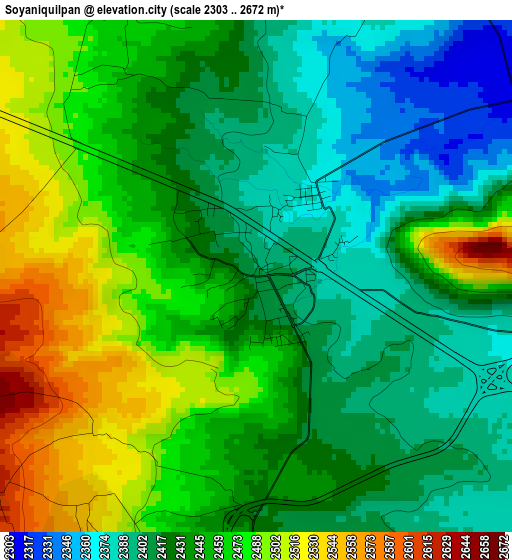
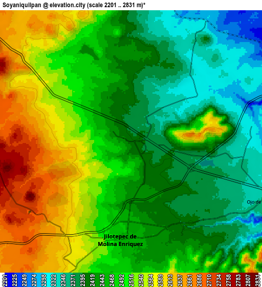
Below is the Elevation map of Soyaniquilpan, which displays elevation range with different colors. Scale of the first map is from 2303 to 2672 m (7556 to 8766 ft) with average elevation of 2443.1 meters (=8015 ft) [note 1]
These maps also provides idea of topography and contour of this city, they are displayed at different zoom levels. More info about maps, scale and edge coordinates you can find below images.
| \ | Map #1 | Map #2 | Topo.Map |
| Scale [m] | 2303..2672 m | 2201..2831 m | × |
| Scale [ft] | 7556..8766 ft | 7221..9288 ft | × |
| Average | 2443.1 m = 8015 ft | 2474 m = 8117 ft | × |
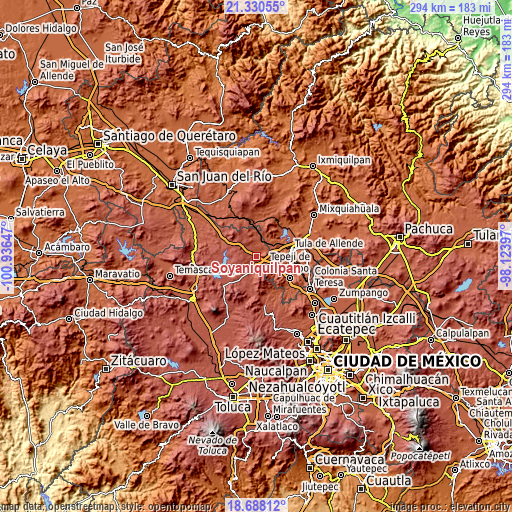
| Width | 9.18 km = 5.7 mi | 18.36 km = 11.4 mi | 293.8 km = 182.6 mi |
| Height | 9.18 km = 5.7 mi | 18.36 km = 11.4 mi | 293.8 km = 182.6 mi |
| ↑Max Latitude | 20.056166° | 20.097441° | 21.33055° |
| Latitude at center | 20.01488° | 20.01488° | 20.01488° |
| ↓Min Latitude | 19.973583° | 19.932276° | 18.68812° |
| ← Min Longitude | -99.574165° | -99.618111° | -100.93647° |
| Longitude center | -99.53022° | -99.53022° | -99.53022° |
| →Max Longitude | -99.486275° | -99.442329° | -98.12397° |
Nearby cities:
Cities around Soyaniquilpan sort by population:
• Jilotepec de Molina Enríquez elevation 2451 m
7 km,  182°
182°
• Las Huertas 2529 m
5.5 km,  209°
209°
• San Pablo Huantepec 2401 m
5.5 km,  131°
131°
• San Miguel de La Victoria 2561 m
7.8 km,  305°
305°
• Las Manzanas 2552 m
7.8 km,  204°
204°
• La Comunidad 2568 m
4.8 km,  278°
278°
• Agua Escondida 2642 m
6.4 km,  231°
231°
• Xhixhata 2491 m
5.2 km, 198°
• San Agustín Buenavista 2314 m
5.3 km,  53°
53°
• Ojo de Agua 2362 m
8 km, 127°
• Xhitey 2435 m
3.7 km, 176°
• Octeyuco Dos Mil 2651 m
8.3 km, 226°
Multilingual:
 En español:
Soyaniquilpan elevación 2406 m.
 En France:
Soyaniquilpan élévation 2406 m.
 Auf Deutsch:
Soyaniquilpan höhe über dem Meeresspiegel ist 2406 m.

Sources and notes:
- [note 1] Map square and city borders are not equal. Map elevation data is calculated only from area inside that square.
- [src 1] Elevation data from geonames database provided with same terms of usage.
- [src 2] The elevation map of Soyaniquilpan is generated using elevation data from NASA's 3 arcsec (90m) resolution SRTM data.
- [src 3] Base (background) map © OpenStreetMap contributors tiles are generated by Geofabrik and OpenTopoMap.
Copyright & License:
This Soyaniquilpan Elevation Map is licensed under CC BY-SA. You may reuse any part from this page, if you give a proper credit by linking to this URL:
 More info on terms of use page.