Tecamachalco elevation
Tecamachalco (Puebla), Mexico elevation is 2020 meters and Tecamachalco elevation in feet is 6627 ft above sea level [src 1]. Tecamachalco is a seat of a second-order administrative division (feature code) with elevation that is 706 meters (2316 ft) bigger than average city elevation in Mexico.
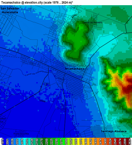
Below is the Elevation map of Tecamachalco, which displays elevation range with different colors. Scale of the first map is from 1976 to 2624 m (6483 to 8609 ft) with average elevation of 2071.6 meters (=6797 ft) [note 1]
These maps also provides idea of topography and contour of this city, they are displayed at different zoom levels. More info about maps, scale and edge coordinates you can find below images.
| \ | Map #1 | Map #2 | Topo.Map |
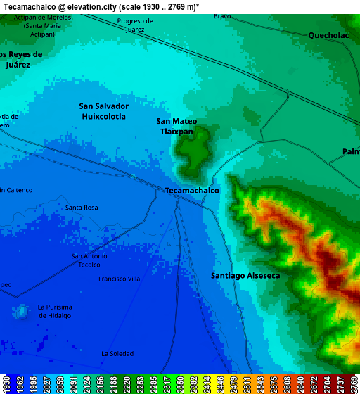
| Scale [m] | 1976..2624 m | 1930..2769 m | × |
| Scale [ft] | 6483..8609 ft | 6332..9085 ft | × |
| Average | 2071.6 m = 6797 ft | 2094.1 m = 6870 ft | × |
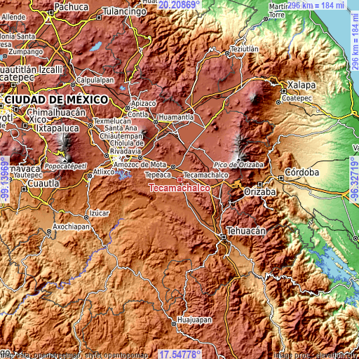
| Width | 9.25 km = 5.7 mi | 18.49 km = 11.5 mi | 295.9 km = 183.9 mi |
| Height | 9.25 km = 5.7 mi | 18.49 km = 11.5 mi | 295.9 km = 183.9 mi |
| ↑Max Latitude | 18.925095° | 18.96666° | 20.20869° |
| Latitude at center | 18.88352° | 18.88352° | 18.88352° |
| ↓Min Latitude | 18.841935° | 18.800339° | 17.54778° |
| ← Min Longitude | -97.777385° | -97.821331° | -99.13969° |
| Longitude center | -97.73344° | -97.73344° | -97.73344° |
| →Max Longitude | -97.689495° | -97.645549° | -96.32719° |
Nearby cities:
Cities around Tecamachalco sort by population:
• Huixcolotla elevation 2044 m
5.8 km,  315°
315°
• Tlaixpan 2058 m
3.2 km,  351°
351°
• Santiago Alseseca 2058 m
5.1 km,  147°
147°
• Santa Rosa 2003 m
5.1 km,  261°
261°
• Tuzuapan 2140 m
7.3 km,  74°
74°
• La Purísima 1975 m
8.8 km,  226°
226°
• Xochimilco 2000 m
4.7 km,  170°
170°
• San Antonio Tecolco 1989 m
5.8 km, 233°
• Lomas de Santa Cruz 2099 m
4.6 km,  4°
4°
• Lomas de Romero 2164 m
3.8 km,  26°
26°
• La Soledad 1974 m
8.8 km,  201°
201°
• Francisco Villa 1987 m
5.4 km,  215°
215°
Multilingual:
 En español:
Tecamachalco elevación 2020 m.
 En France:
Tecamachalco élévation 2020 m.
 Auf Deutsch:
Tecamachalco höhe über dem Meeresspiegel ist 2020 m.

Sources and notes:
- [note 1] Map square and city borders are not equal. Map elevation data is calculated only from area inside that square.
- [src 1] Elevation data from geonames database provided with same terms of usage.
- [src 2] The elevation map of Tecamachalco is generated using elevation data from NASA's 3 arcsec (90m) resolution SRTM data.
- [src 3] Base (background) map © OpenStreetMap contributors tiles are generated by Geofabrik and OpenTopoMap.
Copyright & License:
This Tecamachalco Elevation Map is licensed under CC BY-SA. You may reuse any part from this page, if you give a proper credit by linking to this URL:
 More info on terms of use page.