Temascalcingo elevation
Temascalcingo (State of Mexico), Mexico elevation is 2400 meters and Temascalcingo elevation in feet is 7874 ft above sea level [src 1]. Temascalcingo is a seat of a second-order administrative division (feature code) with elevation that is 1086 meters (3563 ft) bigger than average city elevation in Mexico.
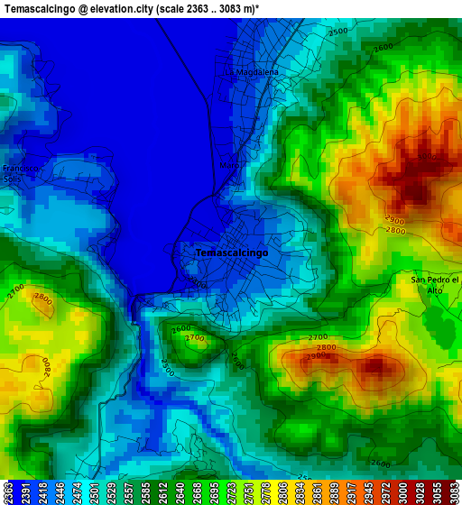
Below is the Elevation map of Temascalcingo, which displays elevation range with different colors. Scale of the first map is from 2363 to 3083 m (7753 to 10115 ft) with average elevation of 2569.8 meters (=8431 ft) [note 1]
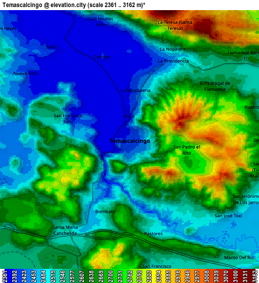
These maps also provides idea of topography and contour of this city, they are displayed at different zoom levels. More info about maps, scale and edge coordinates you can find below images.
| \ | Map #1 | Map #2 | Topo.Map |
| Scale [m] | 2363..3083 m | 2361..3162 m | × |
| Scale [ft] | 7753..10115 ft | 7746..10374 ft | × |
| Average | 2569.8 m = 8431 ft | 2585.9 m = 8484 ft | × |
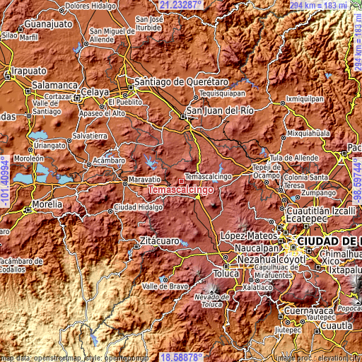
| Width | 9.19 km = 5.7 mi | 18.38 km = 11.4 mi | 294 km = 182.7 mi |
| Height | 9.19 km = 5.7 mi | 18.38 km = 11.4 mi | 294 km = 182.7 mi |
| ↑Max Latitude | 19.957662° | 19.998962° | 21.23287° |
| Latitude at center | 19.91635° | 19.91635° | 19.91635° |
| ↓Min Latitude | 19.875028° | 19.833694° | 18.58878° |
| ← Min Longitude | -100.047635° | -100.091581° | -101.40994° |
| Longitude center | -100.00369° | -100.00369° | -100.00369° |
| →Max Longitude | -99.959745° | -99.915799° | -98.59744° |
Nearby cities:
Cities around Temascalcingo sort by population:
• La Magdalena elevation 2421 m
3.5 km,  7°
7°
• Santiago Coachochitlan 2491 m
6.8 km,  208°
208°
• San Pedro el Alto 2742 m
4.2 km,  98°
98°
• Santa María Canchesdá 2546 m
8.7 km,  218°
218°
• San José Toxi 2496 m
8.8 km,  127°
127°
• Ahuacatitlán Cuarto y Quinto Cuartel 2415 m
5.4 km,  18°
18°
• Doxteje Centro 2650 m
8.3 km,  37°
37°
• Doxtejé Centro 2592 m
8 km, 41°
• San Francisco Solis 2402 m
4.6 km,  288°
288°
• Cerritos de Cárdenas 2409 m
6.2 km,  341°
341°
• San Nicolás Solís 2377 m
8.6 km, 344°
• Doxteje Barrio Primero 2594 m
6.7 km, 44°
Multilingual:
 En español:
Temascalcingo de José María Velazco elevación 2400 m.
 En France:
Temascalcingo élévation 2400 m.
 Auf Deutsch:
Temascalcingo höhe über dem Meeresspiegel ist 2400 m.

Sources and notes:
- [note 1] Map square and city borders are not equal. Map elevation data is calculated only from area inside that square.
- [src 1] Elevation data from geonames database provided with same terms of usage.
- [src 2] The elevation map of Temascalcingo is generated using elevation data from NASA's 3 arcsec (90m) resolution SRTM data.
- [src 3] Base (background) map © OpenStreetMap contributors tiles are generated by Geofabrik and OpenTopoMap.
Copyright & License:
This Temascalcingo Elevation Map is licensed under CC BY-SA. You may reuse any part from this page, if you give a proper credit by linking to this URL:
 More info on terms of use page.