Tepotzotlán elevation
Tepotzotlán (State of Mexico), Mexico elevation is 2317 meters and Tepotzotlán elevation in feet is 7602 ft above sea level [src 1]. Tepotzotlán is a seat of a second-order administrative division (feature code) with elevation that is 1003 meters (3291 ft) bigger than average city elevation in Mexico.
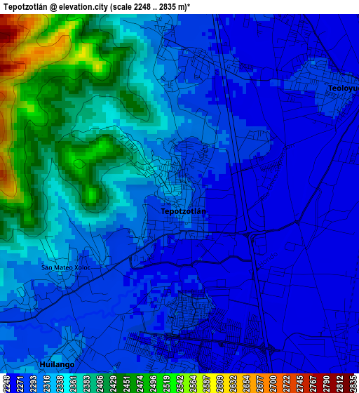
Below is the Elevation map of Tepotzotlán, which displays elevation range with different colors. Scale of the first map is from 2248 to 2835 m (7375 to 9301 ft) with average elevation of 2320.8 meters (=7614 ft) [note 1]
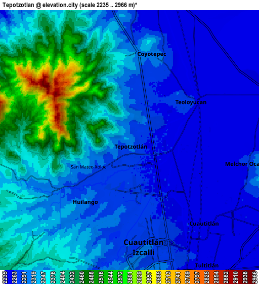
These maps also provides idea of topography and contour of this city, they are displayed at different zoom levels. More info about maps, scale and edge coordinates you can find below images.
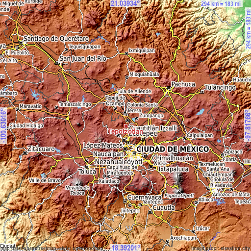
| \ | Map #1 | Map #2 | Topo.Map |
| Scale [m] | 2248..2835 m | 2235..2966 m | × |
| Scale [ft] | 7375..9301 ft | 7333..9731 ft | × |
| Average | 2320.8 m = 7614 ft | 2335.8 m = 7663 ft | × |
| Width | 9.2 km = 5.7 mi | 18.4 km = 11.4 mi | 294.4 km = 182.9 mi |
| Height | 9.2 km = 5.7 mi | 18.4 km = 11.4 mi | 294.4 km = 182.9 mi |
| ↑Max Latitude | 19.762522° | 19.803874° | 21.03934° |
| Latitude at center | 19.72116° | 19.72116° | 19.72116° |
| ↓Min Latitude | 19.679787° | 19.638403° | 18.39201° |
| ← Min Longitude | -99.267855° | -99.311801° | -100.63016° |
| Longitude center | -99.22391° | -99.22391° | -99.22391° |
| →Max Longitude | -99.179965° | -99.136019° | -97.81766° |
Nearby cities:
Cities around Tepotzotlán sort by population:
• Teoloyucan elevation 2268 m
5.2 km,  60°
60°
• Huilango 2312 m
5.7 km,  216°
216°
• San Mateo Xoloc 2293 m
3 km,  237°
237°
• Santa Cruz del Monte 2318 m
5.1 km,  354°
354°
• Axotlán 2274 m
3.4 km,  208°
208°
• Santa María Huecatitla 2255 m
5.8 km,  85°
85°
• Barrio Tlatenco 2264 m
3.9 km, 59°
• Santa Cruz 2305 m
4.8 km,  233°
233°
• San Sebastián 2283 m
3.5 km,  16°
16°
• San José del Puente 2261 m
2.9 km, 91°
• San Pablo de los Gallos 2282 m
5.4 km, 205°
• Colonia Guadalupe 2310 m
2.8 km,  251°
251°
Multilingual:
 En español:
Tepotzotlán elevación 2317 m.
 En France:
Tepotzotlán élévation 2317 m.
 Auf Deutsch:
Tepotzotlán höhe über dem Meeresspiegel ist 2317 m.

Sources and notes:
- [note 1] Map square and city borders are not equal. Map elevation data is calculated only from area inside that square.
- [src 1] Elevation data from geonames database provided with same terms of usage.
- [src 2] The elevation map of Tepotzotlán is generated using elevation data from NASA's 3 arcsec (90m) resolution SRTM data.
- [src 3] Base (background) map © OpenStreetMap contributors tiles are generated by Geofabrik and OpenTopoMap.
Copyright & License:
This Tepotzotlán Elevation Map is licensed under CC BY-SA. You may reuse any part from this page, if you give a proper credit by linking to this URL:
 More info on terms of use page.