Texcalyacac elevation
Texcalyacac (State of Mexico), Mexico elevation is 2590 meters and Texcalyacac elevation in feet is 8497 ft above sea level [src 1]. Texcalyacac is a seat of a second-order administrative division (feature code) with elevation that is 1276 meters (4186 ft) bigger than average city elevation in Mexico.
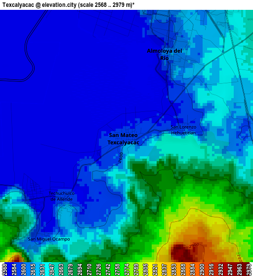
Below is the Elevation map of Texcalyacac, which displays elevation range with different colors. Scale of the first map is from 2568 to 2979 m (8425 to 9774 ft) with average elevation of 2632.4 meters (=8636 ft) [note 1]
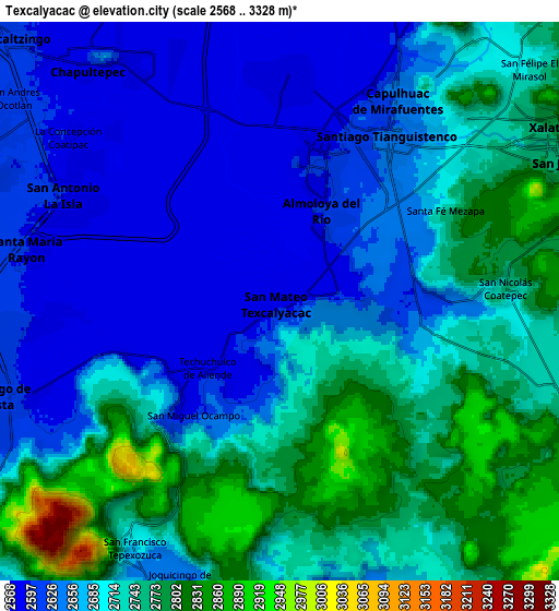
These maps also provides idea of topography and contour of this city, they are displayed at different zoom levels. More info about maps, scale and edge coordinates you can find below images.
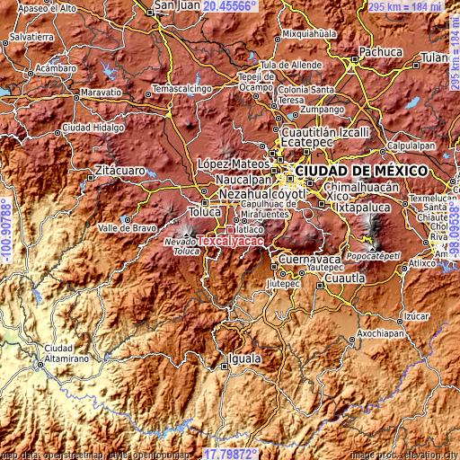
| \ | Map #1 | Map #2 | Topo.Map |
| Scale [m] | 2568..2979 m | 2568..3328 m | × |
| Scale [ft] | 8425..9774 ft | 8425..10919 ft | × |
| Average | 2632.4 m = 8636 ft | 2694.3 m = 8840 ft | × |
| Width | 9.23 km = 5.7 mi | 18.47 km = 11.5 mi | 295.4 km = 183.6 mi |
| Height | 9.23 km = 5.7 mi | 18.47 km = 11.5 mi | 295.4 km = 183.6 mi |
| ↑Max Latitude | 19.174043° | 19.215545° | 20.45566° |
| Latitude at center | 19.13253° | 19.13253° | 19.13253° |
| ↓Min Latitude | 19.091007° | 19.049473° | 17.79872° |
| ← Min Longitude | -99.545575° | -99.589521° | -100.90788° |
| Longitude center | -99.50163° | -99.50163° | -99.50163° |
| →Max Longitude | -99.457685° | -99.413739° | -98.09538° |
Nearby cities:
Cities around Texcalyacac sort by population:
• Santiago Tianguistenco de Galeana elevation 2637 m
6.5 km,  34°
34°
• Almoloya del Río 2604 m
3.4 km, 25°
• Santa Cruz Atizapán 2594 m
5.1 km,  15°
15°
• Santa María Jajalpa 2583 m
4.3 km,  237°
237°
• San Pedro Techuchulco 2589 m
3.2 km,  228°
228°
• San Mateo Texcalyacac 2633 m
5.3 km,  44°
44°
• San Juan la Isla 2584 m
7.3 km,  268°
268°
• San Lorenzo Huehuetitlán 2599 m
2 km,  84°
84°
• Tlacomulco 2720 m
5.8 km,  102°
102°
• Colonia la Libertad 2580 m
5.9 km,  358°
358°
• San José Mezapa Sección I 2673 m
6 km,  55°
55°
• Tlaminca 2708 m
6.5 km,  86°
86°
Multilingual:
 En español:
Texcalyacac elevación 2590 m.
 En France:
Texcalyacac élévation 2590 m.
 Auf Deutsch:
Texcalyacac höhe über dem Meeresspiegel ist 2590 m.

Sources and notes:
- [note 1] Map square and city borders are not equal. Map elevation data is calculated only from area inside that square.
- [src 1] Elevation data from geonames database provided with same terms of usage.
- [src 2] The elevation map of Texcalyacac is generated using elevation data from NASA's 3 arcsec (90m) resolution SRTM data.
- [src 3] Base (background) map © OpenStreetMap contributors tiles are generated by Geofabrik and OpenTopoMap.
Copyright & License:
This Texcalyacac Elevation Map is licensed under CC BY-SA. You may reuse any part from this page, if you give a proper credit by linking to this URL:
 More info on terms of use page.