Tlacotalpan elevation
Tlacotalpan (Veracruz), Mexico elevation is 9 meters and Tlacotalpan elevation in feet is 30 ft above sea level [src 1]. Tlacotalpan is a seat of a second-order administrative division (feature code) with elevation that is 1305 meters (4281 ft) smaller than average city elevation in Mexico.
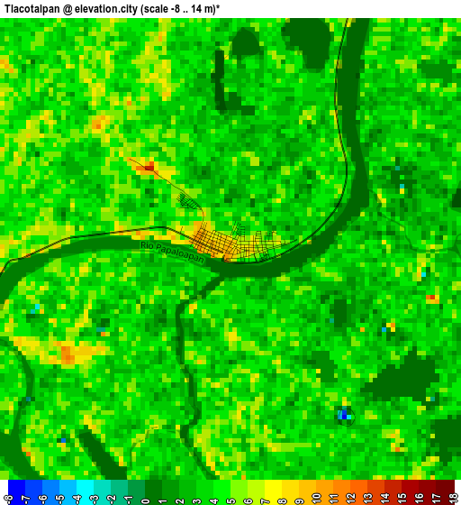
Below is the Elevation map of Tlacotalpan, which displays elevation range with different colors. Scale of the first map is from -8 to 14 m (-26 to 46 ft) with average elevation of 3.3 meters (=11 ft) [note 1]
These maps also provides idea of topography and contour of this city, they are displayed at different zoom levels. More info about maps, scale and edge coordinates you can find below images.
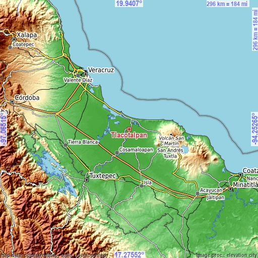
| \ | Map #1 | Map #2 | Topo.Map |
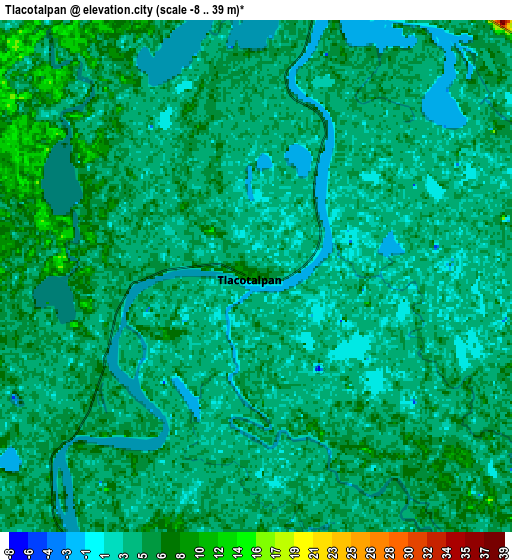
| Scale [m] | -8..14 m | -8..39 m | × |
| Scale [ft] | -26..46 ft | -26..128 ft | × |
| Average | 3.3 m = 11 ft | 4.3 m = 14 ft | × |
| Width | 9.26 km = 5.8 mi | 18.52 km = 11.5 mi | 296.3 km = 184.1 mi |
| Height | 9.26 km = 5.8 mi | 18.52 km = 11.5 mi | 296.4 km = 184.2 mi |
| ↑Max Latitude | 18.654972° | 18.696603° | 19.9407° |
| Latitude at center | 18.61333° | 18.61333° | 18.61333° |
| ↓Min Latitude | 18.571678° | 18.530016° | 17.27552° |
| ← Min Longitude | -95.702845° | -95.746791° | -97.06515° |
| Longitude center | -95.6589° | -95.6589° | -95.6589° |
| →Max Longitude | -95.614955° | -95.571009° | -94.25265° |
Nearby cities:
Cities around Tlacotalpan sort by population:
• Alvarado elevation 18 m
20.7 km,  328°
328°
• Lerdo de Tejada 9 m
14.8 km,  83°
83°
• Ángel R. Cabada 30 m
22.5 km,  94°
94°
• Saltabarranca 7 m
13.6 km,  100°
100°
• Acula 9 m
17.1 km,  225°
225°
• El Corte 12 m
19.6 km,  204°
204°
• Paso Nacional 6 m
19.5 km, 330°
• Santiago 9 m
25.7 km,  224°
224°
• San Juan de los Reyes (Luis Valenzuela) 26 m
24.6 km,  115°
115°
• Amatitlán 7 m
21.7 km, 201°
• Zamora 17 m
18.8 km, 101°
• Dos Bocas 11 m
23.1 km,  192°
192°
Multilingual:
 En español:
Tlacotalpan elevación 9 m.
 En France:
Tlacotalpan élévation 9 m.
 Auf Deutsch:
Tlacotalpan höhe über dem Meeresspiegel ist 9 m.

Sources and notes:
- [note 1] Map square and city borders are not equal. Map elevation data is calculated only from area inside that square.
- [src 1] Elevation data from geonames database provided with same terms of usage.
- [src 2] The elevation map of Tlacotalpan is generated using elevation data from NASA's 3 arcsec (90m) resolution SRTM data.
- [src 3] Base (background) map © OpenStreetMap contributors tiles are generated by Geofabrik and OpenTopoMap.
Copyright & License:
This Tlacotalpan Elevation Map is licensed under CC BY-SA. You may reuse any part from this page, if you give a proper credit by linking to this URL:
 More info on terms of use page.