San Miguel Topilejo elevation
San Miguel Topilejo (Mexico City, Tlalpan), Mexico elevation is 2652 meters and San Miguel Topilejo elevation in feet is 8701 ft above sea level [src 1]. San Miguel Topilejo is a populated place (feature code) with elevation that is 1338 meters (4390 ft) bigger than average city elevation in Mexico.
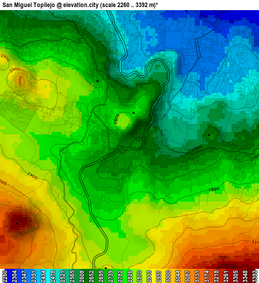
Below is the Elevation map of San Miguel Topilejo, which displays elevation range with different colors. Scale of the first map is from 2260 to 3392 m (7415 to 11129 ft) with average elevation of 2745.2 meters (=9007 ft) [note 1]
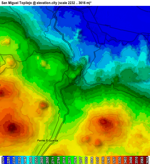
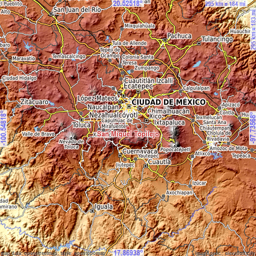
These maps also provides idea of topography and contour of this city, they are displayed at different zoom levels. More info about maps, scale and edge coordinates you can find below images.
| \ | Map #1 | Map #2 | Topo.Map |
| Scale [m] | 2260..3392 m | 2232..3616 m | × |
| Scale [ft] | 7415..11129 ft | 7323..11864 ft | × |
| Average | 2745.2 m = 9007 ft | 2779.2 m = 9118 ft | × |
| Width | 9.23 km = 5.7 mi | 18.46 km = 11.5 mi | 295.3 km = 183.5 mi |
| Height | 9.23 km = 5.7 mi | 18.46 km = 11.5 mi | 295.3 km = 183.5 mi |
| ↑Max Latitude | 19.244135° | 19.28562° | 20.52518° |
| Latitude at center | 19.20264° | 19.20264° | 19.20264° |
| ↓Min Latitude | 19.161135° | 19.119619° | 17.86938° |
| ← Min Longitude | -99.185875° | -99.229821° | -100.54818° |
| Longitude center | -99.14193° | -99.14193° | -99.14193° |
| →Max Longitude | -99.097985° | -99.054039° | -97.73568° |
Nearby cities:
Cities around San Miguel Topilejo sort by population:
• Tlalpan elevation 2256 m
10.5 km,  348°
348°
• Xochimilco 2244 m
7 km,  34°
34°
• San Miguel Ajusco 2896 m
6.7 km,  288°
288°
• San Juan Ixtayopan 2274 m
15.4 km,  77°
77°
• Milpa Alta 2428 m
12.5 km,  95°
95°
• San Pablo Oztotepec 2729 m
7.4 km, 104°
• San Salvador Cuauhtenco 2756 m
5.6 km, 101°
• San Francisco Tecoxpa 2377 m
14.3 km,  94°
94°
• San Pedro Atocpan 2455 m
9.7 km, 90°
• San Bartolome Xicomulco 2598 m
7.8 km, 87°
• San Lorenzo Tlacoyucan 2626 m
11.9 km, 104°
• Lomas de Tepemecatl 2955 m
11 km, 291°
Multilingual:
 En español:
San Miguel Topilejo elevación 2652 m.
 En France:
San Miguel Topilejo élévation 2652 m.
 Auf Deutsch:
San Miguel Topilejo höhe über dem Meeresspiegel ist 2652 m.
 На русском:
San Miguel Topilejo высота над уровнем моря 2652 м
Sources and notes:
- [note 1] Map square and city borders are not equal. Map elevation data is calculated only from area inside that square.
- [src 1] Elevation data from geonames database provided with same terms of usage.
- [src 2] The elevation map of San Miguel Topilejo is generated using elevation data from NASA's 3 arcsec (90m) resolution SRTM data.
- [src 3] Base (background) map © OpenStreetMap contributors tiles are generated by Geofabrik and OpenTopoMap.
Copyright & License:
This San Miguel Topilejo Elevation Map is licensed under CC BY-SA. You may reuse any part from this page, if you give a proper credit by linking to this URL:
 More info on terms of use page.