Vega de Alatorre elevation
Vega de Alatorre (Veracruz), Mexico elevation is 27 meters and Vega de Alatorre elevation in feet is 89 ft above sea level [src 1]. Vega de Alatorre is a seat of a second-order administrative division (feature code) with elevation that is 1287 meters (4222 ft) smaller than average city elevation in Mexico.
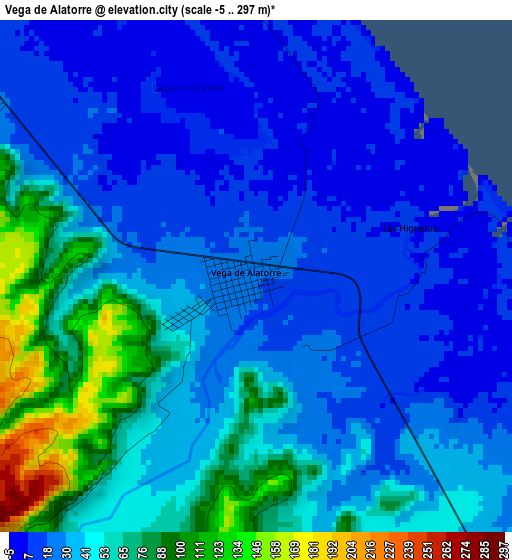
Below is the Elevation map of Vega de Alatorre, which displays elevation range with different colors. Scale of the first map is from -5 to 297 m (-16 to 974 ft) with average elevation of 40.5 meters (=133 ft) [note 1]
These maps also provides idea of topography and contour of this city, they are displayed at different zoom levels. More info about maps, scale and edge coordinates you can find below images.
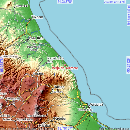
| \ | Map #1 | Map #2 | Topo.Map |
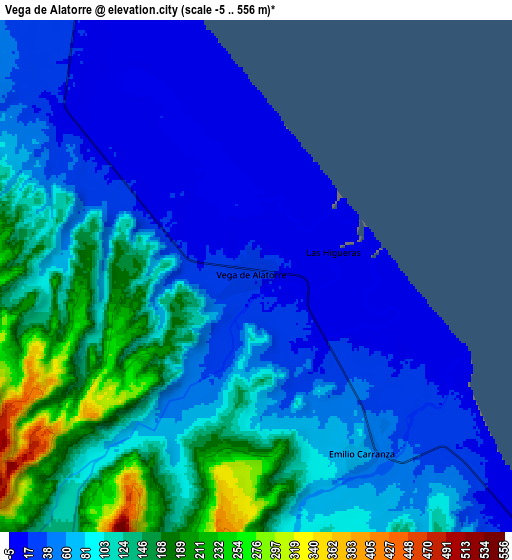
| Scale [m] | -5..297 m | -5..556 m | × |
| Scale [ft] | -16..974 ft | -16..1824 ft | × |
| Average | 40.5 m = 133 ft | 87.5 m = 287 ft | × |
| Width | 9.18 km = 5.7 mi | 18.36 km = 11.4 mi | 293.8 km = 182.6 mi |
| Height | 9.18 km = 5.7 mi | 18.36 km = 11.4 mi | 293.8 km = 182.6 mi |
| ↑Max Latitude | 20.069512° | 20.110784° | 21.34378° |
| Latitude at center | 20.02823° | 20.02823° | 20.02823° |
| ↓Min Latitude | 19.986937° | 19.945633° | 18.70157° |
| ← Min Longitude | -96.691455° | -96.735401° | -98.05376° |
| Longitude center | -96.64751° | -96.64751° | -96.64751° |
| →Max Longitude | -96.603565° | -96.559619° | -95.24126° |
Nearby cities:
Cities around Vega de Alatorre sort by population:
• Misantla elevation 305 m
24 km,  242°
242°
• San Rafael 13 m
29.1 km,  307°
307°
• Villa Emilio Carranza 65 m
7.5 km,  149°
149°
• Yecuatla 468 m
22.6 km,  217°
217°
• Nautla 9 m
23.9 km,  326°
326°
• Juchique de Ferrer 385 m
21.5 km,  193°
193°
• Colipa 193 m
14.3 km, 215°
• El Pital 12 m
29.8 km,  298°
298°
• Arroyo Hondo 63 m
23.6 km,  268°
268°
• Las Higueras 9 m
2.8 km,  70°
70°
• La Isla de Chapachapa 19 m
26.6 km,  293°
293°
• Laguna de Farfán 667 m
25 km,  179°
179°
Multilingual:
 En español:
Vega de Alatorre elevación 27 m.
 En France:
Vega de Alatorre élévation 27 m.
 Auf Deutsch:
Vega de Alatorre höhe über dem Meeresspiegel ist 27 m.

Sources and notes:
- [note 1] Map square and city borders are not equal. Map elevation data is calculated only from area inside that square.
- [src 1] Elevation data from geonames database provided with same terms of usage.
- [src 2] The elevation map of Vega de Alatorre is generated using elevation data from NASA's 3 arcsec (90m) resolution SRTM data.
- [src 3] Base (background) map © OpenStreetMap contributors tiles are generated by Geofabrik and OpenTopoMap.
Copyright & License:
This Vega de Alatorre Elevation Map is licensed under CC BY-SA. You may reuse any part from this page, if you give a proper credit by linking to this URL:
 More info on terms of use page.