Villa Comaltitlán elevation
Villa Comaltitlán (Chiapas), Mexico elevation is 36 meters and Villa Comaltitlán elevation in feet is 118 ft above sea level [src 1]. Villa Comaltitlán is a seat of a second-order administrative division (feature code) with elevation that is 1278 meters (4193 ft) smaller than average city elevation in Mexico.
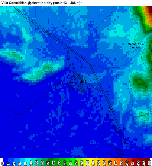
Below is the Elevation map of Villa Comaltitlán, which displays elevation range with different colors. Scale of the first map is from 13 to 486 m (43 to 1594 ft) with average elevation of 53.7 meters (=176 ft) [note 1]
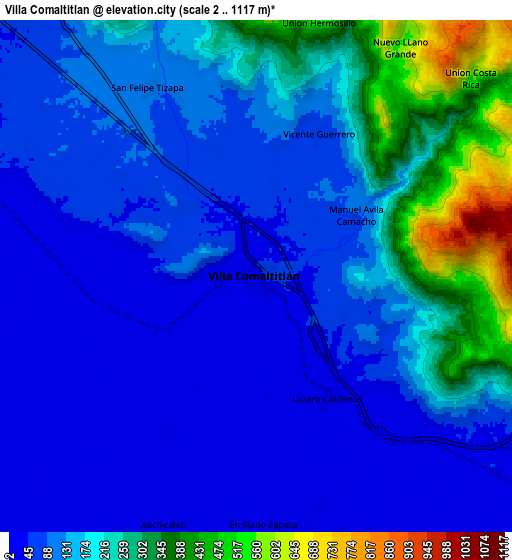
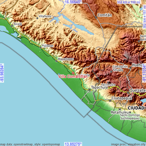
These maps also provides idea of topography and contour of this city, they are displayed at different zoom levels. More info about maps, scale and edge coordinates you can find below images.
| \ | Map #1 | Map #2 | Topo.Map |
| Scale [m] | 13..486 m | 2..1117 m | × |
| Scale [ft] | 43..1594 ft | 7..3665 ft | × |
| Average | 53.7 m = 176 ft | 147.3 m = 483 ft | × |
| Width | 9.43 km = 5.9 mi | 18.86 km = 11.7 mi | 301.7 km = 187.5 mi |
| Height | 9.43 km = 5.9 mi | 18.86 km = 11.7 mi | 301.8 km = 187.5 mi |
| ↑Max Latitude | 15.256371° | 15.298763° | 16.56645° |
| Latitude at center | 15.21397° | 15.21397° | 15.21397° |
| ↓Min Latitude | 15.171561° | 15.129143° | 13.85275° |
| ← Min Longitude | -92.620535° | -92.664481° | -93.98284° |
| Longitude center | -92.57659° | -92.57659° | -92.57659° |
| →Max Longitude | -92.532645° | -92.488699° | -91.17034° |
Nearby cities:
Cities around Villa Comaltitlán sort by population:
• Huixtla elevation 52 m
14.7 km,  124°
124°
• Escuintla 80 m
14.6 km,  323°
323°
• Acapetahua 33 m
14.3 km,  301°
301°
• El Triunfo 356 m
15.5 km,  12°
12°
• Francisco I. Madero 15 m
16.4 km,  167°
167°
• Hidalgo 17 m
8.1 km,  225°
225°
• Lázaro Cárdenas 28 m
5.2 km,  150°
150°
• Colonia Obrera 21 m
15.4 km, 146°
• El Arenal 11 m
13.9 km,  250°
250°
• San Felipe Tizapa 113 m
7.9 km,  330°
330°
• Zacualpa 21 m
7.4 km, 226°
• Cantón las Delicias 28 m
14.9 km, 146°
Multilingual:
 En español:
Villa Comaltitlán elevación 36 m.
 En France:
Villa Comaltitlán élévation 36 m.
 Auf Deutsch:
Villa Comaltitlán höhe über dem Meeresspiegel ist 36 m.

Sources and notes:
- [note 1] Map square and city borders are not equal. Map elevation data is calculated only from area inside that square.
- [src 1] Elevation data from geonames database provided with same terms of usage.
- [src 2] The elevation map of Villa Comaltitlán is generated using elevation data from NASA's 3 arcsec (90m) resolution SRTM data.
- [src 3] Base (background) map © OpenStreetMap contributors tiles are generated by Geofabrik and OpenTopoMap.
Copyright & License:
This Villa Comaltitlán Elevation Map is licensed under CC BY-SA. You may reuse any part from this page, if you give a proper credit by linking to this URL:
 More info on terms of use page.