Villa del Carbón elevation
Villa del Carbón (State of Mexico), Mexico elevation is 2600 meters and Villa del Carbón elevation in feet is 8530 ft above sea level [src 1]. Villa del Carbón is a seat of a second-order administrative division (feature code) with elevation that is 1286 meters (4219 ft) bigger than average city elevation in Mexico.
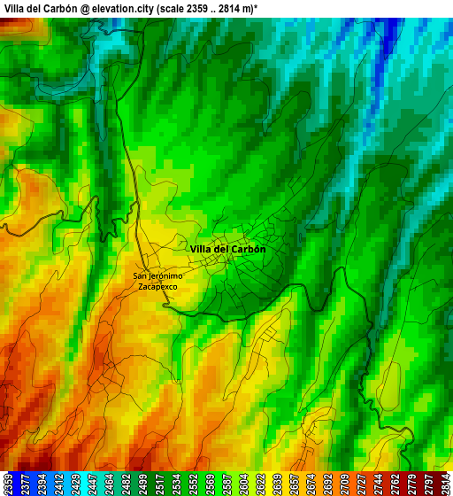
Below is the Elevation map of Villa del Carbón, which displays elevation range with different colors. Scale of the first map is from 2359 to 2814 m (7740 to 9232 ft) with average elevation of 2570.5 meters (=8433 ft) [note 1]
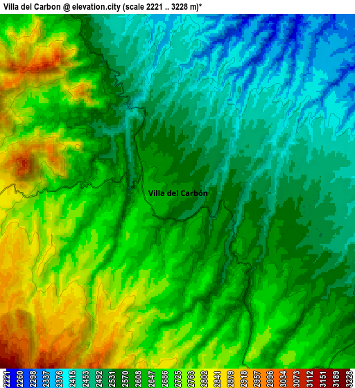
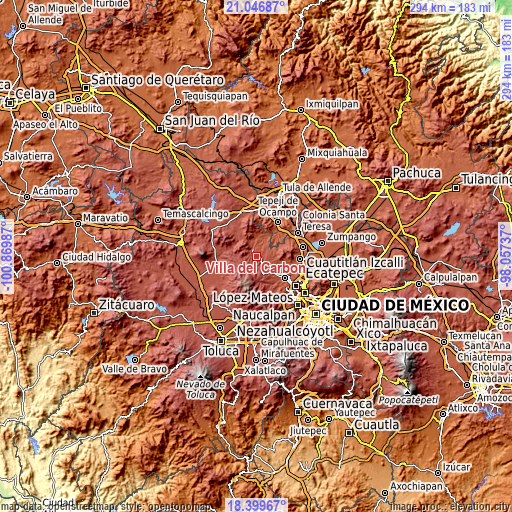
These maps also provides idea of topography and contour of this city, they are displayed at different zoom levels. More info about maps, scale and edge coordinates you can find below images.
| \ | Map #1 | Map #2 | Topo.Map |
| Scale [m] | 2359..2814 m | 2221..3228 m | × |
| Scale [ft] | 7740..9232 ft | 7287..10591 ft | × |
| Average | 2570.5 m = 8433 ft | 2611.2 m = 8567 ft | × |
| Width | 9.2 km = 5.7 mi | 18.4 km = 11.4 mi | 294.3 km = 182.9 mi |
| Height | 9.2 km = 5.7 mi | 18.4 km = 11.4 mi | 294.4 km = 182.9 mi |
| ↑Max Latitude | 19.77011° | 19.81146° | 21.04687° |
| Latitude at center | 19.72875° | 19.72875° | 19.72875° |
| ↓Min Latitude | 19.687379° | 19.645997° | 18.39967° |
| ← Min Longitude | -99.507565° | -99.551511° | -100.86987° |
| Longitude center | -99.46362° | -99.46362° | -99.46362° |
| →Max Longitude | -99.419675° | -99.375729° | -98.05737° |
Nearby cities:
Cities around Villa del Carbón sort by population:
• Santa María Magdalena Cahuacán elevation 2741 m
11.4 km,  152°
152°
• Santa Gertrudis 2448 m
10.2 km,  87°
87°
• Loma Alta 2690 m
4.6 km,  160°
160°
• El Puerto Magú 2515 m
10.5 km,  115°
115°
• San Martín Cachihuapan 2603 m
4.1 km, 124°
• Llano de Zacapexco 2689 m
3.5 km,  219°
219°
• El Esclavo 2542 m
11.3 km, 120°
• Los Arana 2705 m
4.6 km,  242°
242°
• San Luis Anáhuac (Toriles) 2361 m
10.1 km,  41°
41°
• La Esperanza 2820 m
7.4 km,  227°
227°
• El Ocotal 2674 m
5.5 km,  187°
187°
• Chapa de Mota 2619 m
11.5 km,  325°
325°
Multilingual:
 En español:
Villa del Carbón elevación 2600 m.
 En France:
Villa del Carbón élévation 2600 m.
 Auf Deutsch:
Villa del Carbón höhe über dem Meeresspiegel ist 2600 m.

Sources and notes:
- [note 1] Map square and city borders are not equal. Map elevation data is calculated only from area inside that square.
- [src 1] Elevation data from geonames database provided with same terms of usage.
- [src 2] The elevation map of Villa del Carbón is generated using elevation data from NASA's 3 arcsec (90m) resolution SRTM data.
- [src 3] Base (background) map © OpenStreetMap contributors tiles are generated by Geofabrik and OpenTopoMap.
Copyright & License:
This Villa del Carbón Elevation Map is licensed under CC BY-SA. You may reuse any part from this page, if you give a proper credit by linking to this URL:
 More info on terms of use page.