Shiveegovĭ elevation
Shiveegovĭ (Govĭ-Sumber), Mongolia elevation is 1179 meters and Shiveegovĭ elevation in feet is 3868 ft above sea level [src 1]. Shiveegovĭ is a seat of a second-order administrative division (feature code) with elevation that is 234 meters (768 ft) smaller than average city elevation in Mongolia.
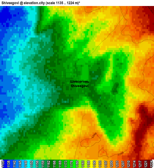
Below is the Elevation map of Shiveegovĭ, which displays elevation range with different colors. Scale of the first map is from 1135 to 1224 m (3724 to 4016 ft) with average elevation of 1176.1 meters (=3859 ft) [note 1]
These maps also provides idea of topography and contour of this city, they are displayed at different zoom levels. More info about maps, scale and edge coordinates you can find below images.
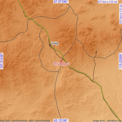
| \ | Map #1 | Topo.Map |
| Scale [m] | 1135..1224 m | × |
| Scale [ft] | 3724..4016 ft | × |
| Average | 1176.1 m = 3859 ft | × |
| Width | 6.78 km = 4.2 mi | 216.8 km = 134.7 mi |
| Height | 6.78 km = 4.2 mi | 216.8 km = 134.7 mi |
| ↑Max Latitude | 46.13604° | 47.07196° |
| Latitude at center | 46.10558° | 46.10558° |
| ↓Min Latitude | 46.075103° | 45.12196° |
| ← Min Longitude | 108.576665° | 107.21436° |
| Longitude center | 108.62061° | 108.62061° |
| →Max Longitude | 108.664555° | 110.02686° |
Nearby cities:
Cities around Shiveegovĭ sort by population:
• Choyr elevation 1286 m
34.7 km,  324°
324°
• Ulaan-Ereg 1109 m
123.6 km,  44°
44°
• Bayasgalant 1376 m
122.5 km,  347°
347°
• Bayan 1163 m
120.1 km,  82°
82°
• Böhöt 1177 m
100.6 km,  195°
195°
• Hajuu-Us 1457 m
87.5 km,  265°
265°
• Darhan 1267 m
83.4 km,  47°
47°
• Haraat 1381 m
82.2 km,  294°
294°
• Tsagaandörvölj 1051 m
63.9 km,  122°
122°
• Argatay 1261 m
62 km,  232°
232°
• Bayantal 1277 m
56.3 km,  334°
334°
• Tsomog 1096 m
40.3 km, 121°
Multilingual:
 En español:
Shiveegovĭ elevación 1179 m.
 En France:
Shiveegovĭ élévation 1179 m.
 Auf Deutsch:
Shiveegovĭ höhe über dem Meeresspiegel ist 1179 m.

Sources and notes:
- [note 1] Map square and city borders are not equal. Map elevation data is calculated only from area inside that square.
- [src 1] Elevation data from geonames database provided with same terms of usage.
- [src 2] The elevation map of Shiveegovĭ is generated using elevation data from NASA's 3 arcsec (90m) resolution SRTM data.
- [src 3] Base (background) map © OpenStreetMap contributors tiles are generated by Geofabrik and OpenTopoMap.
Copyright & License:
This Shiveegovĭ Elevation Map is licensed under CC BY-SA. You may reuse any part from this page, if you give a proper credit by linking to this URL:
 More info on terms of use page.