Choyr elevation
Choyr (Govĭ-Sumber), Mongolia elevation is 1286 meters and Choyr elevation in feet is 4219 ft above sea level [src 1]. Choyr is a seat of a first-order administrative division (feature code) with elevation that is 127 meters (417 ft) smaller than average city elevation in Mongolia.
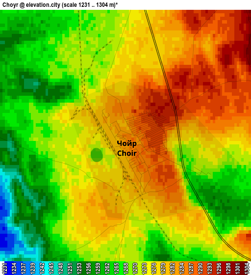
Below is the Elevation map of Choyr, which displays elevation range with different colors. Scale of the first map is from 1231 to 1304 m (4039 to 4278 ft) with average elevation of 1273.5 meters (=4178 ft) [note 1]
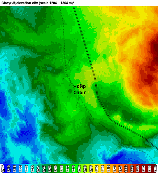
These maps also provides idea of topography and contour of this city, they are displayed at different zoom levels. More info about maps, scale and edge coordinates you can find below images.
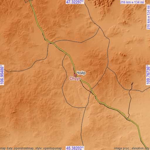
| \ | Map #1 | Map #2 | Topo.Map |
| Scale [m] | 1231..1304 m | 1204..1364 m | × |
| Scale [ft] | 4039..4278 ft | 3950..4475 ft | × |
| Average | 1273.5 m = 4178 ft | 1267.5 m = 4158 ft | × |
| Width | 6.74 km = 4.2 mi | 13.49 km = 8.4 mi | 215.8 km = 134.1 mi |
| Height | 6.74 km = 4.2 mi | 13.49 km = 8.4 mi | 215.8 km = 134.1 mi |
| ↑Max Latitude | 46.391429° | 46.421731° | 47.32297° |
| Latitude at center | 46.36111° | 46.36111° | 46.36111° |
| ↓Min Latitude | 46.330774° | 46.300422° | 45.38202° |
| ← Min Longitude | 108.317165° | 108.273219° | 106.95486° |
| Longitude center | 108.36111° | 108.36111° | 108.36111° |
| →Max Longitude | 108.405055° | 108.449001° | 109.76736° |
Nearby cities:
Cities around Choyr sort by population:
• Maanĭt elevation 1413 m
117.2 km,  327°
327°
• Avraga 1241 m
110.6 km,  34°
34°
• Dzogsool 1381 m
104.6 km,  297°
297°
• Tsagaandörvölj 1051 m
96.8 km,  130°
130°
• Bayasgalant 1376 m
91.3 km,  355°
355°
• Darhan 1267 m
85.7 km,  70°
70°
• Hajuu-Us 1457 m
75.5 km,  242°
242°
• Tsomog 1096 m
73.5 km, 132°
• Argatay 1261 m
72.2 km,  203°
203°
• Haraat 1381 m
54.9 km,  276°
276°
• Shiveegovĭ 1179 m
34.7 km,  144°
144°
• Bayantal 1277 m
22.8 km,  349°
349°
Multilingual:
 En español:
Choyr elevación 1286 m.
 En France:
Choyr élévation 1286 m.


Sources and notes:
- [note 1] Map square and city borders are not equal. Map elevation data is calculated only from area inside that square.
- [src 1] Elevation data from geonames database provided with same terms of usage.
- [src 2] The elevation map of Choyr is generated using elevation data from NASA's 3 arcsec (90m) resolution SRTM data.
- [src 3] Base (background) map © OpenStreetMap contributors tiles are generated by Geofabrik and OpenTopoMap.
Copyright & License:
This Choyr Elevation Map is licensed under CC BY-SA. You may reuse any part from this page, if you give a proper credit by linking to this URL:
 More info on terms of use page.