Podareš elevation
Podareš (Radovish), North Macedonia elevation is 349 meters and Podareš elevation in feet is 1145 ft above sea level [src 1]. Podareš is a populated place (feature code) with elevation that is 150 meters (492 ft) smaller than average city elevation in North Macedonia.
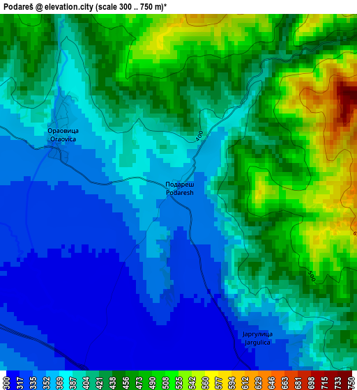
Below is the Elevation map of Podareš, which displays elevation range with different colors. Scale of the first map is from 300 to 750 m (984 to 2461 ft) with average elevation of 407.7 meters (=1338 ft) [note 1]
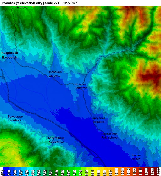
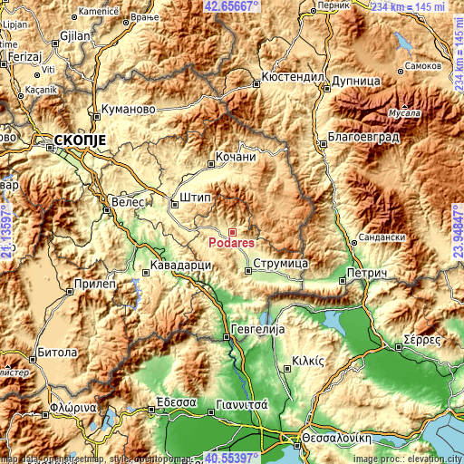
These maps also provides idea of topography and contour of this city, they are displayed at different zoom levels. More info about maps, scale and edge coordinates you can find below images.
| \ | Map #1 | Map #2 | Topo.Map |
| Scale [m] | 300..750 m | 271..1277 m | × |
| Scale [ft] | 984..2461 ft | 889..4190 ft | × |
| Average | 407.7 m = 1338 ft | 525.3 m = 1723 ft | × |
| Width | 7.31 km = 4.5 mi | 14.61 km = 9.1 mi | 233.8 km = 145.3 mi |
| Height | 7.31 km = 4.5 mi | 14.61 km = 9.1 mi | 233.8 km = 145.3 mi |
| ↑Max Latitude | 41.646737° | 41.679567° | 42.65667° |
| Latitude at center | 41.61389° | 41.61389° | 41.61389° |
| ↓Min Latitude | 41.581026° | 41.548146° | 40.55397° |
| ← Min Longitude | 22.498275° | 22.454329° | 21.13597° |
| Longitude center | 22.54222° | 22.54222° | 22.54222° |
| →Max Longitude | 22.586165° | 22.630111° | 23.94847° |
Nearby cities:
Cities around Podareš sort by population:
• Strumica elevation 228 m
21.3 km,  156°
156°
• Radovis 382 m
7 km,  292°
292°
• Bosilovo 216 m
24.7 km,  141°
141°
• Vasilevo 234 m
17.7 km,  151°
151°
• Kuklis 237 m
25.4 km, 156°
• Oraovica 358 m
2.7 km,  298°
298°
• Konče 580 m
18.7 km,  224°
224°
• Rusinovo 899 m
23.6 km,  69°
69°
• Blatec 702 m
25 km,  7°
7°
• Veljusa 364 m
15.5 km,  172°
172°
• Vladimirovo 850 m
23.4 km,  62°
62°
• Gradec 515 m
26.5 km,  354°
354°
Multilingual:
 En español:
Podareš elevación 349 m.
 En France:
Podareš élévation 349 m.


Sources and notes:
- [note 1] Map square and city borders are not equal. Map elevation data is calculated only from area inside that square.
- [src 1] Elevation data from geonames database provided with same terms of usage.
- [src 2] The elevation map of Podareš is generated using elevation data from NASA's 3 arcsec (90m) resolution SRTM data.
- [src 3] Base (background) map © OpenStreetMap contributors tiles are generated by Geofabrik and OpenTopoMap.
Copyright & License:
This Podareš Elevation Map is licensed under CC BY-SA. You may reuse any part from this page, if you give a proper credit by linking to this URL:
 More info on terms of use page.