Vasilevo elevation
Vasilevo, North Macedonia elevation is 234 meters and Vasilevo elevation in feet is 768 ft above sea level [src 1]. Vasilevo is a seat of a first-order administrative division (feature code) with elevation that is 265 meters (869 ft) smaller than average city elevation in North Macedonia.
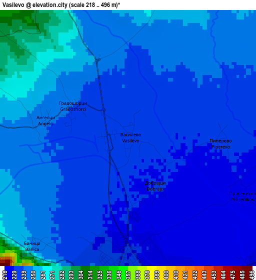
Below is the Elevation map of Vasilevo, which displays elevation range with different colors. Scale of the first map is from 218 to 496 m (715 to 1627 ft) with average elevation of 241.3 meters (=792 ft) [note 1]
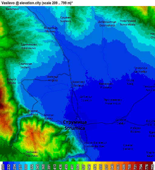
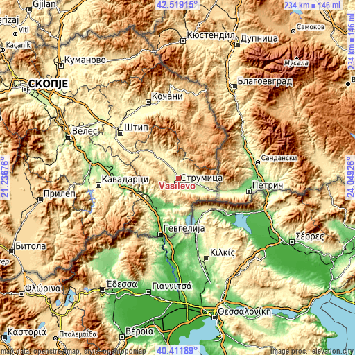
These maps also provides idea of topography and contour of this city, they are displayed at different zoom levels. More info about maps, scale and edge coordinates you can find below images.
| \ | Map #1 | Map #2 | Topo.Map |
| Scale [m] | 218..496 m | 209..799 m | × |
| Scale [ft] | 715..1627 ft | 686..2621 ft | × |
| Average | 241.3 m = 792 ft | 305.3 m = 1002 ft | × |
| Width | 7.32 km = 4.5 mi | 14.64 km = 9.1 mi | 234.3 km = 145.6 mi |
| Height | 7.32 km = 4.5 mi | 14.64 km = 9.1 mi | 234.3 km = 145.6 mi |
| ↑Max Latitude | 41.506998° | 41.539899° | 42.51915° |
| Latitude at center | 41.47408° | 41.47408° | 41.47408° |
| ↓Min Latitude | 41.441145° | 41.408194° | 40.41189° |
| ← Min Longitude | 22.599065° | 22.555119° | 21.23676° |
| Longitude center | 22.64301° | 22.64301° | 22.64301° |
| →Max Longitude | 22.686955° | 22.730901° | 24.04926° |
Nearby cities:
Cities around Vasilevo sort by population:
• Strumica elevation 228 m
4.1 km,  179°
179°
• Bosilovo 216 m
8 km,  117°
117°
• Kuklis 237 m
7.9 km,  166°
166°
• Valandovo 127 m
18.7 km,  201°
201°
• Oraovica 358 m
20 km,  327°
327°
• Podareš 349 m
17.7 km, 331°
• Murtino 212 m
9.5 km,  133°
133°
• Ilovica 293 m
13.5 km,  90°
90°
• Sušica 262 m
16.6 km,  103°
103°
• Veljusa 364 m
6.3 km,  272°
272°
• Pirava 103 m
19.5 km,  208°
208°
• Sekirnik 221 m
13.2 km,  106°
106°
Multilingual:
 En español:
Vasilevo elevación 234 m.
 En France:
Vasilevo élévation 234 m.
 Auf Deutsch:
Vasilevo höhe über dem Meeresspiegel ist 234 m.

Sources and notes:
- [note 1] Map square and city borders are not equal. Map elevation data is calculated only from area inside that square.
- [src 1] Elevation data from geonames database provided with same terms of usage.
- [src 2] The elevation map of Vasilevo is generated using elevation data from NASA's 3 arcsec (90m) resolution SRTM data.
- [src 3] Base (background) map © OpenStreetMap contributors tiles are generated by Geofabrik and OpenTopoMap.
Copyright & License:
This Vasilevo Elevation Map is licensed under CC BY-SA. You may reuse any part from this page, if you give a proper credit by linking to this URL:
 More info on terms of use page.