Radovis elevation
Radovis (Radovish), North Macedonia elevation is 382 meters and Radovis elevation in feet is 1253 ft above sea level [src 1]. Radovis is a seat of a first-order administrative division (feature code) with elevation that is 117 meters (384 ft) smaller than average city elevation in North Macedonia.
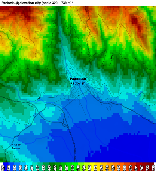
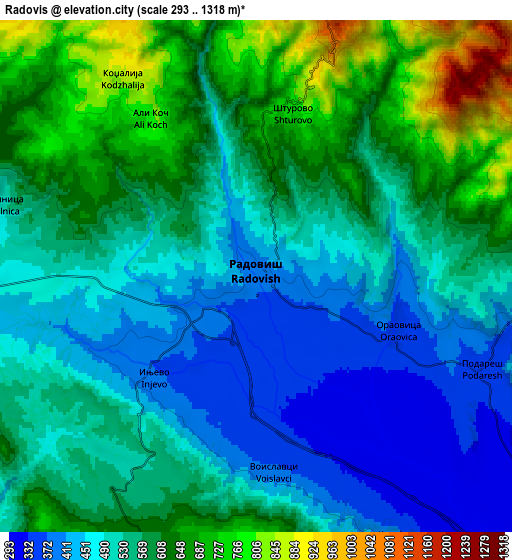
Below is the Elevation map of Radovis, which displays elevation range with different colors. Scale of the first map is from 320 to 739 m (1050 to 2425 ft) with average elevation of 447.4 meters (=1468 ft) [note 1]
These maps also provides idea of topography and contour of this city, they are displayed at different zoom levels. More info about maps, scale and edge coordinates you can find below images.
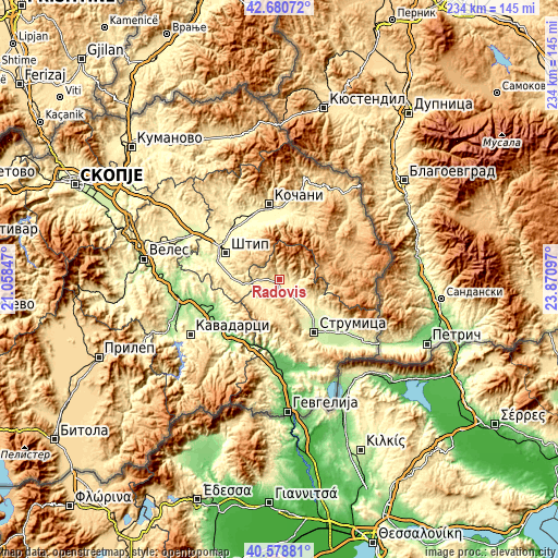
| \ | Map #1 | Map #2 | Topo.Map |
| Scale [m] | 320..739 m | 293..1318 m | × |
| Scale [ft] | 1050..2425 ft | 961..4324 ft | × |
| Average | 447.4 m = 1468 ft | 551.5 m = 1809 ft | × |
| Width | 7.3 km = 4.5 mi | 14.61 km = 9.1 mi | 233.7 km = 145.2 mi |
| Height | 7.3 km = 4.5 mi | 14.61 km = 9.1 mi | 233.7 km = 145.2 mi |
| ↑Max Latitude | 41.671164° | 41.703982° | 42.68072° |
| Latitude at center | 41.63833° | 41.63833° | 41.63833° |
| ↓Min Latitude | 41.605479° | 41.572611° | 40.57881° |
| ← Min Longitude | 22.420775° | 22.376829° | 21.05847° |
| Longitude center | 22.46472° | 22.46472° | 22.46472° |
| →Max Longitude | 22.508665° | 22.552611° | 23.87097° |
Nearby cities:
Cities around Radovis sort by population:
• Shtip elevation 294 m
25.3 km,  298°
298°
• Strumica 228 m
26.8 km,  146°
146°
• Vinica 407 m
27.4 km,  7°
7°
• Vasilevo 234 m
23.5 km,  140°
140°
• Karbinci 288 m
27.6 km,  316°
316°
• Oraovica 358 m
4.3 km,  108°
108°
• Podareš 349 m
7 km, 112°
• Konče 580 m
17.3 km,  202°
202°
• Zrnovci 361 m
24.1 km,  355°
355°
• Blatec 702 m
24 km,  23°
23°
• Veljusa 364 m
20 km, 154°
• Gradec 515 m
23.9 km, 9°
Multilingual:
 En español:
Radovis elevación 382 m.
 En France:
Radovis élévation 382 m.


Sources and notes:
- [note 1] Map square and city borders are not equal. Map elevation data is calculated only from area inside that square.
- [src 1] Elevation data from geonames database provided with same terms of usage.
- [src 2] The elevation map of Radovis is generated using elevation data from NASA's 3 arcsec (90m) resolution SRTM data.
- [src 3] Base (background) map © OpenStreetMap contributors tiles are generated by Geofabrik and OpenTopoMap.
Copyright & License:
This Radovis Elevation Map is licensed under CC BY-SA. You may reuse any part from this page, if you give a proper credit by linking to this URL:
 More info on terms of use page.