Mahabe elevation
Mahabe (Melaky, Besalampy), Madagascar elevation is 293 meters and Mahabe elevation in feet is 961 ft above sea level [src 1]. Mahabe is a populated place (feature code) with elevation that is 264 meters (866 ft) smaller than average city elevation in Madagascar.
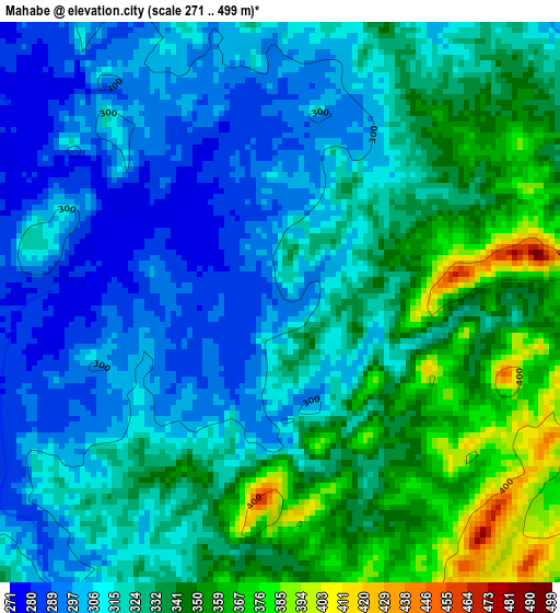
Below is the Elevation map of Mahabe, which displays elevation range with different colors. Scale of the first map is from 271 to 499 m (889 to 1637 ft) with average elevation of 323.8 meters (=1062 ft) [note 1]
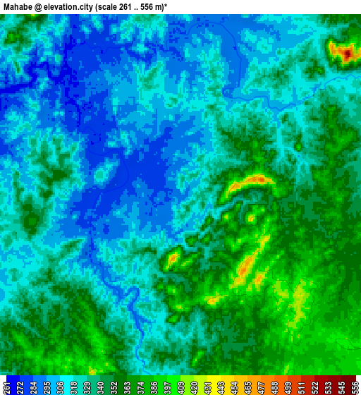
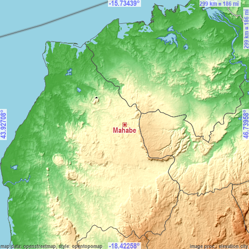
These maps also provides idea of topography and contour of this city, they are displayed at different zoom levels. More info about maps, scale and edge coordinates you can find below images.
| \ | Map #1 | Map #2 | Topo.Map |
| Scale [m] | 271..499 m | 261..556 m | × |
| Scale [ft] | 889..1637 ft | 856..1824 ft | × |
| Average | 323.8 m = 1062 ft | 331.8 m = 1089 ft | × |
| Width | 9.34 km = 5.8 mi | 18.68 km = 11.6 mi | 298.9 km = 185.7 mi |
| Height | 9.34 km = 5.8 mi | 18.68 km = 11.6 mi | 298.9 km = 185.7 mi |
| ↑Max Latitude | -17.041319° | -16.999298° | -15.73439° |
| Latitude at center | -17.08333° | -17.08333° | -17.08333° |
| ↓Min Latitude | -17.125332° | -17.167324° | -18.42258° |
| ← Min Longitude | 45.289385° | 45.245439° | 43.92708° |
| Longitude center | 45.33333° | 45.33333° | 45.33333° |
| →Max Longitude | 45.377275° | 45.421221° | 46.73958° |
Nearby cities:
Cities around Mahabe sort by population:
• Mahajanga elevation 20 m
184.6 km,  34°
34°
• Marovoay 33 m
176.6 km,  52°
52°
• Tsiroanomandidy 862 m
202.1 km,  158°
158°
• Maevatanana 64 m
160.2 km,  84°
84°
• Ambato Boeny 36 m
162.4 km,  65°
65°
• Sitampiky 100 m
93.8 km,  60°
60°
• Miandrivazo 67 m
272.2 km,  177°
177°
• Fenoarivo Be 983 m
199 km,  138°
138°
• Tsaratanana 349 m
248.6 km, 82°
• Maintirano 11 m
176 km,  231°
231°
• Ankazobe 1231 m
233.4 km,  125°
125°
• Miarinarivo 1325 m
266.7 km, 141°
Multilingual:
 En español:
Mahabe elevación 293 m.
 En France:
Mahabe élévation 293 m.


Sources and notes:
- [note 1] Map square and city borders are not equal. Map elevation data is calculated only from area inside that square.
- [src 1] Elevation data from geonames database provided with same terms of usage.
- [src 2] The elevation map of Mahabe is generated using elevation data from NASA's 3 arcsec (90m) resolution SRTM data.
- [src 3] Base (background) map © OpenStreetMap contributors tiles are generated by Geofabrik and OpenTopoMap.
Copyright & License:
This Mahabe Elevation Map is licensed under CC BY-SA. You may reuse any part from this page, if you give a proper credit by linking to this URL:
 More info on terms of use page.