Fenoarivo Be elevation
Fenoarivo Be (Bongolava, Fenoarivobe), Madagascar elevation is 983 meters and Fenoarivo Be elevation in feet is 3225 ft above sea level [src 1]. Fenoarivo Be is a populated place (feature code) with elevation that is 426 meters (1398 ft) bigger than average city elevation in Madagascar.
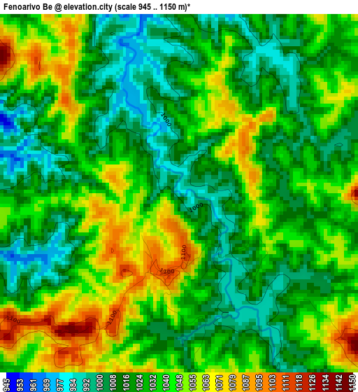
Below is the Elevation map of Fenoarivo Be, which displays elevation range with different colors. Scale of the first map is from 945 to 1150 m (3100 to 3773 ft) with average elevation of 1031.1 meters (=3383 ft) [note 1]
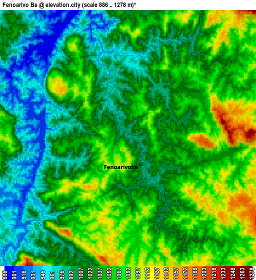
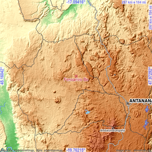
These maps also provides idea of topography and contour of this city, they are displayed at different zoom levels. More info about maps, scale and edge coordinates you can find below images.
| \ | Map #1 | Map #2 | Topo.Map |
| Scale [m] | 945..1150 m | 886..1278 m | × |
| Scale [ft] | 3100..3773 ft | 2907..4193 ft | × |
| Average | 1031.1 m = 3383 ft | 1031.4 m = 3384 ft | × |
| Width | 9.27 km = 5.8 mi | 18.54 km = 11.5 mi | 296.7 km = 184.4 mi |
| Height | 9.27 km = 5.8 mi | 18.54 km = 11.5 mi | 296.7 km = 184.4 mi |
| ↑Max Latitude | -18.391634° | -18.349929° | -17.09416° |
| Latitude at center | -18.43333° | -18.43333° | -18.43333° |
| ↓Min Latitude | -18.475016° | -18.516691° | -19.76215° |
| ← Min Longitude | 46.522725° | 46.478779° | 45.16042° |
| Longitude center | 46.56667° | 46.56667° | 46.56667° |
| →Max Longitude | 46.610615° | 46.654561° | 47.97292° |
Nearby cities:
Cities around Fenoarivo Be sort by population:
• Antananarivo elevation 1274 m
115.2 km,  117°
117°
• Soavinandriana 1500 m
83.4 km,  167°
167°
• Faratsiho 1729 m
114.8 km,  159°
159°
• Tsiroanomandidy 862 m
66.4 km,  235°
235°
• Miandrarivo 1424 m
112.8 km, 170°
• Arivonimamo 1418 m
91.8 km,  134°
134°
• Sadabe 1336 m
121.5 km,  100°
100°
• Ambohitrolomahitsy 1502 m
121.4 km, 104°
• Ankazondandy 1378 m
131.6 km, 103°
• Ankazobe 1231 m
59.5 km,  77°
77°
• Anjepy 1550 m
129.7 km,  110°
110°
• Miarinarivo 1325 m
68.5 km,  148°
148°
Multilingual:
 En español:
Fenoarivo Be elevación 983 m.
 En France:
Fenoarivo Be élévation 983 m.
 Auf Deutsch:
Fenoarivo Be höhe über dem Meeresspiegel ist 983 m.

Sources and notes:
- [note 1] Map square and city borders are not equal. Map elevation data is calculated only from area inside that square.
- [src 1] Elevation data from geonames database provided with same terms of usage.
- [src 2] The elevation map of Fenoarivo Be is generated using elevation data from NASA's 3 arcsec (90m) resolution SRTM data.
- [src 3] Base (background) map © OpenStreetMap contributors tiles are generated by Geofabrik and OpenTopoMap.
Copyright & License:
This Fenoarivo Be Elevation Map is licensed under CC BY-SA. You may reuse any part from this page, if you give a proper credit by linking to this URL:
 More info on terms of use page.