Soavinandriana elevation
Soavinandriana (Itasy), Madagascar elevation is 1500 meters and Soavinandriana elevation in feet is 4921 ft above sea level [src 1]. Soavinandriana is a populated place (feature code) with elevation that is 943 meters (3094 ft) bigger than average city elevation in Madagascar.
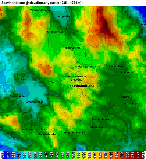
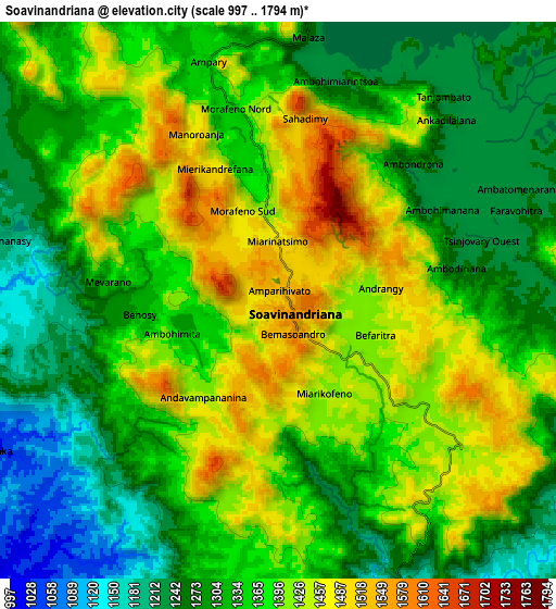
Below is the Elevation map of Soavinandriana, which displays elevation range with different colors. Scale of the first map is from 1235 to 1794 m (4052 to 5886 ft) with average elevation of 1473.9 meters (=4836 ft) [note 1]
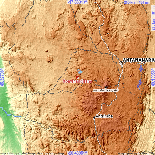
These maps also provides idea of topography and contour of this city, they are displayed at different zoom levels. More info about maps, scale and edge coordinates you can find below images.
| \ | Map #1 | Map #2 | Topo.Map |
| Scale [m] | 1235..1794 m | 997..1794 m | × |
| Scale [ft] | 4052..5886 ft | 3271..5886 ft | × |
| Average | 1473.9 m = 4836 ft | 1353.7 m = 4441 ft | × |
| Width | 9.23 km = 5.7 mi | 18.46 km = 11.5 mi | 295.4 km = 183.6 mi |
| Height | 9.23 km = 5.7 mi | 18.46 km = 11.5 mi | 295.4 km = 183.6 mi |
| ↑Max Latitude | -19.125155° | -19.08363° | -17.83313° |
| Latitude at center | -19.16667° | -19.16667° | -19.16667° |
| ↓Min Latitude | -19.208174° | -19.249668° | -20.48951° |
| ← Min Longitude | 46.689385° | 46.645439° | 45.32708° |
| Longitude center | 46.73333° | 46.73333° | 46.73333° |
| →Max Longitude | 46.777275° | 46.821221° | 48.13958° |
Nearby cities:
Cities around Soavinandriana sort by population:
• Antananarivo elevation 1274 m
88.9 km,  71°
71°
• Antsirabe 1513 m
83.9 km,  157°
157°
• Antanifotsy 1571 m
81.4 km,  131°
131°
• Faratsiho 1729 m
34.5 km,  138°
138°
• Betafo 1371 m
75.1 km,  170°
170°
• Ambatolampy 1586 m
75.7 km,  108°
108°
• Tsiroanomandidy 862 m
84.6 km,  301°
301°
• Miandrarivo 1424 m
29.7 km,  176°
176°
• Arivonimamo 1418 m
50.1 km, 70°
• Fenoarivo Be 983 m
83.4 km,  347°
347°
• Antsampanimahazo 1676 m
68.8 km, 139°
• Miarinarivo 1325 m
29.4 km,  38°
38°
Multilingual:
 En español:
Soavinandriana elevación 1500 m.
 En France:
Soavinandriana élévation 1500 m.
 Auf Deutsch:
Soavinandriana höhe über dem Meeresspiegel ist 1500 m.

Sources and notes:
- [note 1] Map square and city borders are not equal. Map elevation data is calculated only from area inside that square.
- [src 1] Elevation data from geonames database provided with same terms of usage.
- [src 2] The elevation map of Soavinandriana is generated using elevation data from NASA's 3 arcsec (90m) resolution SRTM data.
- [src 3] Base (background) map © OpenStreetMap contributors tiles are generated by Geofabrik and OpenTopoMap.
Copyright & License:
This Soavinandriana Elevation Map is licensed under CC BY-SA. You may reuse any part from this page, if you give a proper credit by linking to this URL:
 More info on terms of use page.