Pervomaisc elevation
Pervomaisc (Transnistria), Moldova elevation is 12 meters and Pervomaisc elevation in feet is 39 ft above sea level [src 1]. Pervomaisc is a populated place (feature code) with elevation that is 81 meters (266 ft) smaller than average city elevation in Moldova.
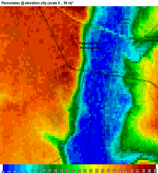
Below is the Elevation map of Pervomaisc, which displays elevation range with different colors. Scale of the first map is from 0 to 58 m (0 to 190 ft) with average elevation of 29.1 meters (=95 ft) [note 1]
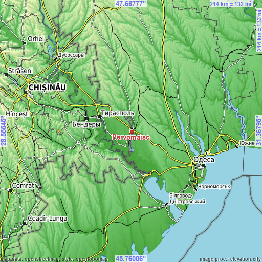
These maps also provides idea of topography and contour of this city, they are displayed at different zoom levels. More info about maps, scale and edge coordinates you can find below images.
| \ | Map #1 | Map #2 | Topo.Map |
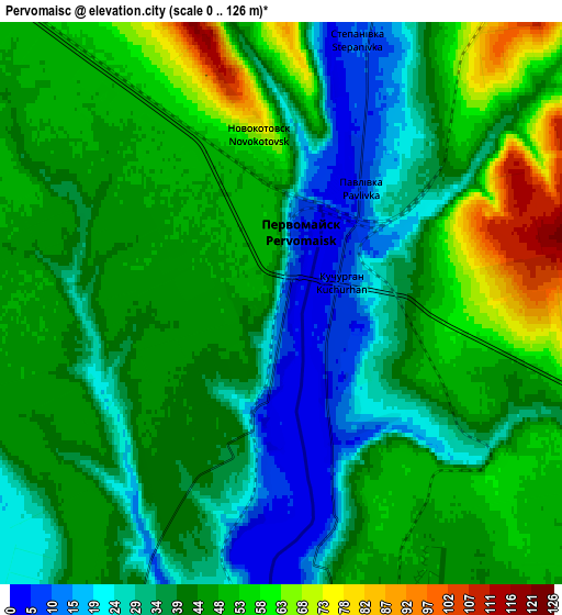
| Scale [m] | 0..58 m | 0..126 m | × |
| Scale [ft] | 0..190 ft | 0..413 ft | × |
| Average | 29.1 m = 95 ft | 42.3 m = 139 ft | × |
| Width | 6.7 km = 4.2 mi | 13.4 km = 8.3 mi | 214.3 km = 133.2 mi |
| Height | 6.7 km = 4.2 mi | 13.4 km = 8.3 mi | 214.3 km = 133.2 mi |
| ↑Max Latitude | 46.762642° | 46.792737° | 47.68777° |
| Latitude at center | 46.73253° | 46.73253° | 46.73253° |
| ↓Min Latitude | 46.702401° | 46.672256° | 45.76006° |
| ← Min Longitude | 29.917755° | 29.873809° | 28.55545° |
| Longitude center | 29.9617° | 29.9617° | 29.9617° |
| →Max Longitude | 30.005645° | 30.049591° | 31.36795° |
Nearby cities:
Cities around Pervomaisc sort by population:
• Tiraspol elevation 30 m
28.1 km,  295°
295°
• Bender 33 m
38.5 km,  286°
286°
• Căuşeni 32 m
43.3 km,  255°
255°
• Slobozia 24 m
19.6 km,  268°
268°
• Dnestrovsc 16 m
13.3 km,  194°
194°
• Hryhoriopol 21 m
68.7 km,  313°
313°
• Chiţcani 11 m
26.9 km,  282°
282°
• Anenii Noi 28 m
57.6 km, 286°
• Ştefan Vodă 166 m
33.5 km,  223°
223°
• Crasnoe 13 m
15.2 km,  232°
232°
• Varniţa 94 m
40.5 km, 291°
• Tiraspolul Nou 28 m
35.2 km, 287°
Multilingual:
 En español:
Pervomaisc elevación 12 m.
 En France:
Pervomaisc élévation 12 m.
 Auf Deutsch:
Pervomaisc höhe über dem Meeresspiegel ist 12 m.

Sources and notes:
- [note 1] Map square and city borders are not equal. Map elevation data is calculated only from area inside that square.
- [src 1] Elevation data from geonames database provided with same terms of usage.
- [src 2] The elevation map of Pervomaisc is generated using elevation data from NASA's 3 arcsec (90m) resolution SRTM data.
- [src 3] Base (background) map © OpenStreetMap contributors tiles are generated by Geofabrik and OpenTopoMap.
Copyright & License:
This Pervomaisc Elevation Map is licensed under CC BY-SA. You may reuse any part from this page, if you give a proper credit by linking to this URL:
 More info on terms of use page.