Anenii Noi elevation
Anenii Noi, Moldova elevation is 28 meters and Anenii Noi elevation in feet is 92 ft above sea level [src 1]. Anenii Noi is a seat of a first-order administrative division (feature code) with elevation that is 65 meters (213 ft) smaller than average city elevation in Moldova.
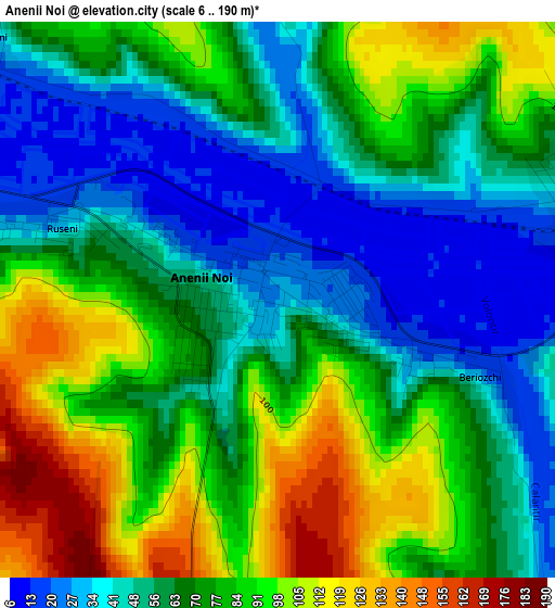
Below is the Elevation map of Anenii Noi, which displays elevation range with different colors. Scale of the first map is from 6 to 190 m (20 to 623 ft) with average elevation of 70.4 meters (=231 ft) [note 1]
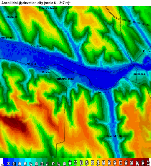
These maps also provides idea of topography and contour of this city, they are displayed at different zoom levels. More info about maps, scale and edge coordinates you can find below images.
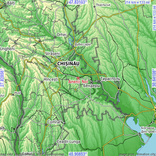
| \ | Map #1 | Map #2 | Topo.Map |
| Scale [m] | 6..190 m | 6..217 m | × |
| Scale [ft] | 20..623 ft | 20..712 ft | × |
| Average | 70.4 m = 231 ft | 92.4 m = 303 ft | × |
| Width | 6.68 km = 4.2 mi | 13.36 km = 8.3 mi | 213.8 km = 132.8 mi |
| Height | 6.68 km = 4.2 mi | 13.36 km = 8.3 mi | 213.7 km = 132.8 mi |
| ↑Max Latitude | 46.90842° | 46.938434° | 47.83103° |
| Latitude at center | 46.87839° | 46.87839° | 46.87839° |
| ↓Min Latitude | 46.848343° | 46.818279° | 45.90853° |
| ← Min Longitude | 29.190885° | 29.146939° | 27.82858° |
| Longitude center | 29.23483° | 29.23483° | 29.23483° |
| →Max Longitude | 29.278775° | 29.322721° | 30.64108° |
Nearby cities:
Cities around Anenii Noi sort by population:
• Chisinau elevation 55 m
31.9 km,  296°
296°
• Tiraspol 30 m
30.2 km,  97°
97°
• Bender 33 m
19.2 km,  105°
105°
• Căuşeni 32 m
30 km,  153°
153°
• Ialoveni 97 m
35.1 km,  281°
281°
• Hryhoriopol 21 m
31.1 km,  9°
9°
• Chiţcani 11 m
30.9 km, 110°
• Sîngera 50 m
20.8 km, 281°
• Stăuceni 188 m
36.9 km,  311°
311°
• Vadul lui Vodă 47 m
26.5 km,  332°
332°
• Varniţa 94 m
17.7 km,  94°
94°
• Tiraspolul Nou 28 m
22.5 km, 104°
Multilingual:
 En español:
Anenii Noi elevación 28 m.
 En France:
Anenii Noi élévation 28 m.
 Auf Deutsch:
Anenii Noi höhe über dem Meeresspiegel ist 28 m.

Sources and notes:
- [note 1] Map square and city borders are not equal. Map elevation data is calculated only from area inside that square.
- [src 1] Elevation data from geonames database provided with same terms of usage.
- [src 2] The elevation map of Anenii Noi is generated using elevation data from NASA's 3 arcsec (90m) resolution SRTM data.
- [src 3] Base (background) map © OpenStreetMap contributors tiles are generated by Geofabrik and OpenTopoMap.
Copyright & License:
This Anenii Noi Elevation Map is licensed under CC BY-SA. You may reuse any part from this page, if you give a proper credit by linking to this URL:
 More info on terms of use page.