El Hajeb elevation
El Hajeb (Fès-Meknès, El-Hajeb), Morocco elevation is 1023 meters and El Hajeb elevation in feet is 3356 ft above sea level [src 1]. El Hajeb is a seat of a third-order administrative division (feature code) with elevation that is 407 meters (1335 ft) bigger than average city elevation in Morocco.
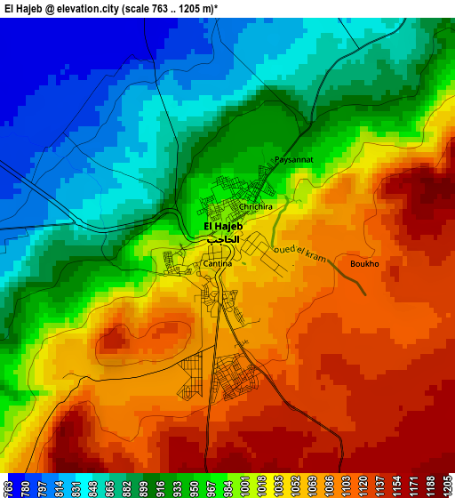
Below is the Elevation map of El Hajeb, which displays elevation range with different colors. Scale of the first map is from 763 to 1205 m (2503 to 3953 ft) with average elevation of 992.2 meters (=3255 ft) [note 1]
These maps also provides idea of topography and contour of this city, they are displayed at different zoom levels. More info about maps, scale and edge coordinates you can find below images.
| \ | Map #1 | Map #2 | Topo.Map |
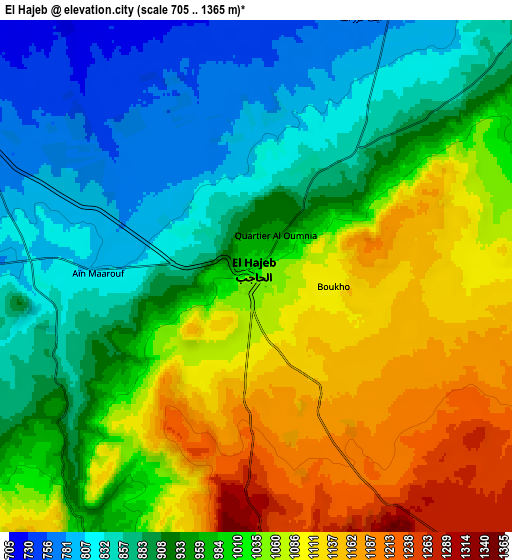
| Scale [m] | 763..1205 m | 705..1365 m | × |
| Scale [ft] | 2503..3953 ft | 2313..4478 ft | × |
| Average | 992.2 m = 3255 ft | 979.6 m = 3214 ft | × |
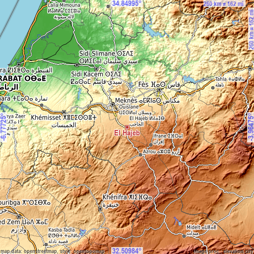
| Width | 8.13 km = 5.1 mi | 16.26 km = 10.1 mi | 260.2 km = 161.7 mi |
| Height | 8.13 km = 5.1 mi | 16.26 km = 10.1 mi | 260.2 km = 161.7 mi |
| ↑Max Latitude | 33.724418° | 33.76096° | 34.84995° |
| Latitude at center | 33.68786° | 33.68786° | 33.68786° |
| ↓Min Latitude | 33.651287° | 33.614698° | 32.50984° |
| ← Min Longitude | -5.414945° | -5.458891° | -6.77725° |
| Longitude center | -5.371° | -5.371° | -5.371° |
| →Max Longitude | -5.327055° | -5.283109° | -3.96475° |
Nearby cities:
Cities around El Hajeb sort by population:
• Fès elevation 406 m
51.4 km,  41°
41°
• Meknès 531 m
28.1 km,  324°
324°
• Fès al Bali 237 m
57.3 km, 42°
• Ifrane 1648 m
30.1 km,  126°
126°
• Sefrou 809 m
52.7 km,  72°
72°
• Azrou 1277 m
31.4 km,  153°
153°
• Oulmes 1175 m
65.3 km,  243°
243°
• Aïn Leuh 1424 m
44.4 km,  176°
176°
• Oulad Tayeb 533 m
45.1 km,  50°
50°
• Sidi Harazem 257 m
58.7 km, 50°
• Bhalil 945 m
49.6 km, 68°
• Moulay Yacoub 254 m
47.8 km,  21°
21°
Multilingual:
 En español:
El Hajeb elevación 1023 m.
 En France:
El Hajeb élévation 1023 m.
 Auf Deutsch:
El Hajeb höhe über dem Meeresspiegel ist 1023 m.

Sources and notes:
- [note 1] Map square and city borders are not equal. Map elevation data is calculated only from area inside that square.
- [src 1] Elevation data from geonames database provided with same terms of usage.
- [src 2] The elevation map of El Hajeb is generated using elevation data from NASA's 3 arcsec (90m) resolution SRTM data.
- [src 3] Base (background) map © OpenStreetMap contributors tiles are generated by Geofabrik and OpenTopoMap.
Copyright & License:
This El Hajeb Elevation Map is licensed under CC BY-SA. You may reuse any part from this page, if you give a proper credit by linking to this URL:
 More info on terms of use page.