Khenifra elevation
Khenifra (Béni Mellal-Khénifra), Morocco elevation is 868 meters and Khenifra elevation in feet is 2848 ft above sea level [src 1]. Khenifra is a seat of a third-order administrative division (feature code) with elevation that is 252 meters (827 ft) bigger than average city elevation in Morocco.
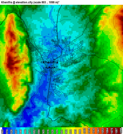
Below is the Elevation map of Khenifra, which displays elevation range with different colors. Scale of the first map is from 803 to 1098 m (2635 to 3602 ft) with average elevation of 902.9 meters (=2962 ft) [note 1]
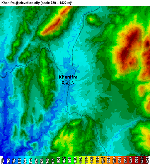
These maps also provides idea of topography and contour of this city, they are displayed at different zoom levels. More info about maps, scale and edge coordinates you can find below images.
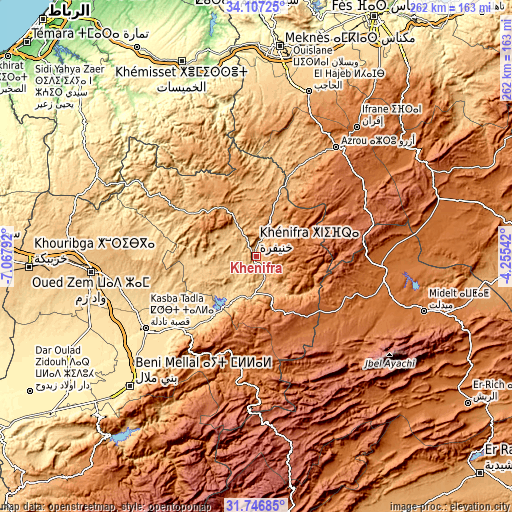
| \ | Map #1 | Map #2 | Topo.Map |
| Scale [m] | 803..1098 m | 739..1422 m | × |
| Scale [ft] | 2635..3602 ft | 2425..4665 ft | × |
| Average | 902.9 m = 2962 ft | 952.3 m = 3124 ft | × |
| Width | 8.2 km = 5.1 mi | 16.4 km = 10.2 mi | 262.5 km = 163.1 mi |
| Height | 8.2 km = 5.1 mi | 16.4 km = 10.2 mi | 262.5 km = 163.1 mi |
| ↑Max Latitude | 32.971795° | 33.008655° | 34.10725° |
| Latitude at center | 32.93492° | 32.93492° | 32.93492° |
| ↓Min Latitude | 32.89803° | 32.861124° | 31.74685° |
| ← Min Longitude | -5.705615° | -5.749561° | -7.06792° |
| Longitude center | -5.66167° | -5.66167° | -5.66167° |
| →Max Longitude | -5.617725° | -5.573779° | -4.25542° |
Nearby cities:
Cities around Khenifra sort by population:
• Kasba Tadla elevation 499 m
68 km,  236°
236°
• Oulmes 1175 m
63.1 km,  329°
329°
• Aïn Leuh 1424 m
49.6 km,  37°
37°
• Zawyat ech Cheïkh 718 m
40.2 km,  216°
216°
• Boumia 1520 m
57.3 km,  114°
114°
• Itzer 1658 m
57.3 km,  96°
96°
• El Ksiba 1079 m
52.3 km, 219°
• Sidi Lamine 733 m
36.4 km,  265°
265°
• Kerrouchen 1370 m
35.5 km,  115°
115°
• Aguelmous 1187 m
30.5 km, 325°
• Sidi Yahya Ou Saad 1484 m
29.4 km,  164°
164°
• Sidi Amar 905 m
16 km,  275°
275°
Multilingual:
 En español:
Jenifra elevación 868 m.
 En France:
Khénifra élévation 868 m.
 Auf Deutsch:
Khénifra höhe über dem Meeresspiegel ist 868 m.

Sources and notes:
- [note 1] Map square and city borders are not equal. Map elevation data is calculated only from area inside that square.
- [src 1] Elevation data from geonames database provided with same terms of usage.
- [src 2] The elevation map of Khenifra is generated using elevation data from NASA's 3 arcsec (90m) resolution SRTM data.
- [src 3] Base (background) map © OpenStreetMap contributors tiles are generated by Geofabrik and OpenTopoMap.
Copyright & License:
This Khenifra Elevation Map is licensed under CC BY-SA. You may reuse any part from this page, if you give a proper credit by linking to this URL:
 More info on terms of use page.