Ifrane elevation
Ifrane (Béni Mellal-Khénifra), Morocco elevation is 2019 meters and Ifrane elevation in feet is 6624 ft above sea level [src 1]. Ifrane is a populated place (feature code) with elevation that is 1403 meters (4603 ft) bigger than average city elevation in Morocco.
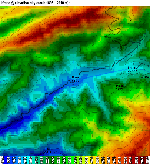
Below is the Elevation map of Ifrane, which displays elevation range with different colors. Scale of the first map is from 1895 to 2910 m (6217 to 9547 ft) with average elevation of 2300.9 meters (=7549 ft) [note 1]
These maps also provides idea of topography and contour of this city, they are displayed at different zoom levels. More info about maps, scale and edge coordinates you can find below images.

| \ | Map #1 | Map #2 | Topo.Map |
| Scale [m] | 1895..2910 m | 1834..3638 m | × |
| Scale [ft] | 6217..9547 ft | 6017..11936 ft | × |
| Average | 2300.9 m = 7549 ft | 2429.4 m = 7970 ft | × |
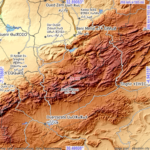
| Width | 8.31 km = 5.2 mi | 16.63 km = 10.3 mi | 266 km = 165.3 mi |
| Height | 8.31 km = 5.2 mi | 16.63 km = 10.3 mi | 266.1 km = 165.3 mi |
| ↑Max Latitude | 31.739551° | 31.776916° | 32.89083° |
| Latitude at center | 31.70217° | 31.70217° | 31.70217° |
| ↓Min Latitude | 31.664774° | 31.627363° | 30.49808° |
| ← Min Longitude | -6.393345° | -6.437291° | -7.75565° |
| Longitude center | -6.3494° | -6.3494° | -6.3494° |
| →Max Longitude | -6.305455° | -6.261509° | -4.94315° |
Nearby cities:
Cities around Ifrane sort by population:
• Kelaat Mgouna elevation 1431 m
54.8 km,  157°
157°
• Demnate 927 m
62.1 km,  273°
273°
• Isseksi 1407 m
59.1 km,  6°
6°
• Timoulilt 604 m
56.8 km,  348°
348°
• Tifni 1417 m
56.6 km,  261°
261°
• Tilmi 2057 m
56.4 km,  76°
76°
• Anergui 1468 m
56.2 km,  43°
43°
• Tabia 561 m
56 km,  310°
310°
• Taounza 681 m
49.8 km,  330°
330°
• Ouaoula 1237 m
42.2 km,  296°
296°
• Azilal 1357 m
35.6 km,  324°
324°
• Tabant 1972 m
8 km,  226°
226°
Multilingual:
 En español:
Ifrane elevación 2019 m.
 En France:
Ifrane élévation 2019 m.


Sources and notes:
- [note 1] Map square and city borders are not equal. Map elevation data is calculated only from area inside that square.
- [src 1] Elevation data from geonames database provided with same terms of usage.
- [src 2] The elevation map of Ifrane is generated using elevation data from NASA's 3 arcsec (90m) resolution SRTM data.
- [src 3] Base (background) map © OpenStreetMap contributors tiles are generated by Geofabrik and OpenTopoMap.
Copyright & License:
This Ifrane Elevation Map is licensed under CC BY-SA. You may reuse any part from this page, if you give a proper credit by linking to this URL:
 More info on terms of use page.